A mid-sized resort which is attracting more non-Japanese people in response to people complaining that other areas are tending to be full up.
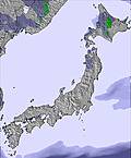
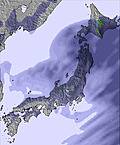
Not quite "Hokkaido Powder" but north enough and high elevation enough to be pretty close at times. We spent a week there and had no trouble staying on mostly untracked forest runs. That said, the further north you get in Honshu, the windier it tends to be. It was never enough to close lifts, which was surprising, but be prepared for the chill.
Busier with Morioka locals at the weekend but really empty on weekdays. A fair proportion of locals are primarily here for the various hot springs.
One of these has an adjacent visitor center with impressive displays relating the national park here. Well worth a visit.
There is just one large hotel at the ski area and it isn't going to win any architecture prizes but Japan has a lot of these 1970s bland buildings.
Even so, staff and facilities are just first class, meals are excellent and good value.
Three chairs connect and each one gains about 200m of vertical.
Off-piste is forbidden within the extent of the pistes which is a shame because large patches of woodland ride very well. People risk it, of course and the reward is generally moderate tree-riding with some lovely gullies here and there forming natural half-pipes, albeit with trees.
The designated off-piste area on skiers right is a more moderate gradient forest that is only moderately used such that it seems always possible to find fresh lines, all converging on a collector track back to the bottom lift.
Hearty lunches at two cafes in the base area and a chance to sit by a radiator and warm up.
Skiers left has a strip of "allowable" woodland and then an area of out-of-bounds with volcanic hazards and the concern that an avalanche here could have severe impact on buildings below. Above this exclusion zone, starting at the top lift exit, a ridge takes tourers towards the main summit with awfully tempting huge ridge-runs back towards the road.
Not the best off-piste resort in the region but you could do a whole lot worse too. Uncrowded pistes with something for all abilities apart from experts. No park.
About 40 minutes from Morioka Station complex with a free resort shuttle bus from the West (minor) exit. This exit is not that well signposted if you arrive here on a Shinkansen.


 Nearest