

Niseko Announce New Gondola
Niseko Village has confirmed a major lift expansion that will reshape access on the southern side of the Niseko United ski area, with a new gondola scheduled to open next winter and a second stage planned for 2027–28.

Next 3 days weather summary:Mostly dry. Very mild (max 15°C on Sat afternoon, min 9°C on Thu morning). Mainly fresh winds. | Days 4-6 weather summary:Mostly dry. Very mild (max 18°C on Tue afternoon, min 13°C on Sun morning). Wind will be generally light. | |||||||||||||||||
Thursday 2 | Friday 3 | Saturday 4 | Sunday 5 | Monday 6 | Tuesday 7 | |||||||||||||
AM | PM | night | AM | PM | night | AM | PM | night | AM | PM | night | AM | PM | night | AM | PM | night | |
clear | clear | clear | clear | cloudy | clear | clear | clear | clear | clear | clear | clear | clear | clear | clear | clear | clear | clear | |
km/h | ||||||||||||||||||
Snow map |  |  |  |  |  |  | ||||||||||||
— | — | — | — | — | — | — | — | — | — | — | — | — | — | — | — | — | — | |
mm | — | — | — | — | — | — | — | — | — | — | — | — | — | — | — | — | — | — |
max °C | 10 | 14 | 14 | 12 | 13 | 13 | 12 | 15 | 15 | 13 | 16 | 16 | 14 | 16 | 16 | 14 | 18 | 18 |
min °C | 9 | 13 | 13 | 11 | 13 | 12 | 11 | 14 | 14 | 13 | 15 | 15 | 13 | 15 | 14 | 14 | 16 | 16 |
chill °C | 6 | 11 | 11 | 10 | 12 | 10 | 9 | 13 | 13 | 11 | 14 | 14 | 11 | 14 | 12 | 13 | 15 | 16 |
Humid % | 66 | 40 | 44 | 69 | 63 | 52 | 58 | 33 | 32 | 38 | 33 | 38 | 51 | 39 | 42 | 48 | 33 | 34 |
Freeze m | 4250 | 4150 | 4300 | 4200 | 4350 | 4400 | 4200 | 4300 | 4450 | 4250 | 4150 | 4050 | 4050 | 4150 | 4100 | 4250 | 4300 | 4500 |
5:50 | — | — | 5:50 | — | — | 5:50 | — | — | 5:52 | — | — | 5:52 | — | — | 5:54 | — | — | |
— | — | 9:28 | — | — | 9:28 | — | — | 9:28 | — | — | 9:27 | — | — | 9:27 | — | — | 9:27 | |
Go pro and carve into:
Avalanche information: European Avalanche Warning Services (EAWS)
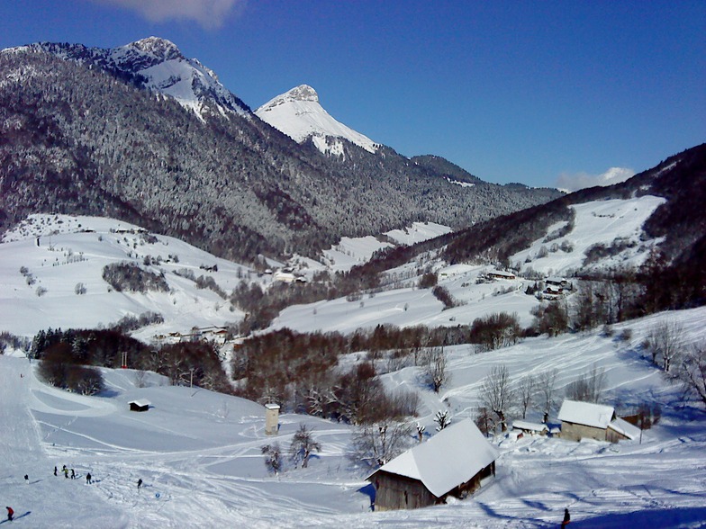
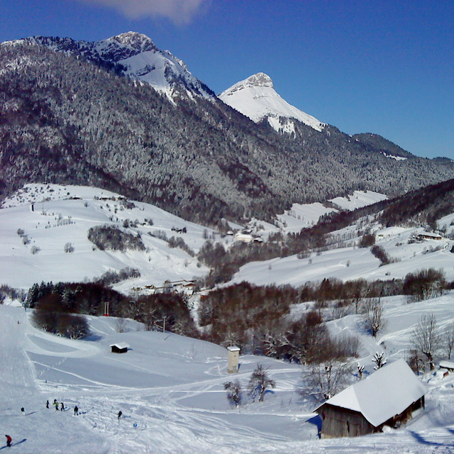
Latest snow reports near Aillons-Margeriaz:
| Top snow depth: | — |
|---|---|
| Bottom snow depth: | — |
| Fresh snowfall depth: | — |
| Last snowfall: | 16 May 2026 |
| Snow Alerts | Create Alert |
0.0 | Bluebird Powder days Fresh snow, mostly sunny, light wind. |
|---|---|
0.0 | Powder days Fresh snow, limited sun, any wind. |
0.0 | Bluebird days Average snow, mostly sunny, light wind. |

The above table gives the weather forecast for Aillons-Margeriaz at the specific elevation of 1900 m. Our sophisticated weather models allow us to provide snow forecasts for the top, middle and bottom ski stations of Aillons-Margeriaz. To access the weather forecasts for the other elevations, use the tab navigation above the table. For a wider view of the weather, check out the Weather Map of France.
Click here to read further information on freezing levels and how we forecast our temperatures.
Overall 3.6 Based on 7 votes and 6 reviews
I can only re-iterate the comments of the previous posts. Well kept pistes and plenty of opportunities for off-piste too. Very pretty tree-lined pistes, never too busy. In fact, mid-week outside of the French school holidays you can pretty much have them to yourself. At Margeriaz there is a shack called La Bergerie which is a great place to stop for a vin chaud or some traditional Savoyard food. Although the hotel at Les Aillons is closed there are some great chalets for rental at the nearby village of Le Chatelard which you can find on the HomeAway website.
Ian McCabe from United Kingdom writes:
I can only re-iterate the comments of the previous posts. Well kept pistes and plenty of opportunities for off-piste too. Very pretty tree-lined pistes, never too busy. In fact, mid-week outside of the French school holidays you can pretty much have them to yourself. At Margeriaz there is a shack called La Bergerie which is a great place to stop for a vin chaud or some traditional Savoyard food. Although the hotel at Les Aillons is closed there are some great chalets for rental at the nearby village of Le Chatelard which you can find on the HomeAway website.


 Nearest