

Niseko Announce New Gondola
Niseko Village has confirmed a major lift expansion that will reshape access on the southern side of the Niseko United ski area, with a new gondola scheduled to open next winter and a second stage planned for 2027–28.

Next 3 days weather summary:Mostly dry. Warm (max 23°C on Sat afternoon, min 12°C on Fri night). Wind will be generally light. | Days 4-6 weather summary:Mostly dry. Warm (max 26°C on Tue afternoon, min 14°C on Mon night). Wind will be generally light. | |||||||||||||||||
Thursday 2 | Friday 3 | Saturday 4 | Sunday 5 | Monday 6 | Tuesday 7 | |||||||||||||
AM | PM | night | AM | PM | night | AM | PM | night | AM | PM | night | AM | PM | night | AM | PM | night | |
clear | clear | clear | clear | cloudy | clear | clear | clear | clear | clear | clear | clear | clear | clear | clear | clear | clear | clear | |
km/h | ||||||||||||||||||
Snow map |  |  |  |  |  |  | ||||||||||||
— | — | — | — | — | — | — | — | — | — | — | — | — | — | — | — | — | — | |
mm | — | — | — | — | — | — | — | — | — | — | — | — | — | — | — | — | — | — |
max °C | 17 | 22 | 20 | 18 | 21 | 19 | 18 | 23 | 20 | 20 | 25 | 21 | 21 | 25 | 22 | 21 | 26 | 22 |
min °C | 13 | 21 | 13 | 15 | 21 | 12 | 14 | 22 | 12 | 15 | 24 | 15 | 17 | 24 | 14 | 17 | 25 | 15 |
chill °C | 12 | 21 | 12 | 15 | 21 | 11 | 13 | 22 | 11 | 14 | 24 | 15 | 17 | 24 | 13 | 17 | 25 | 15 |
Humid % | 71 | 39 | 54 | 67 | 67 | 74 | 61 | 30 | 46 | 41 | 30 | 47 | 49 | 36 | 53 | 49 | 31 | 46 |
Freeze m | 4250 | 4150 | 4300 | 4200 | 4350 | 4400 | 4200 | 4300 | 4450 | 4250 | 4150 | 4050 | 4050 | 4150 | 4100 | 4250 | 4300 | 4500 |
5:50 | — | — | 5:50 | — | — | 5:50 | — | — | 5:52 | — | — | 5:52 | — | — | 5:54 | — | — | |
— | — | 9:28 | — | — | 9:28 | — | — | 9:28 | — | — | 9:27 | — | — | 9:27 | — | — | 9:27 | |
Go pro and carve into:
Avalanche information: European Avalanche Warning Services (EAWS)
Latest snow reports near Aillons-Margeriaz:
| Top snow depth: | — |
|---|---|
| Bottom snow depth: | — |
| Fresh snowfall depth: | — |
| Last snowfall: | 16 May 2026 |
| Snow Alerts | Create Alert |
0.0 | Bluebird Powder days Fresh snow, mostly sunny, light wind. |
|---|---|
0.0 | Powder days Fresh snow, limited sun, any wind. |
0.0 | Bluebird days Average snow, mostly sunny, light wind. |
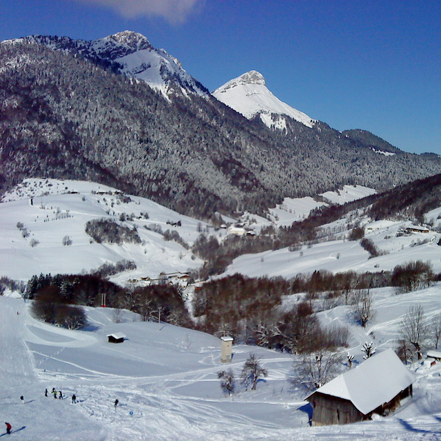
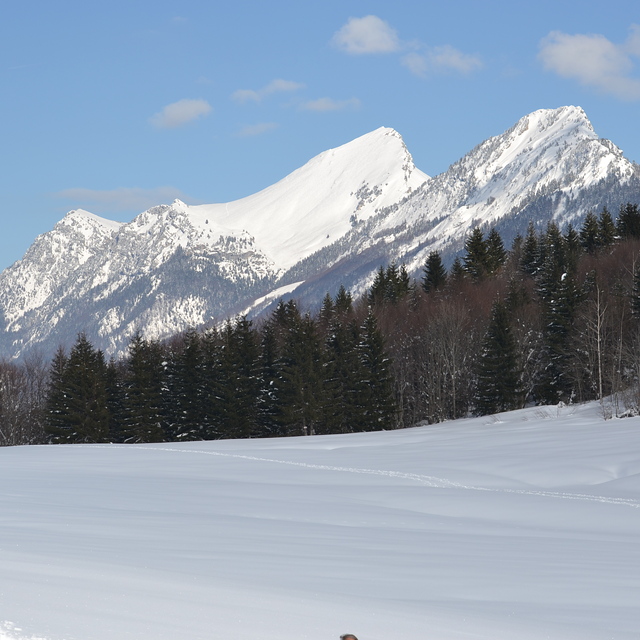

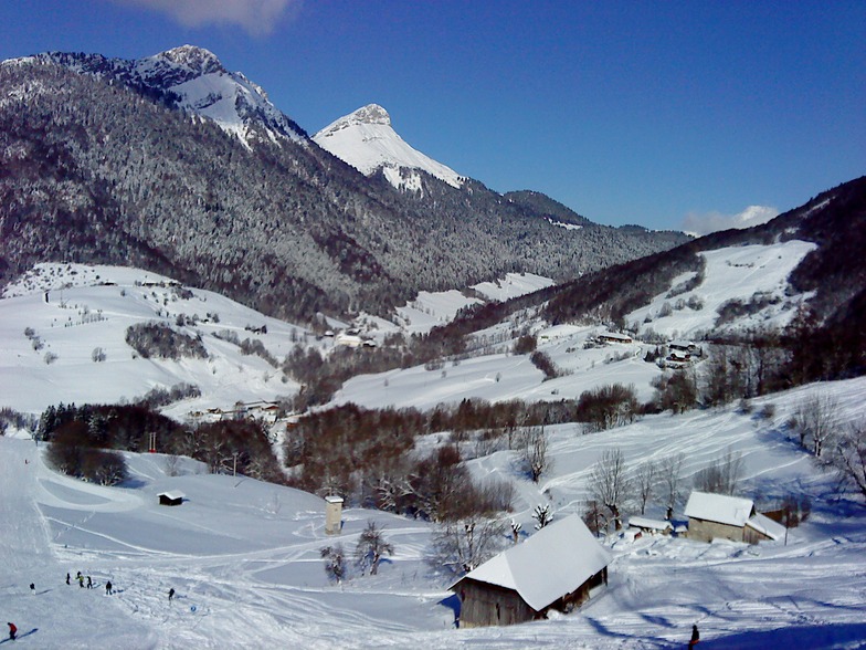
The above table gives the weather forecast for Aillons-Margeriaz at the specific elevation of 1000 m. Our sophisticated weather models allow us to provide snow forecasts for the top, middle and bottom ski stations of Aillons-Margeriaz. To access the weather forecasts for the other elevations, use the tab navigation above the table. For a wider view of the weather, check out the Weather Map of France.
Click here to read further information on freezing levels and how we forecast our temperatures.
Overall 3.6 Based on 7 votes and 6 reviews
Très bonne station a 1400 pour débutants et a 1000 pour bons ou très bons skieurs,pas trop de monde sauf dimanche si il y a du soleil sinon personne.
José rentri from France writes:
Très bonne station a 1400 pour débutants et a 1000 pour bons ou très bons skieurs,pas trop de monde sauf dimanche si il y a du soleil sinon personne.


 Nearest