

Global Weekly Snow Roundup #314
Weekly Global Snow News, updated 14 May 2026: Fresh snowfall in Argentina, Australia and Lesotho signals winter’s approach, while Japan maintains the world’s deepest snowpack.

Next 4 days weather summary:Light rain (total 3.0mm), mostly falling on Sat night. Very mild (max 18°C on Mon afternoon, min 8°C on Fri night). Winds decreasing (strong winds from the WNW on Sun afternoon, calm by Mon morning). | Days 5-7 weather summary:Moderate rain (total 13.0mm), heaviest on Wed afternoon. Warm (max 23°C on Tue afternoon, min 9°C on Thu afternoon). Winds decreasing (strong winds from the W on Tue night, light winds from the W by Wed night). | |||||||||||||||
Saturday 16 | Sunday 17 | Monday 18 | Tuesday 19 | Wednesday 20 | ||||||||||||
night | AM | PM | night | AM | PM | night | AM | PM | night | AM | PM | night | AM | PM | night | |
clear | some clouds | clear | rain shwrs | clear | clear | some clouds | some clouds | some clouds | clear | clear | some clouds | rain shwrs | risk thun- der | rain shwrs | rain shwrs | |
km/h | ||||||||||||||||
Snow map |  |  |  |  |  |  | ||||||||||
— | — | — | — | — | — | — | — | — | — | — | — | — | — | — | — | |
— | — | — | 3 | — | — | — | — | — | — | — | — | 2 | 1 | 4 | 4 | |
max °C | 8 | 12 | 15 | 14 | 13 | 14 | 10 | 15 | 18 | 18 | 21 | 23 | 21 | 21 | 21 | 17 |
min °C | 8 | 10 | 15 | 10 | 12 | 13 | 8 | 12 | 15 | 17 | 20 | 23 | 18 | 20 | 18 | 16 |
7 | 8 | 15 | 6 | 9 | 10 | 5 | 12 | 14 | 16 | 20 | 23 | 17 | 20 | 17 | 15 | |
86 | 61 | 51 | 93 | 61 | 68 | 69 | 53 | 77 | 83 | 59 | 58 | 84 | 66 | 87 | 89 | |
2450 | 3150 | 3350 | 3550 | 3000 | 3400 | 3900 | 3600 | 4050 | 4200 | 4200 | 4300 | 4200 | 4000 | 4250 | 3900 | |
— | 5:16 | — | — | 5:16 | — | — | 5:15 | — | — | 5:13 | — | — | 5:13 | — | — | |
— | — | — | 8:05 | — | — | 8:06 | — | — | 8:07 | — | — | 8:07 | — | — | 8:09 | |
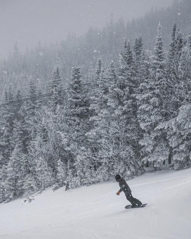
Latest snow reports near Wildcat Mountain:
| Top snow depth: | 0 cm |
|---|---|
| Bottom snow depth: | 0 cm |
| Fresh snowfall depth: | — |
| Last snowfall: | 2 May 2026 |
| Snow Alerts | Create Alert |
0.0 | Bluebird Powder days Fresh snow, mostly sunny, light wind. |
|---|---|
0.0 | Powder days Fresh snow, limited sun, any wind. |
0.1 | Bluebird days Average snow, mostly sunny, light wind. |

The above table gives the weather forecast for Wildcat Mountain at the specific elevation of 899 m. Our sophisticated weather models allow us to provide snow forecasts for the top, middle and bottom ski stations of Wildcat Mountain. To access the weather forecasts for the other elevations, use the tab navigation above the table. For a wider view of the weather, check out the Weather Map of United States.
Click here to read further information on freezing levels and how we forecast our temperatures.
Overall 2.7 Based on 10 votes and 3 reviews
Wildcat is a classic New England cult ski area, boasting the most continuous vertical in New Hampshire. Natural mountain with challenging terrain. Wildcat quad takes you to the summit in 6 minutes. You can easily get 20 runs in half a day, and if you can find it, check out Thompsons brook.
barry murphy from United States writes:
Wildcat is a classic New England cult ski area, boasting the most continuous vertical in New Hampshire. Natural mountain with challenging terrain. Wildcat quad takes you to the summit in 6 minutes. You can easily get 20 runs in half a day, and if you can find it, check out Thompsons brook.


 Nearest