

Global Weekly Snow Roundup #314
Weekly Global Snow News, updated 14 May 2026: Fresh snowfall in Argentina, Australia and Lesotho signals winter’s approach, while Japan maintains the world’s deepest snowpack.

Next 3 days weather summary:Light rain (total 8.0mm), mostly falling on Sat night. Warm (max 23°C on Mon afternoon, min 10°C on Sat morning). Winds decreasing (strong winds from the SW on Sat night, light winds from the W by Sun night). | Days 4-6 weather summary:Light rain (total 5.0mm), mostly falling on Wed morning. Warm (max 22°C on Tue afternoon, min 3°C on Wed night). Winds decreasing (near gales from the W on Tue night, light winds from the NNW by Thu night). | |||||||||||||||||
Saturday 16 | Sunday 17 | Monday 18 | Tuesday 19 | Wednesday 20 | Thursday 21 | |||||||||||||
AM | PM | night | AM | PM | night | AM | PM | night | AM | PM | night | AM | PM | night | AM | PM | night | |
some clouds | cloudy | rain shwrs | clear | some clouds | some clouds | cloudy | clear | rain shwrs | cloudy | some clouds | some clouds | light rain | light rain | light rain | some clouds | some clouds | some clouds | |
km/h | ||||||||||||||||||
Snow map |  |  |  |  |  |  | ||||||||||||
— | — | — | — | — | — | — | — | — | — | — | — | — | — | — | — | — | — | |
— | — | 7 | — | — | — | — | — | 1 | — | — | — | 1 | 2 | 2 | — | — | — | |
max °C | 13 | 17 | 13 | 13 | 14 | 13 | 16 | 23 | 20 | 19 | 22 | 21 | 18 | 18 | 13 | 4 | 8 | 5 |
min °C | 10 | 16 | 11 | 11 | 14 | 11 | 12 | 20 | 19 | 19 | 21 | 17 | 18 | 16 | 3 | 3 | 7 | 3 |
7 | 15 | 8 | 8 | 12 | 9 | 10 | 20 | 18 | 18 | 21 | 16 | 17 | 14 | -1 | -1 | 5 | 0 | |
51 | 54 | 92 | 66 | 65 | 72 | 77 | 56 | 76 | 85 | 72 | 88 | 87 | 96 | 95 | 70 | 53 | 64 | |
3250 | 3600 | 3050 | 3200 | 3500 | 3450 | 3700 | 4200 | 4150 | 4300 | 4250 | 4150 | 3950 | 3900 | 3700 | 1300 | 2150 | 1600 | |
5:26 | — | — | 5:26 | — | — | 5:24 | — | — | 5:24 | — | — | 5:22 | — | — | 5:22 | — | — | |
— | — | 8:15 | — | — | 8:16 | — | — | 8:17 | — | — | 8:19 | — | — | 8:20 | — | — | 8:21 | |
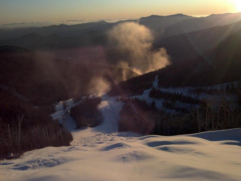
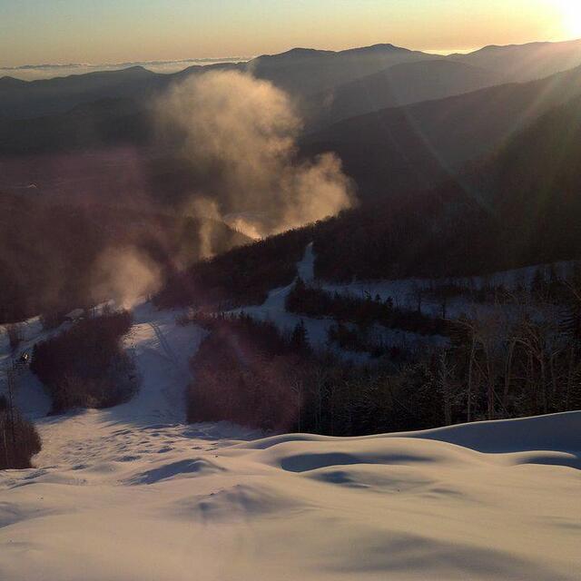
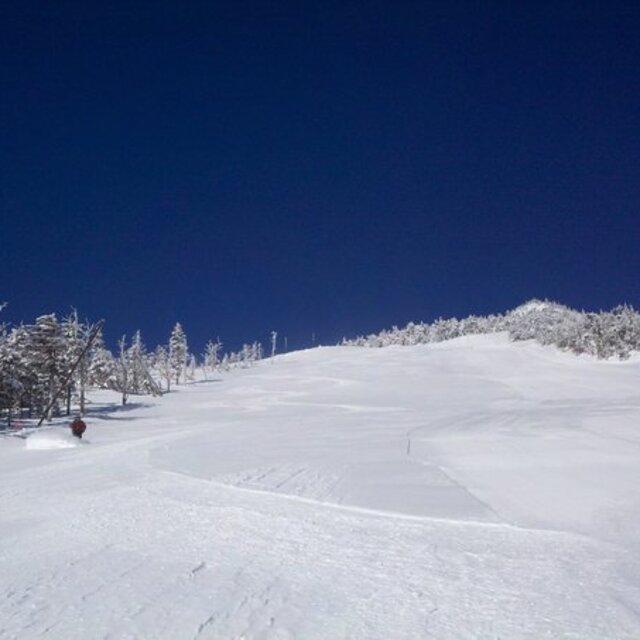
Latest snow reports near Whiteface Mountain (Lake Placid):
| Top snow depth: | 0 cm |
|---|---|
| Bottom snow depth: | 0 cm |
| Fresh snowfall depth: | — |
| Last snowfall: | 2 May 2026 |
| Snow Alerts | Create Alert |
0.0 | Bluebird Powder days Fresh snow, mostly sunny, light wind. |
|---|---|
0.1 | Powder days Fresh snow, limited sun, any wind. |
0.1 | Bluebird days Average snow, mostly sunny, light wind. |

The above table gives the weather forecast for Whiteface Mountain (Lake Placid) at the specific elevation of 842 m. Our sophisticated weather models allow us to provide snow forecasts for the top, middle and bottom ski stations of Whiteface Mountain (Lake Placid). To access the weather forecasts for the other elevations, use the tab navigation above the table. For a wider view of the weather, check out the Weather Map of United States.
Click here to read further information on freezing levels and how we forecast our temperatures.
Resort name is also written as Whiteface Mountain.
Overall 3.8 Based on 21 votes and 5 reviews
Unlike all the other East Coast mountains..... Whiteface is in the Adirondack Mountains, which are not part of the Appalachians. The Adirondacks are part of the Canadian Shield which runs across Eastern Canada to far Western Ontario, including Northern Michigan. This is an entirely different geological formation. The Adirondacks are some of the oldest mountains in the world, similar to the Urals, perhaps 3 billion years old.
Peter from United States writes:
Unlike all the other East Coast mountains.....
Whiteface is in the Adirondack Mountains, which are not part of the Appalachians. The Adirondacks are part of the Canadian Shield which runs across Eastern Canada to far Western Ontario, including Northern Michigan. This is an entirely different geological formation. The Adirondacks are some of the oldest mountains in the world, similar to the Urals, perhaps 3 billion years old.
Read 4 more reviews of Whiteface Mountain (Lake Placid) or submit your own


 Nearest