


Global Weekly Snow Roundup #314
Weekly Global Snow News, updated 14 May 2026: Fresh snowfall in Argentina, Australia and Lesotho signals winter’s approach, while Japan maintains the world’s deepest snowpack.

Next 4 days weather summary:Heavy rain (total 20.0mm), heaviest during Fri night. Very mild (max 11°C on Mon afternoon, min 5°C on Fri night). Wind will be generally light. | Days 5-7 weather summary:Light rain (total 7.0mm), mostly falling on Tue afternoon. Very mild (max 16°C on Thu afternoon, min 5°C on Tue night). Wind will be generally light. | |||||||||||||||
Saturday 16 | Sunday 17 | Monday 18 | Tuesday 19 | Wednesday 20 | ||||||||||||
night | AM | PM | night | AM | PM | night | AM | PM | night | AM | PM | night | AM | PM | night | |
mod. rain | light rain | light rain | light rain | some clouds | some clouds | rain shwrs | light rain | light rain | cloudy | cloudy | light rain | some clouds | cloudy | some clouds | rain shwrs | |
km/h | ||||||||||||||||
Snow map | 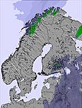 | 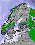 | 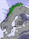 | 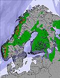 | 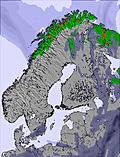 | 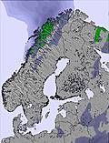 | ||||||||||
— | — | — | — | — | — | — | — | — | — | — | — | — | — | — | — | |
7 | 2 | 3 | 3 | — | — | 2 | 2 | 1 | — | — | 2 | — | — | — | 1 | |
max °C | 7 | 6 | 6 | 6 | 9 | 9 | 8 | 7 | 11 | 11 | 11 | 9 | 9 | 11 | 14 | 13 |
min °C | 5 | 5 | 6 | 5 | 6 | 9 | 5 | 7 | 11 | 8 | 9 | 9 | 5 | 8 | 14 | 9 |
4 | 4 | 6 | 5 | 5 | 7 | 2 | 6 | 10 | 8 | 7 | 7 | 5 | 8 | 13 | 8 | |
95 | 96 | 93 | 95 | 71 | 74 | 93 | 84 | 65 | 83 | 57 | 74 | 88 | 57 | 52 | 93 | |
1300 | 1200 | 1250 | 1100 | 1300 | 1400 | 1500 | 1500 | 1750 | 1700 | 1450 | 1400 | 1700 | 1800 | 2050 | 2100 | |
— | 4:37 | — | — | 4:35 | — | — | 4:33 | — | — | 4:31 | — | — | 4:28 | — | — | |
— | — | — | 9:50 | — | — | 9:52 | — | — | 9:53 | — | — | 9:57 | — | — | 9:59 | |
Latest snow reports near Tryvann:
| Top snow depth: | 0 cm |
|---|---|
| Bottom snow depth: | 0 cm |
| Fresh snowfall depth: | — |
| Last snowfall: | 5 Apr 2026 |
| Snow Alerts | Create Alert |
0.0 | Bluebird Powder days Fresh snow, mostly sunny, light wind. |
|---|---|
0.0 | Powder days Fresh snow, limited sun, any wind. |
0.0 | Bluebird days Average snow, mostly sunny, light wind. |
The above table gives the weather forecast for Tryvann at the specific elevation of 334 m. Our sophisticated weather models allow us to provide snow forecasts for the top, middle and bottom ski stations of Tryvann. To access the weather forecasts for the other elevations, use the tab navigation above the table. For a wider view of the weather, check out the Weather Map of Norway.
Click here to read further information on freezing levels and how we forecast our temperatures.
Overall 1.8 Based on 13 votes and 1 review
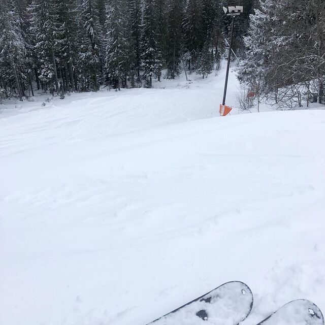
Tryvann is the main resort in the city of Oslo. It is a small resort with 10km of slopes. It is very easily accessible, since the subway goes from the city center up to the resort in just half an hour. If you're going there for the runs, you will quickly be fed up, since it's small. On the other hand, the resort has a good snowpark, for all levels and with 2 half pipes. You can spend hours in the park without ever getting fed up. Conclusion: It's a good city resort, ideal for alpine ski/snowboard beginners and also for freestyle lovers.
Hugo Leitao from Portugal writes:
Tryvann is the main resort in the city of Oslo. It is a small resort with 10km of slopes. It is very easily accessible, since the subway goes from the city center up to the resort in just half an hour.
If you're going there for the runs, you will quickly be fed up, since it's small.
On the other hand, the resort has a good snowpark, for all levels and with 2 half pipes. You can spend hours in the park without ever getting fed up.
Conclusion: It's a good city resort, ideal for alpine ski/snowboard beginners and also for freestyle lovers.


 Nearest