

Global Weekly Snow Roundup #318
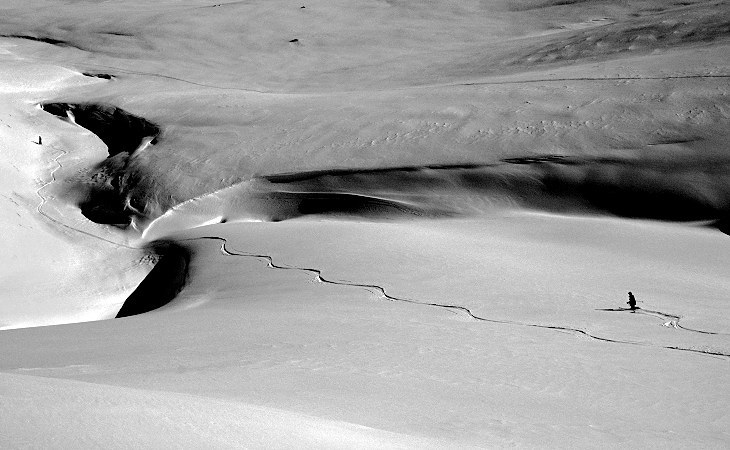
Weekly Snow News for the world, updated 11 June 2026: Australia's season begins, Val d’Isère reopens and major snowfall is forecast for the Andes.

Next 4 days weather summary:Moderate rain (total 18.0mm), heaviest on Sat night. Mild temperatures (max 7°C on Fri night, min 3°C on Sat night). Winds decreasing (fresh winds from the NW on Sat afternoon, calm by Sun morning). | Days 5-7 weather summary:Light rain (total 5.0mm), mostly falling on Tue morning. Mild temperatures (max 8°C on Wed night, min 5°C on Mon night). Wind will be generally light. | |||||||||||||||
Saturday 13 | Sunday 14 | Monday 15 | Tuesday 16 | Wednesday 17 | ||||||||||||
night | AM | PM | night | AM | PM | night | AM | PM | night | AM | PM | night | AM | PM | night | |
some clouds | light rain | light rain | heavy rain | light rain | some clouds | some clouds | some clouds | some clouds | some clouds | rain shwrs | some clouds | some clouds | rain shwrs | light rain | some clouds | |
km/h | ||||||||||||||||
Snow map | 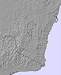 | 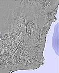 | 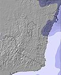 | 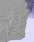 | 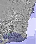 | 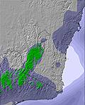 | ||||||||||
— | — | — | — | — | — | — | — | — | — | — | — | — | — | — | — | |
— | 1 | 2 | 14 | 1 | — | — | — | — | — | 1 | — | — | 1 | 1 | — | |
max °C | 7 | 6 | 6 | 6 | 4 | 4 | 5 | 6 | 6 | 6 | 6 | 6 | 7 | 7 | 7 | 8 |
min °C | 5 | 6 | 6 | 3 | 4 | 4 | 3 | 5 | 6 | 5 | 5 | 6 | 6 | 7 | 7 | 7 |
1 | 2 | 1 | 0 | 4 | 3 | 1 | 3 | 4 | 1 | 2 | 4 | 5 | 7 | 7 | 7 | |
43 | 87 | 86 | 97 | 96 | 92 | 77 | 77 | 74 | 69 | 89 | 87 | 85 | 85 | 94 | 86 | |
3550 | 3750 | 3000 | 2500 | 2500 | 2650 | 3200 | 3250 | 3250 | 3450 | 3450 | 2950 | 2950 | 2900 | 2900 | 2850 | |
— | 7:15 | — | — | 7:16 | — | — | 7:16 | — | — | 7:16 | — | — | 7:16 | — | — | |
— | — | 4:57 | — | — | 4:57 | — | — | 4:57 | — | — | 4:57 | — | — | 4:57 | — | |
Go pro and carve into:
Avalanche information: Avalanche Australia
Latest snow reports near Thredbo:
| Top snow depth: | 13 cm |
|---|---|
| Bottom snow depth: | 13 cm |
| Fresh snowfall depth: | — |
| Last snowfall: | 4 Jun 2026 |
| Snow Alerts | Create Alert |
0.1 | Bluebird Powder days Fresh snow, mostly sunny, light wind. |
|---|---|
0.6 | Powder days Fresh snow, limited sun, any wind. |
0.2 | Bluebird days Average snow, mostly sunny, light wind. |


The above table gives the weather forecast for Thredbo at the specific elevation of 1701 m. Our sophisticated weather models allow us to provide snow forecasts for the top, middle and bottom ski stations of Thredbo. To access the weather forecasts for the other elevations, use the tab navigation above the table. For a wider view of the weather, check out the Weather Map of Australia.
Click here to read further information on freezing levels and how we forecast our temperatures.
Overall 3.2 Based on 30 votes and 44 reviews
Be aware that when purchasing kids ski lessons it is a requirement to also purchase chairlift pass at $110 extra each child even though the chairlift is not used at all during their lesson no refund nor even a credit is given. Very deceptive and unfair policy.
Karen Tarlington from Australia writes:
Be aware that when purchasing kids ski lessons it is a requirement to also purchase chairlift pass at $110 extra each child even though the chairlift is not used at all during their lesson no refund nor even a credit is given. Very deceptive and unfair policy.


 Nearest