Next snow in Thredbo: 1.3cm on Mon 3rd (after 4 PM local time)
View forecast
Thredboat 1365 m altitude
Issued by Snow-Forecast.com at:3 am (local time) / 31 Jul 2026
Last 6 daysScroll left for last 6 daysNow
Next 3 days weather summary:
Light rain (total 5.0mm), mostly falling on Sun afternoon. Freeze-thaw conditions (max 7°C on Fri morning, min -1°C on Fri night). Winds increasing (calm on Fri afternoon, fresh winds from the NW by Sun night).
Days 4-6 weather summary:
Drizzle on Mon morning followed by colder weather and a moderate fall of snow, heaviest on Mon night. Freeze-thaw conditions (max 4°C on Mon morning, min -2°C on Mon night). Winds decreasing (fresh winds from the NW on Mon morning, calm by Wed night).
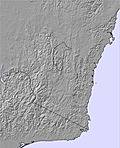
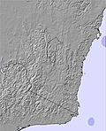
The above table gives the weather forecast for Thredbo at the specific elevation of 1365 m. Our sophisticated weather models allow us to provide snow forecasts for the top, middle and bottom ski stations of Thredbo. To access the weather forecasts for the other elevations, use the tab navigation above the table. For a wider view of the weather, check out the Weather Map of Australia.
Click here to read further information on freezing levels and how we forecast our temperatures.
After skiing in over 20 resorts in North America from December 2017 until April 2018, I have to say that Thredbo stacks up well. It would be nice if it were steeper but in so many ways Thredbo offers a great skiing experience., especially for families.
Ticket prices are much cheaper than in the big resorts in North America, especially when taking the exchange rate into account. And Thredbo's snow making keeps the resort running when many in North America do not have the capacity to do so.
In Thredbo car parking is free and within walking distance of the lifts. In the USA many resorts have you paying to park and then you wait for a bus or gondola to get you to the lifts.
Thredbo's grooming is always excellent and the off-piste runs might often be short, but are rewarding. From my experience there are more rocks in the Rockies than at Thredbo, except the Canadian Rockies.
And yes, Thredbo does get good dry powder and good dry windblown. It was a surprise for me that you could spend a week in a big name resort in peak season and not get a powder day. And often the new snow there is sticky and heavy.
In North America we used Snow Forecast every day for our trip planning and found the data accurate and invaluable, as in Japan and at home. Thanks, Ted.
Free Snow-Forecast.com weather widget for your website
Embed the Thredbo weather widget on your site for free. It provides a weekly snapshot of snow and rain conditions across all elevations. Follow the two quick steps to grab your custom code and paste it into your site. Choose between metric or imperial units. Click here to get the code.


 Nearest