

Global Weekly Snow Roundup #314
Weekly Global Snow News, updated 14 May 2026: Fresh snowfall in Argentina, Australia and Lesotho signals winter’s approach, while Japan maintains the world’s deepest snowpack.

Next 3 days weather summary:Moderate rain (total 12.0mm), heaviest on Mon morning. Freeze-thaw conditions (max 9°C on Sat afternoon, min 0°C on Fri night). Winds increasing (light winds from the NW on Fri night, fresh winds from the SW by Sun afternoon). | Days 4-6 weather summary:Moderate rain (total 15.0mm), heaviest on Mon night. Very mild (max 15°C on Thu morning, min 5°C on Mon night). Mainly fresh winds. | ||||||||||||||||
Fri 15 | Saturday 16 | Sunday 17 | Monday 18 | Tuesday 19 | Wednesday 20 | ||||||||||||
PM | night | AM | PM | night | AM | PM | night | AM | PM | night | AM | PM | night | AM | PM | night | |
light rain | rain shwrs | cloudy | cloudy | rain shwrs | light rain | light rain | light rain | rain shwrs | rain shwrs | light rain | light rain | light rain | light rain | light rain | cloudy | some clouds | |
km/h | |||||||||||||||||
Snow map |  |  |  |  | 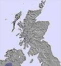 | 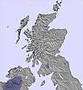 | |||||||||||
— | — | — | — | — | — | — | — | — | — | — | — | — | — | — | — | — | |
2 | 1 | — | — | 2 | 1 | 1 | 2 | 3 | 3 | 4 | 2 | 2 | 2 | 2 | — | — | |
max °C | 6 | 3 | 8 | 9 | 5 | 8 | 8 | 4 | 9 | 9 | 6 | 9 | 11 | 9 | 10 | 10 | 10 |
min °C | 5 | 0 | 6 | 6 | 3 | 6 | 6 | 3 | 7 | 9 | 5 | 8 | 10 | 8 | 10 | 10 | 9 |
1 | -2 | 4 | 3 | -2 | 2 | 1 | -1 | 5 | 7 | 2 | 5 | 6 | 5 | 7 | 7 | 7 | |
81 | 87 | 72 | 66 | 93 | 76 | 74 | 92 | 83 | 75 | 85 | 97 | 84 | 95 | 96 | 97 | 94 | |
1100 | 900 | 1050 | 1350 | 1250 | 1150 | 1250 | 1250 | 1250 | 1550 | 1700 | 2250 | 2150 | 2300 | 2350 | 2850 | 3300 | |
— | — | 5:01 | — | — | 5:00 | — | — | 4:58 | — | — | 4:56 | — | — | 4:54 | — | — | |
9:07 | — | — | 9:08 | — | — | 9:10 | — | — | 9:12 | — | — | 9:14 | — | — | 9:15 | — | |
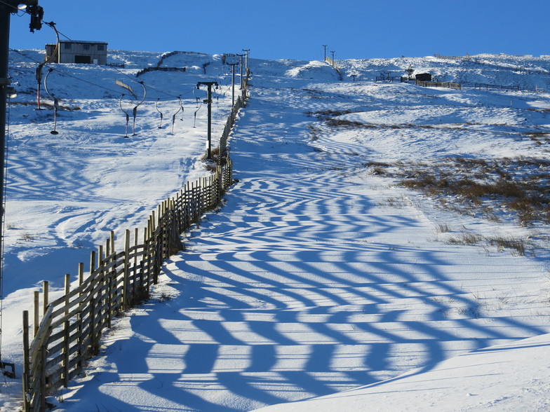
Latest snow reports near Weardale Ski Club:
| Top snow depth: | — |
|---|---|
| Bottom snow depth: | — |
| Fresh snowfall depth: | — |
| Last snowfall: | 12 May 2026 |
| Snow Alerts | Create Alert |
0.0 | Bluebird Powder days Fresh snow, mostly sunny, light wind. |
|---|---|
0.0 | Powder days Fresh snow, limited sun, any wind. |
0.0 | Bluebird days Average snow, mostly sunny, light wind. |


The above table gives the weather forecast for Weardale Ski Club at the specific elevation of 488 m. Our sophisticated weather models allow us to provide snow forecasts for the top, middle and bottom ski stations of Weardale Ski Club. To access the weather forecasts for the other elevations, use the tab navigation above the table. For a wider view of the weather, check out the Weather Map of United Kingdom.
Click here to read further information on freezing levels and how we forecast our temperatures.
Overall 2.6 Based on 5 votes and 7 reviews
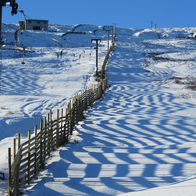
Went up to Swinhope recently and was surprised at the area. There was a fair bit of snow up there, but some long grasses were poking through the upper runs. The lower runs were similar to those at Yad Moss, whilst the runs of the top lift were steeper and more naturally undulating. With good snow there is huge potential for exploring and hiking, with gulleys and steeps off to both sides of the top lift (if you are prepared to walk a bit). The road definitely needs snow chains or a 4wd (we learned the hard way, but were early enough not to cause anyone any delay). There is plenty of variety, with lots of natural kicker building spots and drop-offs. When we visited we found there were a number of kickers already built of a variety of sizes. These in no way constitute a professionally built park, but are just jumps groups of people have built when they visited. The lifts are very good, fast-ish and when we were there even a long looking queue seemed to be cleared in less than 10 minutes. One problem was the number of beginner snowboarders who could not manage the bottom pomma lift, and even proficient snowboarders seemed to struggle on the top lift. In conclusion, needs a bit more snow than Yad Moss does to be decent, and is a bit more of a treck, but when the snow is good it is by far the best place to ski (maybe not snowboard if you don't get on with pommas) in England.
Godders from United Kingdom writes:
Went up to Swinhope recently and was surprised at the area. There was a fair bit of snow up there, but some long grasses were poking through the upper runs. The lower runs were similar to those at Yad Moss, whilst the runs of the top lift were steeper and more naturally undulating. With good snow there is huge potential for exploring and hiking, with gulleys and steeps off to both sides of the top lift (if you are prepared to walk a bit). The road definitely needs snow chains or a 4wd (we learned the hard way, but were early enough not to cause anyone any delay).
There is plenty of variety, with lots of natural kicker building spots and drop-offs. When we visited we found there were a number of kickers already built of a variety of sizes. These in no way constitute a professionally built park, but are just jumps groups of people have built when they visited.
The lifts are very good, fast-ish and when we were there even a long looking queue seemed to be cleared in less than 10 minutes. One problem was the number of beginner snowboarders who could not manage the bottom pomma lift, and even proficient snowboarders seemed to struggle on the top lift.
In conclusion, needs a bit more snow than Yad Moss does to be decent, and is a bit more of a treck, but when the snow is good it is by far the best place to ski (maybe not snowboard if you don't get on with pommas) in England.


 Nearest