


Global Weekly Snow Roundup #314
Weekly Global Snow News, updated 14 May 2026: Fresh snowfall in Argentina, Australia and Lesotho signals winter’s approach, while Japan maintains the world’s deepest snowpack.

Next 3 days weather summary:Light rain (total 4.0mm), mostly falling on Sat night. Very mild (max 16°C on Mon night, min 5°C on Sun morning). Winds decreasing (gales from the WNW on Sat night, light winds from the WSW by Mon morning). | Days 4-6 weather summary:Light rain (total 6.0mm), mostly falling on Tue afternoon. Freeze-thaw conditions (max 18°C on Tue night, min 0°C on Thu morning). Winds decreasing (gales from the W on Tue night, light winds from the NNW by Thu night). | |||||||||||||||||
Saturday 16 | Sunday 17 | Monday 18 | Tuesday 19 | Wednesday 20 | Thursday 21 | |||||||||||||
AM | PM | night | AM | PM | night | AM | PM | night | AM | PM | night | AM | PM | night | AM | PM | night | |
some clouds | some clouds | light rain | some clouds | rain shwrs | some clouds | cloudy | some clouds | clear | cloudy | rain shwrs | some clouds | cloudy | risk thun- der | light rain | cloudy | cloudy | some clouds | |
km/h | ||||||||||||||||||
Snow map |  |  |  |  |  |  | ||||||||||||
— | — | — | — | — | — | — | — | — | — | — | — | — | — | — | — | — | — | |
— | — | 3 | — | 1 | — | — | — | — | — | 1 | — | — | 2 | 3 | — | — | — | |
max °C | 9 | 12 | 11 | 6 | 6 | 6 | 9 | 11 | 16 | 17 | 17 | 18 | 16 | 16 | 13 | 2 | 4 | 2 |
min °C | 8 | 11 | 8 | 5 | 5 | 5 | 8 | 11 | 14 | 17 | 16 | 15 | 14 | 16 | 4 | 0 | 3 | 0 |
3 | 8 | 2 | -1 | -1 | -1 | 5 | 8 | 11 | 15 | 14 | 12 | 11 | 14 | -3 | -7 | -2 | -5 | |
74 | 58 | 97 | 91 | 84 | 44 | 54 | 83 | 75 | 76 | 80 | 75 | 84 | 90 | 86 | 77 | 56 | 54 | |
2950 | 3200 | 3200 | 3100 | 3150 | 3550 | 3450 | 4000 | 4150 | 4000 | 4250 | 4150 | 4000 | 4000 | 3950 | 1300 | 2250 | 1450 | |
5:09 | — | — | 5:09 | — | — | 5:07 | — | — | 5:07 | — | — | 5:05 | — | — | 5:05 | — | — | |
— | — | 8:02 | — | — | 8:05 | — | — | 8:06 | — | — | 8:07 | — | — | 8:07 | — | — | 8:08 | |
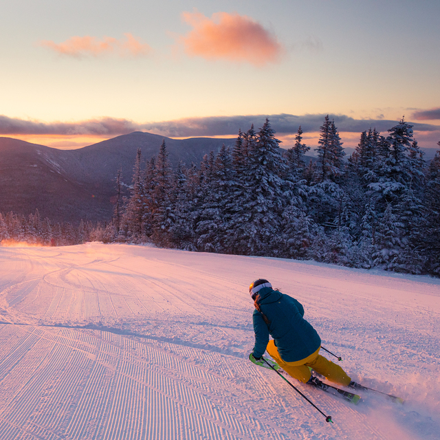
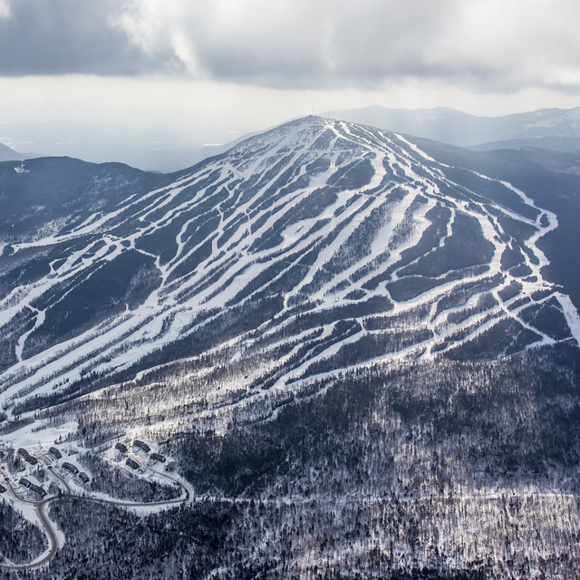
Latest snow reports near Sugarloaf:
| Top snow depth: | 0 cm |
|---|---|
| Bottom snow depth: | 0 cm |
| Fresh snowfall depth: | — |
| Last snowfall: | 20 Apr 2026 |
| Snow Alerts | Create Alert |
0.1 | Bluebird Powder days Fresh snow, mostly sunny, light wind. |
|---|---|
0.2 | Powder days Fresh snow, limited sun, any wind. |
0.1 | Bluebird days Average snow, mostly sunny, light wind. |
The above table gives the weather forecast for Sugarloaf at the specific elevation of 1296 m. Our sophisticated weather models allow us to provide snow forecasts for the top, middle and bottom ski stations of Sugarloaf. To access the weather forecasts for the other elevations, use the tab navigation above the table. For a wider view of the weather, check out the Weather Map of United States.
Click here to read further information on freezing levels and how we forecast our temperatures.
Overall 3.9 Based on 39 votes and 8 reviews
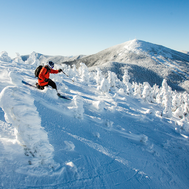
Sugarloaf is the place to be if you are a dedicated hardcore east coast skier. Terrain like none other, and an amazing atmosphere to match. Sugarloaf the best backcountry skiing on the east coast and the grooming is certainly up to par. As for food, the bar located at the bottom of the mountain has a great atmosphere and great for apres-ski. All the people at Sugarloaf are dedicated, and make the trek to go up there every weekend. Sugarloaf is by far the best place to go on the East Coast.
Loafer from United States writes:
Sugarloaf is the place to be if you are a dedicated hardcore east coast skier. Terrain like none other, and an amazing atmosphere to match. Sugarloaf the best backcountry skiing on the east coast and the grooming is certainly up to par. As for food, the bar located at the bottom of the mountain has a great atmosphere and great for apres-ski. All the people at Sugarloaf are dedicated, and make the trek to go up there every weekend. Sugarloaf is by far the best place to go on the East Coast.


 Nearest