

Global Weekly Snow Roundup #314
Weekly Global Snow News, updated 14 May 2026: Fresh snowfall in Argentina, Australia and Lesotho signals winter’s approach, while Japan maintains the world’s deepest snowpack.

Next 3 days weather summary:Light rain (total 8.0mm), mostly falling on Mon afternoon. Mild temperatures (max 9°C on Sun afternoon, min 1°C on Sat morning). Winds decreasing (fresh winds from the NNW on Sat night, calm by Mon night). | Days 4-6 weather summary:Heavy rain (total 22.0mm), heaviest during Tue morning. Mild temperatures (max 9°C on Tue afternoon, min 7°C on Tue morning). Winds increasing (calm on Tue morning, fresh winds from the NW by Wed night). | |||||||||||||||||
Saturday 16 | Sunday 17 | Monday 18 | Tuesday 19 | Wednesday 20 | Thursday 21 | |||||||||||||
AM | PM | night | AM | PM | night | AM | PM | night | AM | PM | night | AM | PM | night | AM | PM | night | |
light snow | light snow | light rain | clear | clear | clear | some clouds | rain shwrs | rain shwrs | rain shwrs | light rain | light rain | light rain | rain shwrs | some clouds | light rain | rain shwrs | rain shwrs | |
km/h | ||||||||||||||||||
Snow map |  |  |  |  |  |  | ||||||||||||
— | 1 | — | — | — | — | — | — | — | — | — | — | — | — | — | — | — | — | |
— | — | 4 | — | — | — | — | 3 | 1 | 3 | 5 | 3 | 3 | 2 | — | 1 | 2 | 3 | |
max °C | 1 | 2 | 3 | 5 | 9 | 7 | 9 | 9 | 8 | 8 | 9 | 9 | 7 | 9 | 8 | 7 | 9 | 8 |
min °C | 1 | 1 | 2 | 2 | 8 | 5 | 6 | 8 | 8 | 7 | 8 | 7 | 7 | 8 | 7 | 7 | 7 | 7 |
-3 | -4 | -4 | -3 | 5 | 5 | 6 | 8 | 6 | 6 | 8 | 5 | 6 | 6 | 3 | 3 | 4 | 4 | |
98 | 98 | 99 | 61 | 47 | 70 | 56 | 69 | 73 | 85 | 88 | 85 | 93 | 85 | 91 | 96 | 85 | 90 | |
1450 | 1600 | 1700 | 2150 | 2250 | 2150 | 2300 | 2500 | 2450 | 2450 | 2700 | 2600 | 2500 | 2700 | 2800 | 2500 | 2800 | 2700 | |
5:18 | — | — | 5:18 | — | — | 5:16 | — | — | 5:15 | — | — | 5:13 | — | — | 5:13 | — | — | |
— | — | 8:27 | — | — | 8:29 | — | — | 8:30 | — | — | 8:30 | — | — | 8:31 | — | — | 8:34 | |
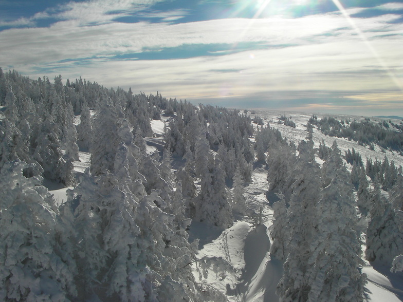
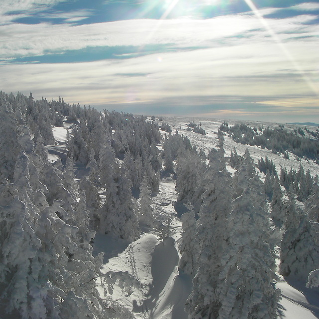
Latest snow reports near Stuhleck:
| Top snow depth: | 0 cm |
|---|---|
| Bottom snow depth: | 0 cm |
| Fresh snowfall depth: | — |
| Last snowfall: | 12 May 2026 |
| Snow Alerts | Create Alert |
0.0 | Bluebird Powder days Fresh snow, mostly sunny, light wind. |
|---|---|
0.0 | Powder days Fresh snow, limited sun, any wind. |
0.0 | Bluebird days Average snow, mostly sunny, light wind. |
The above table gives the weather forecast for Stuhleck at the specific elevation of 1286 m. Our sophisticated weather models allow us to provide snow forecasts for the top, middle and bottom ski stations of Stuhleck. To access the weather forecasts for the other elevations, use the tab navigation above the table. For a wider view of the weather, check out the Weather Map of Austria.
Click here to read further information on freezing levels and how we forecast our temperatures.
Overall 3.1 Based on 19 votes and 3 reviews
We visited Stuhleck for a short 4 day ski trip. The resort is fabulously close to Vienna, only 70 minutes away. We visited with family and stayed in the superbly located hotelBetriebe by the hotel Group Herlinde. The staff at the hotel were very helpful and accommodating. They provided simple but wholesome Austrian half board meals which were welcome after a great day skiing. The resort got busy at the weekend but was pretty empty during the week. For a short trip (skiing with 25km of pistes) it cannot be beaten! We were lucky with snow conditions but I’m told good snow cover is fairly certain. Just check before you book because the resort is only set at 800m and extends up to 1780m. Enjoy.
Guy from Austria writes:
We visited Stuhleck for a short 4 day ski trip. The resort is fabulously close to Vienna, only 70 minutes away. We visited with family and stayed in the superbly located hotelBetriebe by the hotel Group Herlinde. The staff at the hotel were very helpful and accommodating. They provided simple but wholesome Austrian half board meals which were welcome after a great day skiing.
The resort got busy at the weekend but was pretty empty during the week. For a short trip (skiing with 25km of pistes) it cannot be beaten! We were lucky with snow conditions but I’m told good snow cover is fairly certain. Just check before you book because the resort is only set at 800m and extends up to 1780m. Enjoy.


 Nearest