

America’s Next Indoor Snow Centre Takes Shape
Construction of a new indoor snow centre for skiers, boarders and tubers appears to be making good progress at Heritage Farm in Wayne County, West Virginia.

Next 3 days weather summary:Light rain (total 2.0mm), mostly falling on Tue afternoon. Warm (max 27°C on Thu afternoon, min 13°C on Wed night). Wind will be generally light. | Days 4-6 weather summary:Mostly dry. Warm (max 28°C on Fri afternoon, min 13°C on Sun night). Wind will be generally light. | |||||||||||||||||
Tuesday 21 | Wednesday 22 | Thursday 23 | Friday 24 | Saturday 25 | Sunday 26 | |||||||||||||
AM | PM | night | AM | PM | night | AM | PM | night | AM | PM | night | AM | PM | night | AM | PM | night | |
some clouds | rain shwrs | clear | clear | clear | clear | clear | clear | clear | clear | clear | clear | clear | clear | clear | clear | clear | clear | |
km/h | ||||||||||||||||||
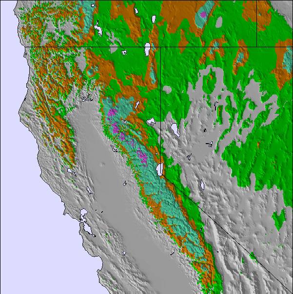
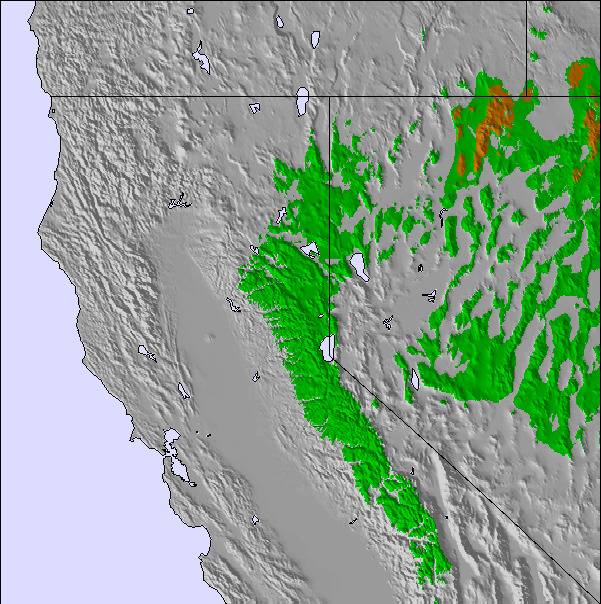
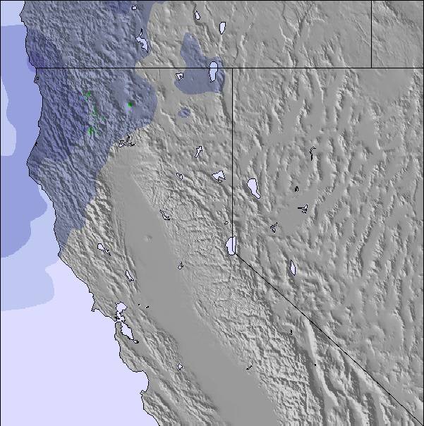
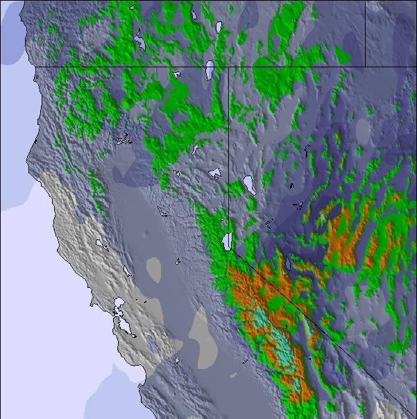
Snow map | 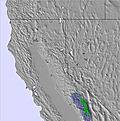 | 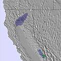 | 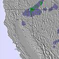 | 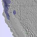 | 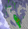 | 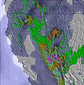 | ||||||||||||
— | — | — | — | — | — | — | — | — | — | — | — | — | — | — | — | — | — | |
mm | — | 2 | — | — | — | — | — | — | — | — | — | — | — | — | — | — | — | — |
max °C | 26 | 24 | 19 | 25 | 26 | 18 | 26 | 27 | 18 | 27 | 28 | 18 | 26 | 27 | 18 | 26 | 27 | 18 |
min °C | 20 | 21 | 14 | 20 | 24 | 13 | 20 | 26 | 13 | 21 | 26 | 14 | 21 | 26 | 14 | 21 | 25 | 13 |
chill °C | 20 | 21 | 14 | 20 | 24 | 12 | 20 | 26 | 12 | 21 | 26 | 13 | 21 | 26 | 13 | 21 | 25 | 12 |
Humid % | 43 | 45 | 58 | 40 | 47 | 68 | 20 | 20 | 22 | 13 | 14 | 18 | 20 | 21 | 26 | 14 | 11 | 19 |
Freeze m | 5100 | 5050 | 5000 | 5000 | 5000 | 5150 | 5200 | 5200 | 5250 | 5200 | 5250 | 5250 | 5100 | 5150 | 5100 | 5100 | 5100 | 5150 |
5:50 | — | — | 5:52 | — | — | 5:52 | — | — | 5:54 | — | — | 5:54 | — | — | 5:54 | — | — | |
— | — | 8:22 | — | — | 8:22 | — | — | 8:21 | — | — | 8:20 | — | — | 8:19 | — | — | 8:17 | |
Go pro and carve into:
Avalanche information: National Avalanche Center
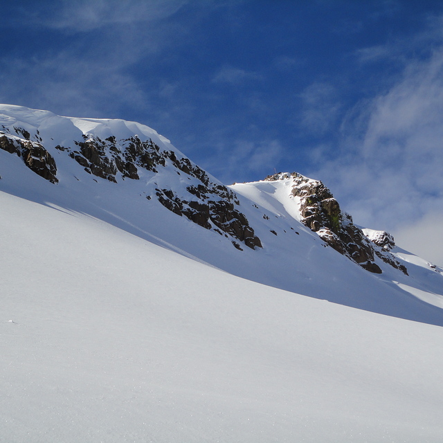
Latest snow reports near Palisades Tahoe:
| Top snow depth: | 0 cm |
|---|---|
| Bottom snow depth: | 0 cm |
| Fresh snowfall depth: | — |
| Last snowfall: | 27 May 2026 |
| Snow Alerts | Create Alert |
0.0 | Bluebird Powder days Fresh snow, mostly sunny, light wind. |
|---|---|
0.0 | Powder days Fresh snow, limited sun, any wind. |
0.0 | Bluebird days Average snow, mostly sunny, light wind. |
The above table gives the weather forecast for Palisades Tahoe at the specific elevation of 1874 m. Our sophisticated weather models allow us to provide snow forecasts for the top, middle and bottom ski stations of Palisades Tahoe. To access the weather forecasts for the other elevations, use the tab navigation above the table. For a wider view of the weather, check out the Weather Map of United States.
Click here to read further information on freezing levels and how we forecast our temperatures.
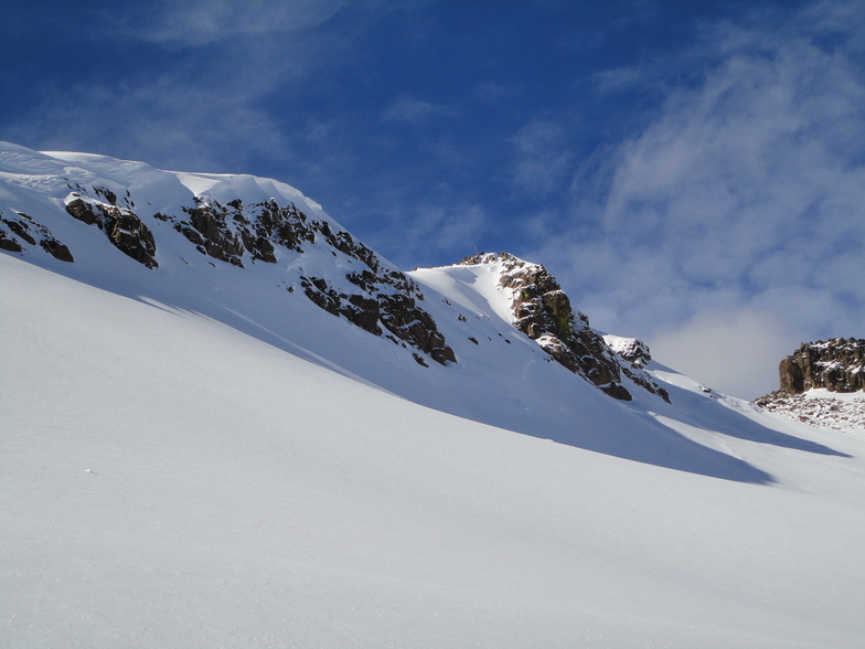
Resort name is also written as Squaw Valley.
Overall 4.4 Based on 18 votes and 5 reviews
Amazing terrain at Squaw, and consistently large snow falls (save for January 2011!!). Problem is though when they do get the snow, the mountain is slow getting terrain open, or the upper mountain will be on wind hold, often leaving 30 min+ waits at the bottom of the select few lifts that do open. This leaves you stuck in line with a bunch of rude, and aggressive locals who'll ski right over your skis or board to get one precious chair ahead of you in the line. When they finally do get Granite Chief/Headwall/ KT22 or whatever open on a powder day you will get a pretty sweet run in.....before you have to spend the rest of your morning in line again. If you can be bothered lining up again, by the time you get back to the top most of the decent lines will be tracked out. Also due to the generally mild conditions the snow usually turns to crud within a day or two of a snow fall. What is not mentioned when they are broadcasting 10 feet of new snow is that several inches of rain also accompanied the storm. We had season passes this season but I wouldn't bother going back to this place. Plenty of other places with great terrain if you are prepared to hunt it out, and without the crowds, hype and aggro....and where you can actually ski powder all day. On a different note, can someone tell the 'Squaw Valley USA' marketing that no-one really cares any more that they hosted the Olympics way back when. It was over 50 years ago, get over it!
coldsmoker from Australia writes:
Amazing terrain at Squaw, and consistently large snow falls (save for January 2011!!).
Problem is though when they do get the snow, the mountain is slow getting terrain open, or the upper mountain will be on wind hold, often leaving 30 min+ waits at the bottom of the select few lifts that do open. This leaves you stuck in line with a bunch of rude, and aggressive locals who'll ski right over your skis or board to get one precious chair ahead of you in the line. When they finally do get Granite Chief/Headwall/ KT22 or whatever open on a powder day you will get a pretty sweet run in.....before you have to spend the rest of your morning in line again. If you can be bothered lining up again, by the time you get back to the top most of the decent lines will be tracked out.
Also due to the generally mild conditions the snow usually turns to crud within a day or two of a snow fall. What is not mentioned when they are broadcasting 10 feet of new snow is that several inches of rain also accompanied the storm.
We had season passes this season but I wouldn't bother going back to this place. Plenty of other places with great terrain if you are prepared to hunt it out, and without the crowds, hype and aggro....and where you can actually ski powder all day.
On a different note, can someone tell the 'Squaw Valley USA' marketing that no-one really cares any more that they hosted the Olympics way back when. It was over 50 years ago, get over it!

 Nearest