


Global Weekly Snow Roundup #314
Weekly Global Snow News, updated 14 May 2026: Fresh snowfall in Argentina, Australia and Lesotho signals winter’s approach, while Japan maintains the world’s deepest snowpack.

Next 4 days weather summary:Mild with light rain (total 3.0mm) on Sat afternoon Becoming colder with a light covering of snow, mostly falling on Mon afternoon. Freeze-thaw conditions (max 12°C on Sat morning, min -6°C on Mon afternoon). Winds decreasing (near gales from the ESE on Sun night, calm by Mon afternoon). | Days 5-7 weather summary:A dusting of snow turning to light rain (total 2.0mm) on Wed afternoon. Freeze-thaw conditions (max 10°C on Thu afternoon, min -5°C on Mon night). Winds increasing (calm on Tue morning, fresh winds from the WNW by Wed afternoon). | |||||||||||||||
Saturday 16 | Sunday 17 | Monday 18 | Tuesday 19 | Wednesday 20 | ||||||||||||
night | AM | PM | night | AM | PM | night | AM | PM | night | AM | PM | night | AM | PM | night | |
some clouds | some clouds | rain shwrs | snow shwrs | snow shwrs | light snow | light snow | light snow | light snow | light snow | light snow | light snow | some clouds | snow shwrs | light rain | clear | |
km/h | ||||||||||||||||
Snow map |  |  | 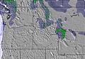 |  |  |  | ||||||||||
— | — | — | — | — | 1 | 3 | 2 | 3 | — | — | — | — | — | — | — | |
— | — | 1 | 2 | — | — | — | — | — | — | — | — | — | — | 2 | — | |
max °C | 10 | 12 | 11 | 7 | 3 | 2 | -2 | -4 | -5 | -5 | -4 | -2 | -1 | 2 | 3 | 3 |
min °C | 8 | 8 | 10 | 0 | 1 | 0 | -4 | -5 | -6 | -5 | -5 | -2 | -2 | 0 | 2 | 2 |
4 | 5 | 7 | -7 | -4 | -5 | -13 | -13 | -8 | -10 | -7 | -6 | -4 | -5 | -4 | -4 | |
25 | 36 | 31 | 78 | 69 | 68 | 98 | 98 | 95 | 93 | 93 | 78 | 71 | 59 | 56 | 55 | |
4000 | 3900 | 4250 | 3450 | 3000 | 3150 | 2550 | 2100 | 2050 | 1550 | 2050 | 2650 | 2550 | 2850 | 3150 | 3250 | |
— | 5:43 | — | — | 5:41 | — | — | 5:41 | — | — | 5:39 | — | — | 5:39 | — | — | |
— | — | 8:14 | — | — | 8:15 | — | — | 8:15 | — | — | 8:16 | — | — | 8:17 | — | |
Latest snow reports near Snowy Range Ski and Recreation Area:
| Top snow depth: | — |
|---|---|
| Bottom snow depth: | — |
| Fresh snowfall depth: | — |
| Last snowfall: | 9 May 2026 |
| Snow Alerts | Create Alert |
0.1 | Bluebird Powder days Fresh snow, mostly sunny, light wind. |
|---|---|
0.3 | Powder days Fresh snow, limited sun, any wind. |
0.1 | Bluebird days Average snow, mostly sunny, light wind. |
The above table gives the weather forecast for Snowy Range Ski and Recreation Area at the specific elevation of 2894 m. Our sophisticated weather models allow us to provide snow forecasts for the top, middle and bottom ski stations of Snowy Range Ski and Recreation Area. To access the weather forecasts for the other elevations, use the tab navigation above the table. For a wider view of the weather, check out the Weather Map of United States.
Click here to read further information on freezing levels and how we forecast our temperatures.
You best update that terrain park info... suppose to have some sick features this year 2012!
Joe from United States writes:
You best update that terrain park info... suppose to have some sick features this year 2012!
Read 1 more reviews of Snowy Range Ski and Recreation Area or submit your own


 Nearest