Issued by Snow-Forecast.com at:11 pm (local time) / 13 Jun 2026
Last 6 daysScroll left for last 6 daysNow
Next 4 days weather summary:
Mostly dry. Very mild (max 13°C on Tue afternoon, min 8°C on Sun morning). Winds increasing (calm on Sun night, fresh winds from the WNW by Tue afternoon).
Days 5-7 weather summary:
Mostly dry. Very mild (max 16°C on Fri afternoon, min 9°C on Wed morning). Winds decreasing (strong winds from the WNW on Tue night, light winds from the WNW by Thu night).
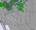
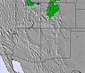
The above table gives the weather forecast for Snowbird at the specific elevation of 3352 m. Our sophisticated weather models allow us to provide snow forecasts for the top, middle and bottom ski stations of Snowbird. To access the weather forecasts for the other elevations, use the tab navigation above the table. For a wider view of the weather, check out the Weather Map of United States.
Click here to read further information on freezing levels and how we forecast our temperatures.
Snowbird offers an impressive terrain with 988 m of vertical drop, 85 trails across 1,011 hectares, and a solid infrastructure with 13 lifts. Because its snow conditions are closely tracked — including average snow-days in December of ~3.4 snow days/week.
For users of the Snow Day Predictor tool, Snowbird is a strong test case: its well-monitored snow history and predictable seasonal patterns mean that forecasting models (like yours) can be calibrated effectively. The detailed data (snow depth, recent accumulation, live weather conditions) available for Snowbird helps refine and validate the predictor’s algorithms.
In short: Snowbird is not just a world-class resort — it also provides the reliable snow-weather data context that makes your Snow Day Predictor more accurate and meaningful to users planning for a snow day.
Free Snow-Forecast.com weather widget for your website
Embed the Snowbird weather widget on your site for free. It provides a weekly snapshot of snow and rain conditions across all elevations. Follow the two quick steps to grab your custom code and paste it into your site. Choose between metric or imperial units. Click here to get the code.


 Nearest