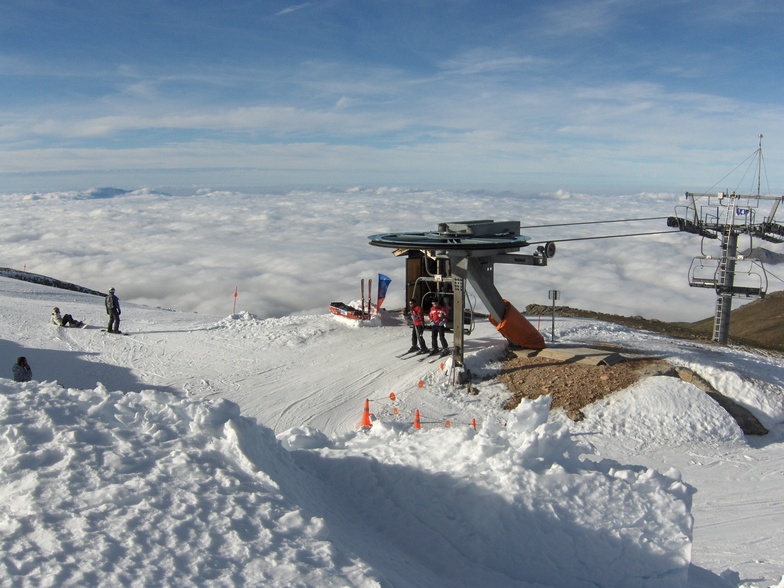


Portillo Re-Opens To Guests Arriving By Helicopter
Chile’s famous Portillo ski resort is reported to have re-opened to guests arriving by helicopter after being cut off by road for more than two weeks by over 6m/20 feet of snowfall.

Next 3 days weather summary:Some drizzle, heaviest during Wed night. Very mild (max 18°C on Wed afternoon, min 13°C on Mon morning). Wind will be generally light. | Days 4-6 weather summary:Mostly dry. Warm (max 21°C on Fri afternoon, min 15°C on Thu morning). Wind will be generally light. | |||||||||||||||||
Monday 3 | Tuesday 4 | Wednesday 5 | Thursday 6 | Friday 7 | Saturday 8 | |||||||||||||
AM | PM | night | AM | PM | night | AM | PM | night | AM | PM | night | AM | PM | night | AM | PM | night | |
some clouds | clear | clear | clear | clear | clear | some clouds | clear | rain shwrs | clear | clear | clear | clear | clear | clear | clear | clear | clear | |
km/h | ||||||||||||||||||
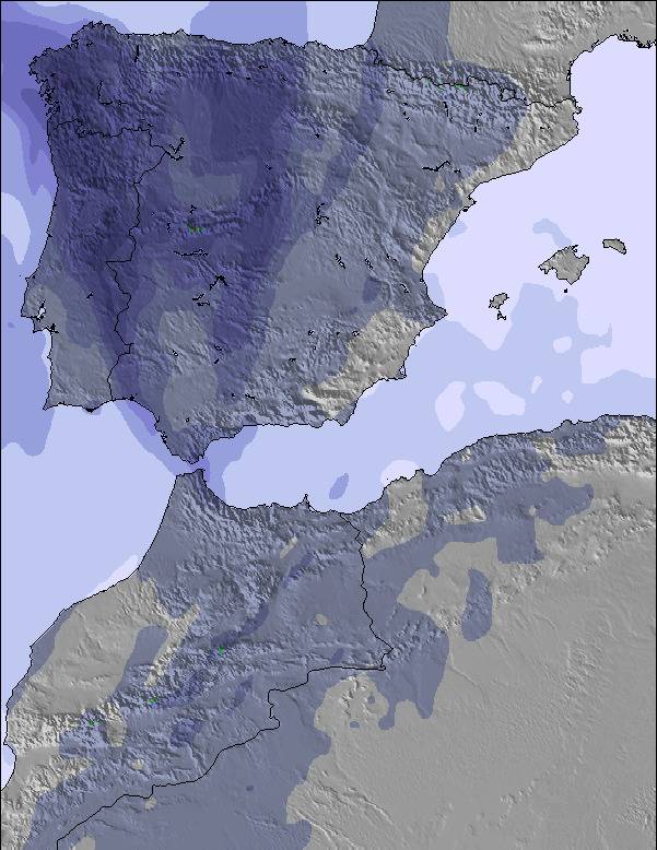
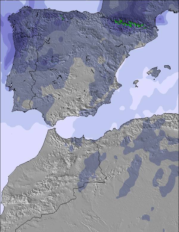
Snow map | 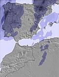 |  | 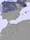 | 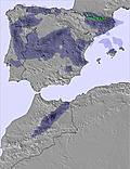 | 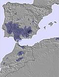 | 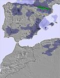 | ||||||||||||
— | — | — | — | — | — | — | — | — | — | — | — | — | — | — | — | — | — | |
mm | — | — | — | — | — | — | — | — | 1 | — | — | — | — | — | — | — | — | — |
max °C | 14 | 15 | 15 | 13 | 17 | 17 | 15 | 18 | 18 | 16 | 19 | 19 | 17 | 21 | 21 | 17 | 20 | 20 |
min °C | 13 | 14 | 13 | 13 | 16 | 15 | 15 | 16 | 16 | 15 | 17 | 17 | 16 | 19 | 17 | 17 | 19 | 17 |
chill °C | 11 | 12 | 12 | 12 | 15 | 15 | 15 | 16 | 16 | 15 | 17 | 16 | 16 | 19 | 17 | 17 | 19 | 17 |
Humid % | 54 | 59 | 53 | 52 | 43 | 52 | 53 | 50 | 52 | 46 | 43 | 44 | 36 | 30 | 33 | 32 | 26 | 35 |
Freeze m | 4150 | 4100 | 4650 | 4800 | 4600 | 4750 | 4600 | 4550 | 4550 | 4600 | 4650 | 4650 | 4700 | 4750 | 4700 | 4500 | 4600 | 4550 |
7:20 | — | — | 7:22 | — | — | 7:22 | — | — | 7:24 | — | — | 7:24 | — | — | 7:26 | — | — | |
— | — | 9:35 | — | — | 9:34 | — | — | 9:32 | — | — | 9:31 | — | — | 9:30 | — | — | 9:30 | |
Go pro and carve into:
Avalanche information: European Avalanche Warning Services (EAWS)
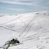
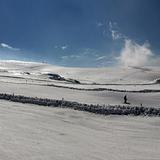
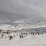
Latest snow reports near Sierra de Béjar - La Covatilla:
| Top snow depth: | — |
|---|---|
| Bottom snow depth: | — |
| Fresh snowfall depth: | — |
| Last snowfall: | 12 May 2026 |
| Snow Alerts | Create Alert |
0.0 | Bluebird Powder days Fresh snow, mostly sunny, light wind. |
|---|---|
0.0 | Powder days Fresh snow, limited sun, any wind. |
0.0 | Bluebird days Average snow, mostly sunny, light wind. |
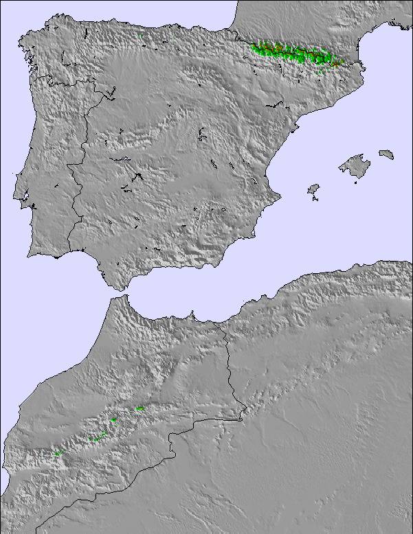
The above table gives the weather forecast for Sierra de Béjar - La Covatilla at the specific elevation of 2178 m. Our sophisticated weather models allow us to provide snow forecasts for the top, middle and bottom ski stations of Sierra de Béjar - La Covatilla. To access the weather forecasts for the other elevations, use the tab navigation above the table. For a wider view of the weather, check out the Weather Map of Spain.
Click here to read further information on freezing levels and how we forecast our temperatures.
Resort name is also written as Sierra de Bejar - La Covatilla.
Overall 3.1 Based on 16 votes and 28 reviews
La gestión del Ayuntamiento de Béjar en esta estación está resultando pésima, debería privatizarse ya y que los políticos dejen de jorobarnos tb en esto.
Francisco from Spain writes:
La gestión del Ayuntamiento de Béjar en esta estación está resultando pésima, debería privatizarse ya y que los políticos dejen de jorobarnos tb en esto.
Read 27 more reviews of Sierra de Béjar - La Covatilla or submit your own


 Nearest