Alternatively, you can now use your Outside account to sign in to any brand in the Outside digital ecosystem, including Snow-Forecast, Surf-Forecast, and Mountain-Forecast.
The snow forecast for Serfaus is: Mostly dry. Very mild (max 17°C on Sun afternoon, min 3°C on Fri night). Wind will be generally light.
Serfaus Weather (Next 3 days): The snow forecast for Serfaus is: Mostly dry. Very mild (max 17°C on Sun afternoon, min 3°C on Fri night). Wind will be generally light.
Serfaus Weather (Days 4-6): Heavy rain (total 28.0mm), heaviest during Wed night. Very mild (max 14°C on Wed afternoon, min 8°C on Wed night). Wind will be generally light.
Serfaus Live Weather
Resort
Snow Depth
Temp. (°C)
Wind (km/h)
Weather
Top Lift:
0
Middle Lift:
3
Bottom Lift:
4
Powered by Snow-Forecast.com
Serfaus Weather
(Next 3 days):
The snow forecast for Serfaus is: Mostly dry. Very mild (max 17°C on Sun afternoon, min 3°C on Fri night). Wind will be generally light.
Serfaus Weather (Days 4-6):
Heavy rain (total 28.0mm), heaviest during Wed night. Very mild (max 14°C on Wed afternoon, min 8°C on Wed night). Wind will be generally light.
Light rain showers reported from Galtür at 1577 metres elevation 9 kms SW of Ischgl but it is forecast cold enough for snow at higher elevations in the ski area from Ischgl
25km away from Serfaus
11 hours ago
Light rain showers reported from Pitztaler Gletscher at 2848 metres elevation only 4 kms SSE of Pitztal Glacier but it is forecast cold enough for snow at higher elevations in the ski area from Pitztal Glacier
The above table gives the weather forecast for Serfaus at the specific elevation of 2010 m. Our sophisticated weather models allow us to provide snow forecasts for the top, middle and bottom ski stations of Serfaus. To access the weather forecasts for the other elevations, use the tab navigation above the table. For a wider view of the weather, check out the Weather Map of Austria.
Click here to read further information on freezing levels and how we forecast our temperatures.
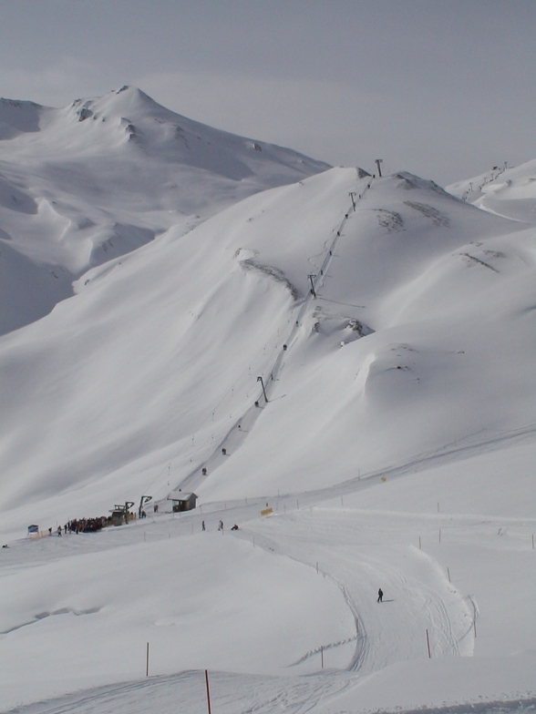
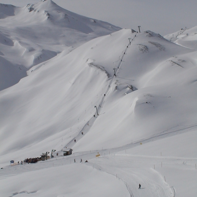
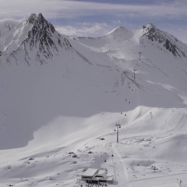
We arrived in Serfaus in mid-January and we were lucky enough to get some snow on the first day, on an otherwise poor snow season, so the slopes were decent at the start of the day. By the end of the day, however, you were skiing on ice on most of the busy connecting slopes linking Serfaus, Fiss and Ladis. The longest lines were about 10 minutes, but generally they were under 5 minutes.
Unsurprisingly, you find the best slopes at the highest altitude: the Masner area at the left end of the map is absolutely great, when it isn't absolutely crowded (try going there at the start of the week, if conditions allow). The self-service Masner restaurant is conveniently placed at the bottom of all runs there.
At the right-end of the map, the Frommesabfahrt piste no. 7 offers fantastic views and over 1000 vertical meters of descent.
While we loved some of the slopes - 155 Masnerabfahrt, 160 Masnerkopfabfahrt, 7 Frommesabfahrt, 153 Masner-Alm-Abfahrt, 18 Schöngampabfahrt, we didn't love the transit routes between the various parts of the domain, which mean that you spent an average of two hours every day commuting on busy slopes and lifts.
Given these drawbacks, it is worth going for "Skipass 6", which includes Kaunertal (lovely little glacier domain with fantastic views, rolling slopes, a tunnel and no lift lines, take the bus if you don't like snowy switchbacks) plus Venet (where you'll have the slopes to yourself), plus Nauders (with the longest run 3+1 and great views, also less crowded than Serfaus).
Free Snow-Forecast.com weather widget for your website
The Serfaus skiing weather widget is available to embed on external websites free of charge. It provides a daily summary of our Serfaus snow forecast and current weather conditions. Simply go to the feed configuration page and follow the 3 simple steps to grab the custom html code snippet and paste it into your own site. You can choose the snow forecast elevation (summit, mid-mountain or bottom lift) and metric/imperial units for the snow forecast feed to suit your own website…. Click here to get the code.


 Nearest