

Global Weekly Snow Roundup #314
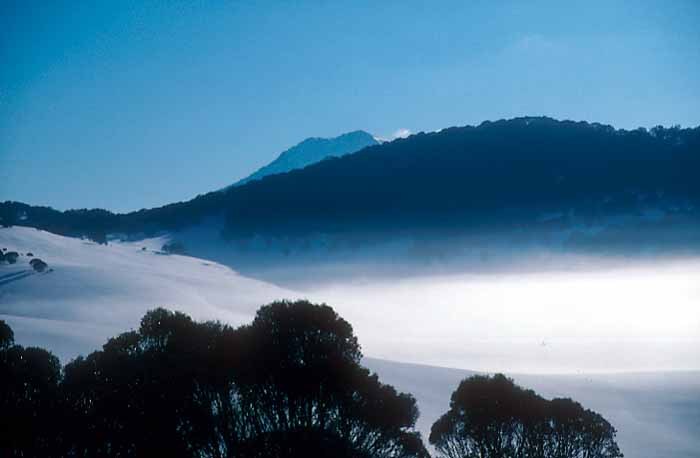
Weekly Global Snow News, updated 14 May 2026: Fresh snowfall in Argentina, Australia and Lesotho signals winter’s approach, while Japan maintains the world’s deepest snowpack.

Next 3 days weather summary:Light rain (total 5.0mm), mostly falling on Fri afternoon. Very mild (max 12°C on Sat morning, min 8°C on Fri night). Wind will be generally light. | Days 4-6 weather summary:Heavy rain (total 42.0mm), heaviest during Tue morning. Mild temperatures (max 8°C on Mon afternoon, min 1°C on Tue night). Winds decreasing (fresh winds from the W on Tue afternoon, calm by Thu morning). | ||||||||||||||||
Fri 15 | Saturday 16 | Sunday 17 | Monday 18 | Tuesday 19 | Wednesday 20 | ||||||||||||
PM | night | AM | PM | night | AM | PM | night | AM | PM | night | AM | PM | night | AM | PM | night | |
rain shwrs | some clouds | cloudy | some clouds | some clouds | some clouds | cloudy | light rain | light rain | light rain | heavy rain | heavy rain | light rain | light snow | light snow | light snow | some clouds | |
km/h | |||||||||||||||||
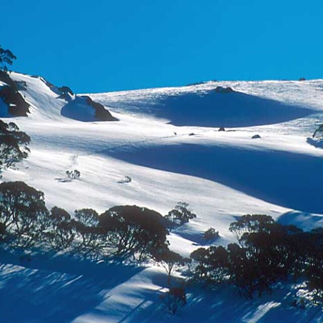
Snow map | 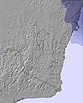 | 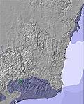 | 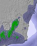 | 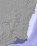 | 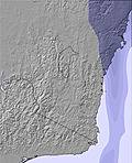 | 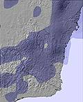 | |||||||||||
— | — | — | — | — | — | — | — | — | — | — | — | — | — | — | — | — | |
1 | — | — | — | — | — | — | 2 | 2 | 3 | 16 | 20 | 2 | 1 | — | — | — | |
max °C | 11 | 9 | 12 | 11 | 9 | 12 | 11 | 10 | 9 | 8 | 8 | 8 | 6 | 2 | 2 | 2 | 4 |
min °C | 9 | 8 | 10 | 9 | 9 | 10 | 10 | 8 | 8 | 8 | 8 | 7 | 4 | 1 | 1 | 2 | 2 |
7 | 6 | 9 | 7 | 7 | 9 | 10 | 8 | 6 | 6 | 6 | 3 | -2 | -5 | -2 | 0 | 0 | |
60 | 73 | 60 | 55 | 77 | 68 | 64 | 63 | 79 | 92 | 98 | 99 | 96 | 95 | 98 | 99 | 84 | |
2800 | 2850 | 2950 | 3000 | 3200 | 3100 | 2950 | 2650 | 2850 | 2950 | 3000 | 2900 | 2450 | 2000 | 1700 | 1900 | 2500 | |
— | — | 6:54 | — | — | 6:56 | — | — | 6:56 | — | — | 6:56 | — | — | 6:58 | — | — | |
5:09 | — | — | 5:08 | — | — | 5:07 | — | — | 5:07 | — | — | 5:07 | — | — | 5:06 | — | |
Latest snow reports near Selwyn Snowfields:
| Top snow depth: | — |
|---|---|
| Bottom snow depth: | — |
| Fresh snowfall depth: | — |
| Last snowfall: | 7 May 2026 |
| Snow Alerts | Create Alert |
0.1 | Bluebird Powder days Fresh snow, mostly sunny, light wind. |
|---|---|
0.0 | Powder days Fresh snow, limited sun, any wind. |
0.0 | Bluebird days Average snow, mostly sunny, light wind. |
The above table gives the weather forecast for Selwyn Snowfields at the specific elevation of 1460 m. Our sophisticated weather models allow us to provide snow forecasts for the top, middle and bottom ski stations of Selwyn Snowfields. To access the weather forecasts for the other elevations, use the tab navigation above the table. For a wider view of the weather, check out the Weather Map of Australia.
Click here to read further information on freezing levels and how we forecast our temperatures.
Overall 2.4 Based on 7 votes and 3 reviews
Selwyn (Selwyn Snowfields) has improved considerably in recent years with better snow, snow making and grooming. The Hydro Electricity Authority has been cloud seeding in recent years which has greatly improved the snow cover. It is a great place for families (kids can't get lost) and is much cheaper than the main range resorts.
Cj from Australia writes:
Selwyn (Selwyn Snowfields) has improved considerably in recent years with better snow, snow making and grooming. The Hydro Electricity Authority has been cloud seeding in recent years which has greatly improved the snow cover.
It is a great place for families (kids can't get lost) and is much cheaper than the main range resorts.


 Nearest