
Is AI About to Change How We Plan Ski Trips?
Meet WeSki.ai - the new AI-powered trip planner from the ski experts at WeSki that turns your ideas into a fully planned ski trip in seconds, simply by describing what you want.

Next 3 days weather summary:Heavy rain (total 30.0mm), heaviest during Fri night. Very mild (max 15°C on Sun afternoon, min 3°C on Sat night). Wind will be generally light. | Days 4-6 weather summary:Heavy rain (total 33.0mm), heaviest during Mon night. Very mild (max 18°C on Mon afternoon, min 6°C on Mon night). Wind will be generally light. | |||||||||||||||||
Friday 15 | Saturday 16 | Sunday 17 | Monday 18 | Tuesday 19 | Wednesday 20 | |||||||||||||
AM | PM | night | AM | PM | night | AM | PM | night | AM | PM | night | AM | PM | night | AM | PM | night | |
light rain | light rain | heavy rain | light rain | light rain | rain shwrs | clear | some clouds | clear | rain shwrs | risk thun- der | rain shwrs | some clouds | light rain | light rain | light rain | rain shwrs | mod. rain | |
km/h | ||||||||||||||||||
Snow map |  |  |  |  |  |  | ||||||||||||
— | — | — | — | — | — | — | — | — | — | — | — | — | — | — | — | — | — | |
4 | 3 | 15 | 4 | 3 | 1 | — | — | — | 1 | 3 | 7 | — | 1 | 5 | 5 | 3 | 8 | |
max °C | 6 | 10 | 6 | 5 | 8 | 7 | 12 | 15 | 11 | 17 | 18 | 10 | 16 | 15 | 11 | 11 | 15 | 12 |
min °C | 4 | 8 | 4 | 5 | 7 | 3 | 7 | 15 | 4 | 10 | 14 | 6 | 10 | 14 | 10 | 10 | 11 | 7 |
4 | 8 | 4 | 5 | 7 | 3 | 7 | 15 | 4 | 10 | 14 | 6 | 10 | 14 | 10 | 10 | 11 | 7 | |
93 | 91 | 100 | 99 | 89 | 89 | 62 | 49 | 80 | 53 | 71 | 96 | 61 | 68 | 96 | 92 | 78 | 95 | |
1450 | 1700 | 1350 | 1400 | 1700 | 1500 | 2000 | 2350 | 2350 | 2450 | 2550 | 2200 | 2450 | 2600 | 2450 | 2400 | 2550 | 2450 | |
5:33 | — | — | 5:33 | — | — | 5:31 | — | — | 5:31 | — | — | 5:30 | — | — | 5:28 | — | — | |
— | — | 8:39 | — | — | 8:42 | — | — | 8:43 | — | — | 8:44 | — | — | 8:45 | — | — | 8:45 | |
Latest snow reports near Scheffau (SkiWelt):
| Top snow depth: | — |
|---|---|
| Bottom snow depth: | — |
| Fresh snowfall depth: | 14 cm |
| Last snowfall: | 14 May 2026 |
| Snow Alerts | Create Alert |
0.0 | Bluebird Powder days Fresh snow, mostly sunny, light wind. |
|---|---|
0.0 | Powder days Fresh snow, limited sun, any wind. |
0.0 | Bluebird days Average snow, mostly sunny, light wind. |

The above table gives the weather forecast for Scheffau (SkiWelt) at the specific elevation of 620 m. Our sophisticated weather models allow us to provide snow forecasts for the top, middle and bottom ski stations of Scheffau (SkiWelt). To access the weather forecasts for the other elevations, use the tab navigation above the table. For a wider view of the weather, check out the Weather Map of Austria.
Click here to read further information on freezing levels and how we forecast our temperatures.
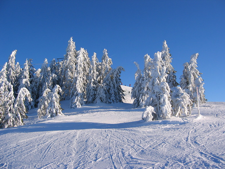
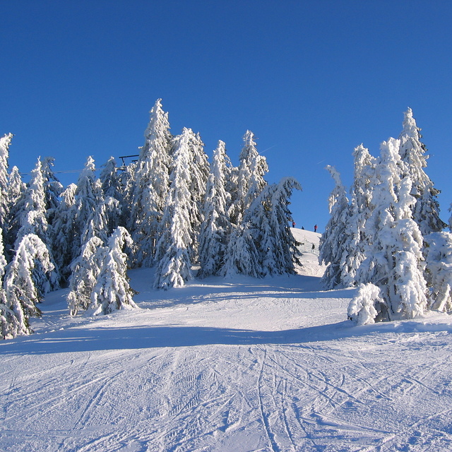
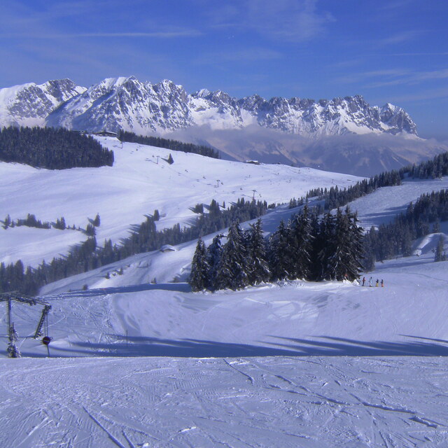
Resort name is also written as Scheffau.
Overall 3.8 Based on 7 votes and 13 reviews
What a place. Just got back from Sheffau on Saturday and have to say it was the best ski holiday ever. Stopped at the Pension Aloisia just opposite the lift. Food was fantastic and the never ending slopes were more than you could ever ask for. If this one comes up as an option, jump at it for the piste. Sheffau is very, very quiet with only 1 decent pub in the village so if it is nightlife you are after head for Soll (next resort) which also shares the same runs. Family involved? Then this is you place.
Matt Evans from United Kingdom writes:
What a place. Just got back from Sheffau on Saturday and have to say it was the best ski holiday ever. Stopped at the Pension Aloisia just opposite the lift. Food was fantastic and the never ending slopes were more than you could ever ask for. If this one comes up as an option, jump at it for the piste. Sheffau is very, very quiet with only 1 decent pub in the village so if it is nightlife you are after head for Soll (next resort) which also shares the same runs. Family involved? Then this is you place.
Read 12 more reviews of Scheffau (SkiWelt) or submit your own


 Nearest