

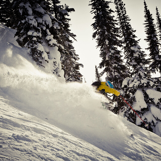
Portillo Storm Snowfall Total Passes 5m / 17 Feet
A snow storm that has now continued for nine days has taken Chilean ski resort Portillo to a snowfall total of 5.2 metres (17 feet) so far, with more snow forecast.

Next 3 days weather summary:Some drizzle, heaviest during Tue afternoon. Warm (max 25°C on Thu afternoon, min 9°C on Tue night). Wind will be generally light. | Days 4-6 weather summary:Light rain (total 8.0mm), mostly falling on Sat afternoon. Warm (max 26°C on Fri afternoon, min 6°C on Sat night). Wind will be generally light. | |||||||||||||||||
Tuesday 28 | Wednesday 29 | Thursday 30 | Friday 31 | Saturday 1 | Sunday 2 | |||||||||||||
AM | PM | night | AM | PM | night | AM | PM | night | AM | PM | night | AM | PM | night | AM | PM | night | |
cloudy | rain shwrs | clear | clear | some clouds | some clouds | clear | clear | clear | clear | clear | clear | some clouds | t-storm risk | rain shwrs | rain shwrs | rain shwrs | some clouds | |
km/h | ||||||||||||||||||
Snow map | 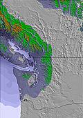 | 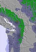 | 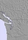 | 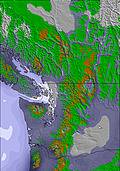 |  | 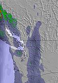 | ||||||||||||
— | — | — | — | — | — | — | — | — | — | — | — | — | — | — | — | — | — | |
mm | — | 1 | — | — | — | — | — | — | — | — | — | — | — | 2 | 3 | 1 | 2 | — |
max °C | 19 | 20 | 18 | 17 | 21 | 19 | 21 | 25 | 23 | 21 | 26 | 24 | 22 | 22 | 14 | 10 | 13 | 12 |
min °C | 13 | 19 | 9 | 11 | 20 | 13 | 14 | 24 | 14 | 15 | 25 | 15 | 16 | 15 | 6 | 7 | 13 | 7 |
chill °C | 13 | 19 | 9 | 11 | 20 | 13 | 14 | 24 | 14 | 15 | 25 | 15 | 16 | 15 | 5 | 6 | 12 | 7 |
Humid % | 42 | 40 | 57 | 33 | 20 | 38 | 30 | 18 | 38 | 25 | 20 | 41 | 30 | 68 | 66 | 60 | 45 | 67 |
Freeze m | 3650 | 3650 | 3600 | 3400 | 3850 | 4050 | 4050 | 4400 | 4300 | 4200 | 4500 | 4450 | 4000 | 3450 | 2650 | 2600 | 2800 | 2600 |
5:11 | — | — | 5:13 | — | — | 5:15 | — | — | 5:16 | — | — | 5:18 | — | — | 5:18 | — | — | |
— | — | 8:45 | — | — | 8:43 | — | — | 8:42 | — | — | 8:39 | — | — | 8:38 | — | — | 8:37 | |
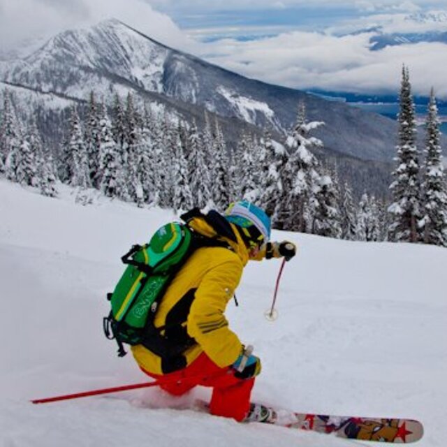
Go pro and carve into:
Avalanche information: Avalanche Canada
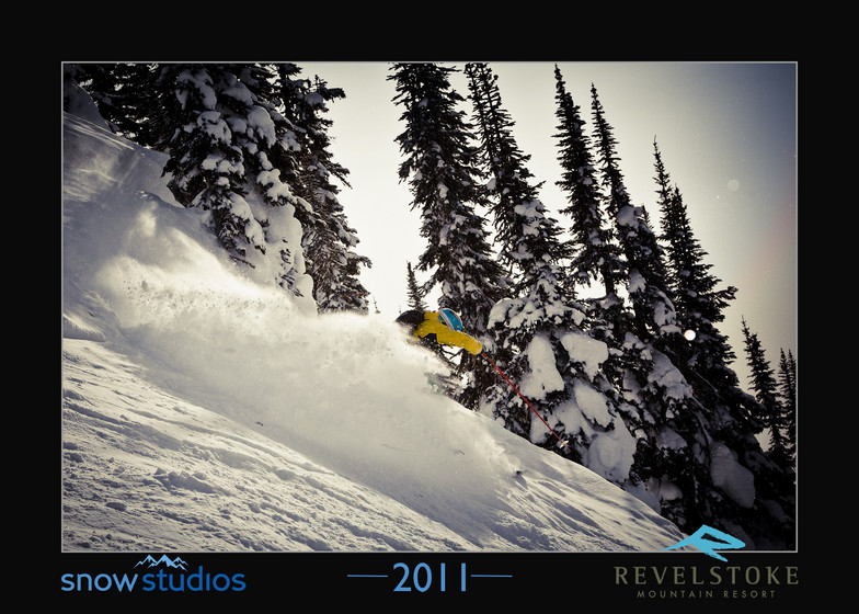
Latest snow reports near Revelstoke Mountain Resort:
| Top snow depth: | 0 cm |
|---|---|
| Bottom snow depth: | 0 cm |
| Fresh snowfall depth: | — |
| Last snowfall: | 19 May 2026 |
| Snow Alerts | Create Alert |
0.0 | Bluebird Powder days Fresh snow, mostly sunny, light wind. |
|---|---|
0.0 | Powder days Fresh snow, limited sun, any wind. |
0.0 | Bluebird days Average snow, mostly sunny, light wind. |
The above table gives the weather forecast for Revelstoke Mountain Resort at the specific elevation of 1368 m. Our sophisticated weather models allow us to provide snow forecasts for the top, middle and bottom ski stations of Revelstoke Mountain Resort. To access the weather forecasts for the other elevations, use the tab navigation above the table. For a wider view of the weather, check out the Weather Map of Canada.
Click here to read further information on freezing levels and how we forecast our temperatures.
Overall 3.4 Based on 76 votes and 111 reviews
Fab terrain. Was there in worst early February conditions on record. Mid mountain facilites equivalent to NZ club field but detachable quads. I was expecting matching rope tows! Mountain base limited tourist trap facilities. Overall, would be a fab mountain with pow.
Fraser from Australia writes:
Fab terrain. Was there in worst early February conditions on record. Mid mountain facilites equivalent to NZ club field but detachable quads. I was expecting matching rope tows! Mountain base limited tourist trap facilities.
Overall, would be a fab mountain with pow.
Read 110 more reviews of Revelstoke Mountain Resort or submit your own


 Nearest