

Global Weekly Snow Roundup #314
Weekly Global Snow News, updated 14 May 2026: Fresh snowfall in Argentina, Australia and Lesotho signals winter’s approach, while Japan maintains the world’s deepest snowpack.

Next 3 days weather summary:Moderate rain (total 14.0mm), heaviest on Mon night. Freeze-thaw conditions (max 7°C on Sun afternoon, min -4°C on Sat night). Wind will be generally light. | Days 4-6 weather summary:Moderate rain (total 11.0mm), heaviest on Wed afternoon. Very mild (max 13°C on Thu afternoon, min 3°C on Tue night). Wind will be generally light. | ||||||||||||||||
Sat 16 | Sunday 17 | Monday 18 | Tuesday 19 | Wednesday 20 | Thursday 21 | ||||||||||||
PM | night | AM | PM | night | AM | PM | night | AM | PM | night | AM | PM | night | AM | PM | night | |
light rain | clear | clear | light rain | light rain | light rain | light rain | rain shwrs | rain shwrs | light rain | rain shwrs | cloudy | rain shwrs | rain shwrs | cloudy | rain shwrs | some clouds | |
km/h | |||||||||||||||||
Snow map |  |  |  |  |  |  | |||||||||||
— | — | — | — | — | — | — | — | — | — | — | — | — | — | — | — | — | |
2 | — | — | 1 | 1 | 1 | 3 | 5 | 1 | 2 | 2 | — | 3 | 2 | — | 2 | — | |
max °C | 3 | 1 | 3 | 7 | 4 | 5 | 6 | 4 | 6 | 9 | 7 | 8 | 11 | 9 | 10 | 13 | 10 |
min °C | 2 | -4 | 0 | 6 | 1 | 2 | 6 | 2 | 3 | 7 | 3 | 5 | 10 | 5 | 6 | 12 | 6 |
-1 | -4 | 0 | 5 | 1 | 2 | 5 | 2 | 3 | 7 | 2 | 4 | 10 | 4 | 5 | 12 | 5 | |
58 | 76 | 52 | 52 | 90 | 70 | 75 | 92 | 68 | 59 | 86 | 62 | 56 | 78 | 55 | 45 | 76 | |
2200 | 1150 | 2250 | 2600 | 2100 | 2400 | 2600 | 2250 | 2550 | 2850 | 2700 | 2850 | 3050 | 2850 | 3000 | 3300 | 3100 | |
— | — | 5:37 | — | — | 5:35 | — | — | 5:35 | — | — | 5:33 | — | — | 5:33 | — | — | |
— | 8:40 | — | — | 8:42 | — | — | 8:43 | — | — | 8:44 | — | — | 8:45 | — | — | 8:46 | |
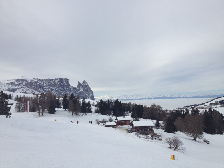
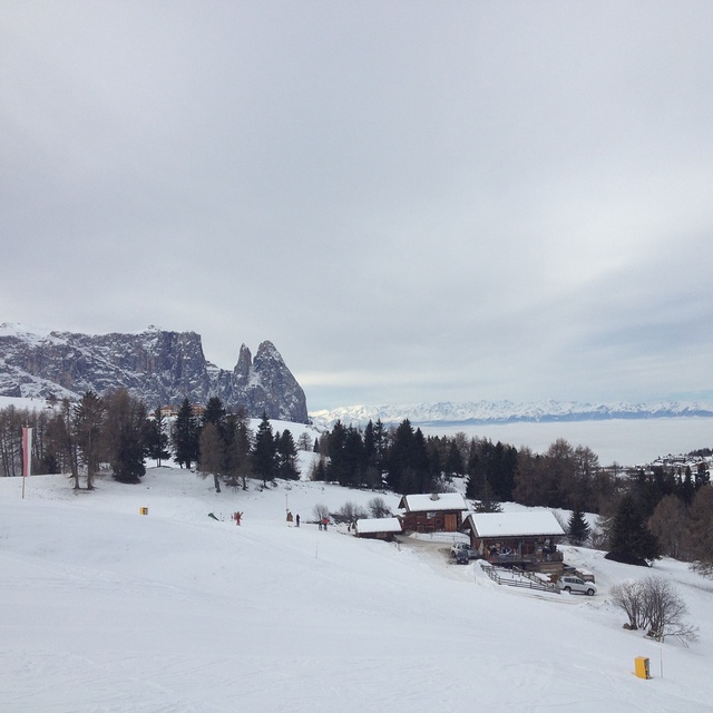
Latest snow reports near Ortisei:
Moderate snow reported from Rolle Pass Airport at 2083 metres elevation only 2 kms S of Passo Rolle Ski Resort from Passo Rolle
Blowing heavy snow reported from Rolle Pass Airport at 2083 metres elevation only 2 kms S of Passo Rolle Ski Resort from Passo Rolle
Moderate snow reported from Rolle Pass at 2083 metres elevation only 2 kms S of Passo Rolle Ski Resort from Passo Rolle
| Top snow depth: | — |
|---|---|
| Bottom snow depth: | — |
| Fresh snowfall depth: | 26 cm |
| Last snowfall: | 15 May 2026 |
| Snow Alerts | Create Alert |
0.0 | Bluebird Powder days Fresh snow, mostly sunny, light wind. |
|---|---|
0.2 | Powder days Fresh snow, limited sun, any wind. |
0.0 | Bluebird days Average snow, mostly sunny, light wind. |
The above table gives the weather forecast for Ortisei at the specific elevation of 1877 m. Our sophisticated weather models allow us to provide snow forecasts for the top, middle and bottom ski stations of Ortisei. To access the weather forecasts for the other elevations, use the tab navigation above the table. For a wider view of the weather, check out the Weather Map of Italy.
Click here to read further information on freezing levels and how we forecast our temperatures.
Overall 4.3 Based on 3 votes and 1 review
What a good place. We found a great apartment, at Ortisei, through the tourist office the morning we travelled (villa Prinoth). We drove from Bergamo which took about 3 hours. The resort has great amenities and escalators to drop you in the town or go to the lifts. Loads of pretty runs for snowboarding. Some good long ones and not too many flats. If it has snowed a lot take the single chair on the Seceda side instead of the gondola and you will get a pretty tree lined run all to yourself. If you want to do the Sella Ronda it is pretty easy going but the queues are bad on the lifts around the Wolkenstien. The igloo bar is ok. The bar staff are pretty and shake it to the music. Really worth going to Ortisei. Pretty runs, great scenery and the people are really friendly. Ortisei is a good antedote to some of the over priced French resorts.
Graeme Tucker from United Kingdom writes:
What a good place. We found a great apartment, at Ortisei, through the tourist office the morning we travelled (villa Prinoth). We drove from Bergamo which took about 3 hours. The resort has great amenities and escalators to drop you in the town or go to the lifts. Loads of pretty runs for snowboarding. Some good long ones and not too many flats. If it has snowed a lot take the single chair on the Seceda side instead of the gondola and you will get a pretty tree lined run all to yourself. If you want to do the Sella Ronda it is pretty easy going but the queues are bad on the lifts around the Wolkenstien. The igloo bar is ok. The bar staff are pretty and shake it to the music. Really worth going to Ortisei. Pretty runs, great scenery and the people are really friendly. Ortisei is a good antedote to some of the over priced French resorts.


 Nearest