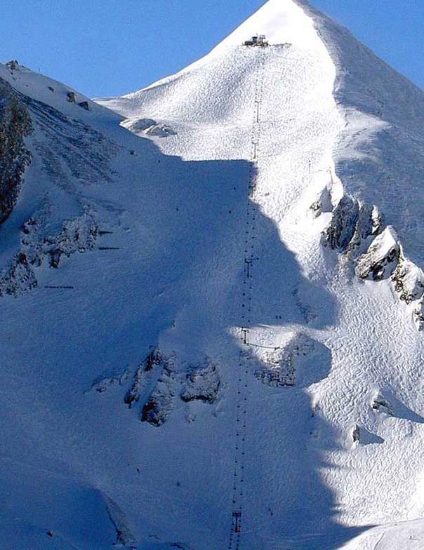


Portillo Storm Snowfall Total Passes 5m / 17 Feet
A snow storm that has now continued for nine days has taken Chilean ski resort Portillo to a snowfall total of 5.2 metres (17 feet) so far, with more snow forecast.

Next 3 days weather summary:Heavy rain (total 21.0mm), heaviest during Fri night. Very mild (max 19°C on Fri afternoon, min 11°C on Fri night). Wind will be generally light. | Days 4-6 weather summary:Heavy rain (total 35.0mm), heaviest during Sat afternoon. Very mild (max 17°C on Mon afternoon, min 10°C on Sat afternoon). Wind will be generally light. | ||||||||||||||||
Wed 29 | Thursday 30 | Friday 31 | Saturday 1 | Sunday 2 | Monday 3 | ||||||||||||
PM | night | AM | PM | night | AM | PM | night | AM | PM | night | AM | PM | night | AM | PM | night | |
t-storm risk | rain shwrs | some clouds | some clouds | clear | clear | light rain | rain shwrs | some clouds | heavy rain | rain shwrs | some clouds | some clouds | some clouds | cloudy | cloudy | some clouds | |
km/h | |||||||||||||||||
Snow map |  |  |  |  |  |  | |||||||||||
— | — | — | — | — | — | — | — | — | — | — | — | — | — | — | — | — | |
mm | 1 | 8 | — | — | — | — | 1 | 11 | — | 21 | 14 | — | — | — | — | — | — |
max °C | 16 | 12 | 16 | 17 | 16 | 18 | 19 | 12 | 15 | 13 | 12 | 14 | 16 | 15 | 16 | 17 | 14 |
min °C | 16 | 12 | 14 | 17 | 14 | 15 | 14 | 11 | 14 | 10 | 10 | 12 | 16 | 13 | 14 | 17 | 12 |
chill °C | 16 | 12 | 14 | 17 | 14 | 15 | 14 | 11 | 14 | 8 | 9 | 12 | 16 | 12 | 14 | 17 | 12 |
Humid % | 69 | 69 | 51 | 49 | 61 | 42 | 72 | 72 | 64 | 97 | 62 | 59 | 60 | 70 | 53 | 54 | 63 |
Freeze m | 4450 | 4350 | 4400 | 4600 | 4450 | 4650 | 4600 | 4550 | 4350 | 4000 | 4450 | 4350 | 4600 | 4600 | 4550 | 4650 | 4550 |
— | — | 5:41 | — | — | 5:41 | — | — | 5:43 | — | — | 5:43 | — | — | 5:46 | — | — | |
— | 8:43 | — | — | 8:42 | — | — | 8:40 | — | — | 8:39 | — | — | 8:37 | — | — | 8:37 | |
Go pro and carve into:
Avalanche information: European Avalanche Warning Services (EAWS)
Latest snow reports near Obertauern:
| Top snow depth: | 0 cm |
|---|---|
| Bottom snow depth: | 0 cm |
| Fresh snowfall depth: | — |
| Last snowfall: | 11 Jun 2026 |
| Snow Alerts | Create Alert |
0.0 | Bluebird Powder days Fresh snow, mostly sunny, light wind. |
|---|---|
0.0 | Powder days Fresh snow, limited sun, any wind. |
0.0 | Bluebird days Average snow, mostly sunny, light wind. |


The above table gives the weather forecast for Obertauern at the specific elevation of 2350 m. Our sophisticated weather models allow us to provide snow forecasts for the top, middle and bottom ski stations of Obertauern. To access the weather forecasts for the other elevations, use the tab navigation above the table. For a wider view of the weather, check out the Weather Map of Austria.
Click here to read further information on freezing levels and how we forecast our temperatures.
Overall 4.2 Based on 29 votes and 21 reviews
I have skiied in Obertauern for the past 6 years and it gets better and better every year. The pistes are accessible and varied plus the resort is snow sure from December to May! There is fabulous apres-ski at "the Lurzer" and up the mountain at "the Hochalm" not to mention lots of choice for eating out. The real jewel was the outstanding 'Steinadler Aparthaus' across the road from the Zehnerkar lift station. The apartment was spacious, warm and very luxurious with all the amenities necessary for a really great holiday. You can ski in / out or just walk across to the ski lift in 5 minutes. All in all, Obertauern is fabulous!
simon from United Kingdom writes:
I have skiied in Obertauern for the past 6 years and it gets better and better every year. The pistes are accessible and varied plus the resort is snow sure from December to May!
There is fabulous apres-ski at "the Lurzer" and up the mountain at "the Hochalm" not to mention lots of choice for eating out.
The real jewel was the outstanding 'Steinadler Aparthaus' across the road from the Zehnerkar lift station. The apartment was spacious, warm and very luxurious with all the amenities necessary for a really great holiday. You can ski in / out or just walk across to the ski lift in 5 minutes.
All in all, Obertauern is fabulous!


 Nearest