

Global Weekly Snow Roundup #314
Weekly Global Snow News, updated 14 May 2026: Fresh snowfall in Argentina, Australia and Lesotho signals winter’s approach, while Japan maintains the world’s deepest snowpack.

Next 4 days weather summary:Light rain (total 2.0mm), mostly falling on Sat night. Very mild (max 19°C on Mon afternoon, min 6°C on Fri night). Winds increasing (light winds from the N on Fri night, strong winds from the WSW by Sat night). | Days 5-7 weather summary:Moderate rain (total 12.0mm), heaviest on Wed night. Warm (max 21°C on Tue afternoon, min 10°C on Thu afternoon). Winds decreasing (strong winds from the W on Tue night, moderate winds from the NW by Thu afternoon). | |||||||||||||||
Saturday 16 | Sunday 17 | Monday 18 | Tuesday 19 | Wednesday 20 | ||||||||||||
night | AM | PM | night | AM | PM | night | AM | PM | night | AM | PM | night | AM | PM | night | |
some clouds | clear | clear | rain shwrs | clear | rain shwrs | some clouds | clear | some clouds | rain shwrs | clear | some clouds | cloudy | clear | risk thun- der | mod. rain | |
km/h | ||||||||||||||||
Snow map | 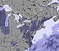 |  |  |  |  |  | ||||||||||
— | — | — | — | — | — | — | — | — | — | — | — | — | — | — | — | |
— | — | — | 1 | — | 1 | — | — | — | 1 | — | — | — | — | 3 | 7 | |
max °C | 8 | 10 | 14 | 14 | 13 | 16 | 14 | 15 | 19 | 18 | 20 | 21 | 20 | 19 | 21 | 18 |
min °C | 6 | 8 | 12 | 12 | 12 | 14 | 12 | 14 | 18 | 17 | 19 | 21 | 18 | 19 | 19 | 14 |
5 | 4 | 9 | 8 | 9 | 12 | 9 | 13 | 17 | 15 | 18 | 21 | 17 | 18 | 18 | 12 | |
85 | 53 | 57 | 89 | 66 | 65 | 48 | 79 | 76 | 78 | 63 | 59 | 73 | 69 | 79 | 96 | |
3000 | 3300 | 3850 | 3750 | 3350 | 3650 | 3800 | 3850 | 4250 | 4200 | 4350 | 4350 | 4350 | 4050 | 4150 | 4050 | |
— | 5:26 | — | — | 5:26 | — | — | 5:24 | — | — | 5:24 | — | — | 5:24 | — | — | |
— | — | — | 8:07 | — | — | 8:08 | — | — | 8:09 | — | — | 8:10 | — | — | 8:12 | |
Latest snow reports near Mount Snow:
| Top snow depth: | — |
|---|---|
| Bottom snow depth: | — |
| Fresh snowfall depth: | — |
| Last snowfall: | 2 May 2026 |
| Snow Alerts | Create Alert |
0.1 | Bluebird Powder days Fresh snow, mostly sunny, light wind. |
|---|---|
0.1 | Powder days Fresh snow, limited sun, any wind. |
0.1 | Bluebird days Average snow, mostly sunny, light wind. |
The above table gives the weather forecast for Mount Snow at the specific elevation of 1097 m. Our sophisticated weather models allow us to provide snow forecasts for the top, middle and bottom ski stations of Mount Snow. To access the weather forecasts for the other elevations, use the tab navigation above the table. For a wider view of the weather, check out the Weather Map of United States.
Click here to read further information on freezing levels and how we forecast our temperatures.
Overall 3.7 Based on 15 votes and 6 reviews
My home hill. Middle-of-the-plate pitch for a New England resort with one caveat: If you're a park-rat (grom to shred; I'm not) Carinthia is the best terrain park in the East, walking away, with a whole face dedicated to jibbers. As a whole, resort favours the intermediate skier with primarily groomed terrain. However, they have a boundary-to-boundary policy in place for when the snow flies. There are a variety of tree runs for all ability levels when there's snow. Trail style runs the gamut from wide-open (Snowdance) to old-school Northeastern trails (Uncles). The "North Face" has decent incline; "Jaws" can be a real treat with good coverage. When there's no natural snow (and when there is) I think recent improvements put it in the top rank for snowmaking, nation-wide, actually. All that said, this is an intermediate hill. A good place to progress your skiing but not an advance/expert playground-for-days. What sets it apart from other Vermont resorts (*cough* Stratton *cough*) is the laid-back, unpretentious vibe. People come here to ski and be with their family and friends, and that's it. Most of them will be happy to see you, too.
Uphill Edge from United States writes:
My home hill.
Middle-of-the-plate pitch for a New England resort with one caveat: If you're a park-rat (grom to shred; I'm not) Carinthia is the best terrain park in the East, walking away, with a whole face dedicated to jibbers.
As a whole, resort favours the intermediate skier with primarily groomed terrain. However, they have a boundary-to-boundary policy in place for when the snow flies. There are a variety of tree runs for all ability levels when there's snow.
Trail style runs the gamut from wide-open (Snowdance) to old-school Northeastern trails (Uncles). The "North Face" has decent incline; "Jaws" can be a real treat with good coverage. When there's no natural snow (and when there is) I think recent improvements put it in the top rank for snowmaking, nation-wide, actually.
All that said, this is an intermediate hill. A good place to progress your skiing but not an advance/expert playground-for-days. What sets it apart from other Vermont resorts (*cough* Stratton *cough*) is the laid-back, unpretentious vibe. People come here to ski and be with their family and friends, and that's it. Most of them will be happy to see you, too.


 Nearest