

Global Weekly Snow Roundup #314
Weekly Global Snow News, updated 14 May 2026: Fresh snowfall in Argentina, Australia and Lesotho signals winter’s approach, while Japan maintains the world’s deepest snowpack.

Next 4 days weather summary:Light rain (total 2.0mm), mostly falling on Sat night. Warm (max 21°C on Mon afternoon, min 7°C on Fri night). Winds increasing (calm on Fri night, strong winds from the WSW by Sat night). | Days 5-7 weather summary:Moderate rain (total 12.0mm), heaviest on Wed night. Warm (max 24°C on Tue afternoon, min 11°C on Thu morning). Mainly strong winds. | |||||||||||||||
Saturday 16 | Sunday 17 | Monday 18 | Tuesday 19 | Wednesday 20 | ||||||||||||
night | AM | PM | night | AM | PM | night | AM | PM | night | AM | PM | night | AM | PM | night | |
some clouds | clear | clear | rain shwrs | clear | rain shwrs | some clouds | clear | some clouds | rain shwrs | clear | some clouds | cloudy | clear | risk thun- der | mod. rain | |
km/h | ||||||||||||||||
Snow map |  |  |  |  |  |  | ||||||||||
— | — | — | — | — | — | — | — | — | — | — | — | — | — | — | — | |
— | — | — | 1 | — | 1 | — | — | — | 1 | — | — | — | — | 3 | 7 | |
max °C | 9 | 12 | 17 | 15 | 15 | 18 | 15 | 17 | 21 | 19 | 22 | 24 | 21 | 22 | 23 | 19 |
min °C | 7 | 9 | 14 | 14 | 14 | 17 | 13 | 15 | 20 | 18 | 20 | 23 | 19 | 20 | 20 | 15 |
4 | 6 | 12 | 12 | 12 | 16 | 11 | 14 | 20 | 17 | 20 | 23 | 18 | 20 | 19 | 13 | |
88 | 51 | 54 | 89 | 62 | 62 | 57 | 72 | 70 | 82 | 60 | 57 | 73 | 64 | 78 | 96 | |
3000 | 3300 | 3850 | 3750 | 3350 | 3650 | 3800 | 3850 | 4250 | 4200 | 4350 | 4350 | 4350 | 4050 | 4150 | 4050 | |
— | 5:26 | — | — | 5:26 | — | — | 5:24 | — | — | 5:24 | — | — | 5:24 | — | — | |
— | — | — | 8:07 | — | — | 8:08 | — | — | 8:09 | — | — | 8:10 | — | — | 8:12 | |
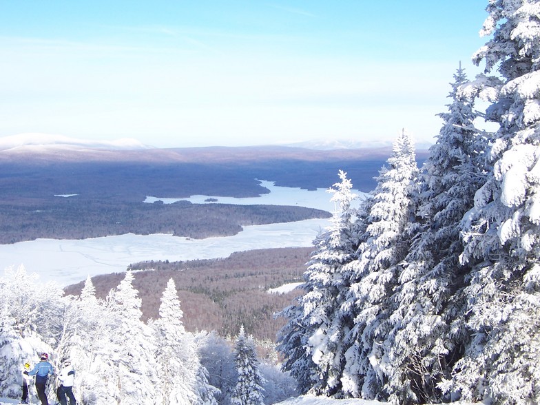
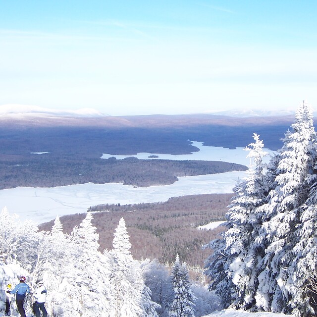
Latest snow reports near Mount Snow:
| Top snow depth: | — |
|---|---|
| Bottom snow depth: | — |
| Fresh snowfall depth: | — |
| Last snowfall: | 2 May 2026 |
| Snow Alerts | Create Alert |
0.0 | Bluebird Powder days Fresh snow, mostly sunny, light wind. |
|---|---|
0.0 | Powder days Fresh snow, limited sun, any wind. |
0.0 | Bluebird days Average snow, mostly sunny, light wind. |
The above table gives the weather forecast for Mount Snow at the specific elevation of 838 m. Our sophisticated weather models allow us to provide snow forecasts for the top, middle and bottom ski stations of Mount Snow. To access the weather forecasts for the other elevations, use the tab navigation above the table. For a wider view of the weather, check out the Weather Map of United States.
Click here to read further information on freezing levels and how we forecast our temperatures.
Overall 3.7 Based on 15 votes and 6 reviews
New owners don't care about long time loyal customers, we couldn't use our season passes due to covid, nor roll over; no credit. We've been going there for 30 years. We'll be going to Stratton for the next 30 unless Vail buys that too!
Dean from United States writes:
New owners don't care about long time loyal customers, we couldn't use our season passes due to covid, nor roll over; no credit. We've been going there for 30 years. We'll be going to Stratton for the next 30 unless Vail buys that too!


 Nearest