

Global Weekly Snow Roundup #314
Weekly Global Snow News, updated 14 May 2026: Fresh snowfall in Argentina, Australia and Lesotho signals winter’s approach, while Japan maintains the world’s deepest snowpack.

Next 3 days weather summary:Moderate rain (total 17.0mm), heaviest on Fri afternoon giving way to a moderate fall of snow, heaviest on Fri afternoon. Mild temperatures (max 6°C on Thu afternoon, min 1°C on Fri afternoon). Wind will be generally light. | Days 4-6 weather summary:Light rain (total 9.0mm), mostly falling on Sun afternoon. Mild temperatures (max 8°C on Tue afternoon, min 3°C on Sun night). Wind will be generally light. | ||||||||||||||||
Thu 14 | Friday 15 | Saturday 16 | Sunday 17 | Monday 18 | Tuesday 19 | ||||||||||||
PM | night | AM | PM | night | AM | PM | night | AM | PM | night | AM | PM | night | AM | PM | night | |
light rain | snow shwrs | light snow | light snow | light snow | light snow | rain shwrs | rain shwrs | rain shwrs | rain shwrs | cloudy | clear | rain shwrs | light rain | rain shwrs | rain shwrs | clear | |
km/h | |||||||||||||||||
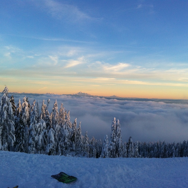
Snow map | 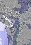 | 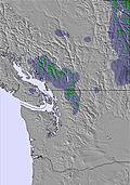 | 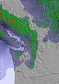 | 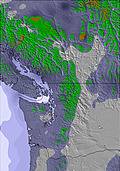 | 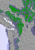 | 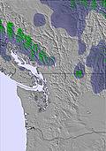 | |||||||||||
— | — | 2 | 3 | 4 | — | — | — | — | — | — | — | — | — | — | — | — | |
4 | 5 | — | 3 | — | — | 2 | 1 | 2 | 2 | — | — | 2 | 1 | 2 | 2 | — | |
max °C | 6 | 4 | 2 | 2 | 1 | 2 | 6 | 4 | 5 | 6 | 5 | 7 | 7 | 6 | 6 | 8 | 7 |
min °C | 6 | 2 | 2 | 1 | 1 | 1 | 5 | 1 | 3 | 6 | 3 | 5 | 7 | 4 | 5 | 8 | 3 |
3 | 0 | -2 | -3 | -2 | -1 | 2 | 1 | 3 | 6 | 3 | 5 | 6 | 2 | 2 | 6 | 3 | |
81 | 94 | 94 | 96 | 98 | 92 | 72 | 91 | 87 | 82 | 81 | 78 | 72 | 86 | 82 | 65 | 73 | |
1600 | 1350 | 1150 | 1150 | 1100 | 1150 | 1500 | 1400 | 1450 | 1750 | 1750 | 1650 | 1900 | 1800 | 1750 | 1950 | 2150 | |
— | — | 5:28 | — | — | 5:26 | — | — | 5:26 | — | — | 5:24 | — | — | 5:22 | — | — | |
— | 8:46 | — | — | 8:47 | — | — | 8:49 | — | — | 8:51 | — | — | 8:52 | — | — | 8:52 | |
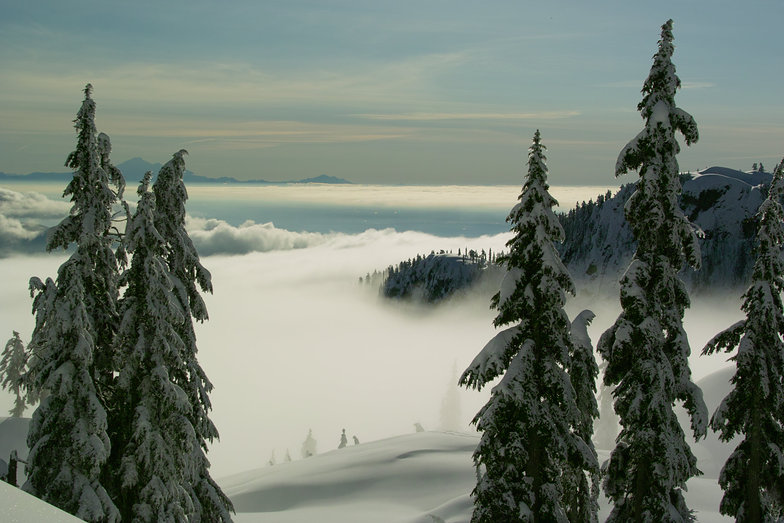
Latest snow reports near Mt Seymour:
| Top snow depth: | 0 cm |
|---|---|
| Bottom snow depth: | 0 cm |
| Fresh snowfall depth: | — |
| Last snowfall: | 15 Apr 2026 |
| Snow Alerts | Create Alert |
0.1 | Bluebird Powder days Fresh snow, mostly sunny, light wind. |
|---|---|
0.0 | Powder days Fresh snow, limited sun, any wind. |
0.0 | Bluebird days Average snow, mostly sunny, light wind. |

The above table gives the weather forecast for Mt Seymour at the specific elevation of 936 m. Our sophisticated weather models allow us to provide snow forecasts for the top, middle and bottom ski stations of Mt Seymour. To access the weather forecasts for the other elevations, use the tab navigation above the table. For a wider view of the weather, check out the Weather Map of Canada.
Click here to read further information on freezing levels and how we forecast our temperatures.
Overall 3.7 Based on 78 votes and 43 reviews
We have been pass holders at Seymour for 5 years. It's our local, low-key, family-friendly mountain and we love it like you love a scruffy, eccentric old relative. The best thing this year has been the restrictions brought in to limit numbers during the pandemic - usually we cannot get near the parking lot during the winter holidays, but with pre-booking ski time and parking, we have skied more often. Don't come here if you expect snow-makers, perfectly groomed slopes, luxury dining and retail; its a few functional buildings at the top of a mountain and its a lot of fun!
JT from Canada writes:
We have been pass holders at Seymour for 5 years. It's our local, low-key, family-friendly mountain and we love it like you love a scruffy, eccentric old relative. The best thing this year has been the restrictions brought in to limit numbers during the pandemic - usually we cannot get near the parking lot during the winter holidays, but with pre-booking ski time and parking, we have skied more often. Don't come here if you expect snow-makers, perfectly groomed slopes, luxury dining and retail; its a few functional buildings at the top of a mountain and its a lot of fun!


 Nearest