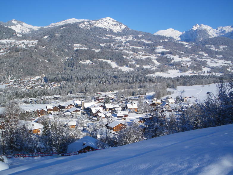


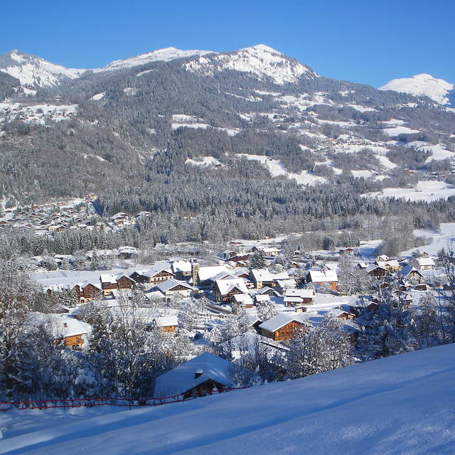
Global Weekly Snow Roundup #314
Weekly Global Snow News, updated 14 May 2026: Fresh snowfall in Argentina, Australia and Lesotho signals winter’s approach, while Japan maintains the world’s deepest snowpack.

Next 3 days weather summary:A dusting of snow on Fri afternoon. Freezing level rising with drizzle on Mon morning. Freeze-thaw conditions (max 5°C on Sun afternoon, min -4°C on Fri night). Wind will be generally light. | Days 4-6 weather summary:Moderate rain (total 19.0mm), heaviest on Mon afternoon. Mild temperatures (max 9°C on Thu morning, min 2°C on Mon night). Wind will be generally light. | ||||||||||||||||
Fri 15 | Saturday 16 | Sunday 17 | Monday 18 | Tuesday 19 | Wednesday 20 | ||||||||||||
PM | night | AM | PM | night | AM | PM | night | AM | PM | night | AM | PM | night | AM | PM | night | |
light snow | light snow | light snow | light snow | snow shwrs | some clouds | some clouds | some clouds | light rain | light rain | light rain | light rain | light rain | mod. rain | light rain | light rain | rain shwrs | |
km/h | |||||||||||||||||
Snow map |  |  |  |  |  |  | |||||||||||
3 | 1 | — | 1 | — | — | — | — | — | — | — | — | — | — | — | — | — | |
— | — | — | — | — | — | — | — | 1 | 5 | 2 | 1 | 1 | 6 | 1 | 2 | 1 | |
max °C | -3 | -3 | -3 | -1 | 0 | 2 | 5 | 4 | 4 | 4 | 4 | 2 | 5 | 6 | 5 | 7 | 7 |
min °C | -3 | -4 | -4 | -2 | -2 | 0 | 4 | 2 | 3 | 3 | 2 | 2 | 3 | 4 | 4 | 7 | 6 |
-6 | -7 | -4 | -4 | -2 | 0 | 2 | -1 | 0 | 0 | 2 | 0 | 2 | 4 | 2 | 6 | 4 | |
92 | 94 | 87 | 80 | 66 | 54 | 62 | 74 | 78 | 77 | 86 | 97 | 80 | 90 | 86 | 75 | 64 | |
1500 | 1200 | 1500 | 1800 | 1550 | 2250 | 2450 | 2300 | 2350 | 2350 | 2250 | 2350 | 2750 | 2600 | 2650 | 2900 | 3250 | |
— | — | 6:00 | — | — | 5:58 | — | — | 5:58 | — | — | 5:56 | — | — | 5:56 | — | — | |
— | 8:58 | — | — | 8:59 | — | — | 9:00 | — | — | 9:00 | — | — | 9:01 | — | — | 9:04 | |
Latest snow reports near Morillon:
Light rain reported from Haute-Savoie Mont Blanc Airport/Aéroport Annecy/Meythet at 711 metres elevation only 3 kms WNW of Annecy-LeSemnoz but it is forecast cold enough for snow at the ski area from Annecy-LeSemnoz
| Top snow depth: | — |
|---|---|
| Bottom snow depth: | — |
| Fresh snowfall depth: | 5 cm |
| Last snowfall: | 14 May 2026 |
| Snow Alerts | Create Alert |
0.1 | Bluebird Powder days Fresh snow, mostly sunny, light wind. |
|---|---|
0.1 | Powder days Fresh snow, limited sun, any wind. |
0.0 | Bluebird days Average snow, mostly sunny, light wind. |


The above table gives the weather forecast for Morillon at the specific elevation of 1900 m. Our sophisticated weather models allow us to provide snow forecasts for the top, middle and bottom ski stations of Morillon. To access the weather forecasts for the other elevations, use the tab navigation above the table. For a wider view of the weather, check out the Weather Map of France.
Click here to read further information on freezing levels and how we forecast our temperatures.
Overall 4.3 Based on 19 votes and 26 reviews
The review by V was accurate until two years ago when the Lanche Lift was replaced by a high speed 6-man chair-lift on a new run to Samoëns called Chars + a new 6-man lift at Moliettes to Tete de Saix. Thus speeding up the process of skiing over to Flaine and other parts of the Grand Massif Overall, the Grand Massif has high speed links, great pistes and a warm welcome
Bongo from United Kingdom writes:
The review by V was accurate until two years ago when the Lanche Lift was replaced by a high speed 6-man chair-lift on a new run to Samoëns called Chars + a new 6-man lift at Moliettes to Tete de Saix. Thus speeding up the process of skiing over to Flaine and other parts of the Grand Massif
Overall, the Grand Massif has high speed links, great pistes and a warm welcome


 Nearest