

Global Weekly Snow Roundup #314
Weekly Global Snow News, updated 14 May 2026: Fresh snowfall in Argentina, Australia and Lesotho signals winter’s approach, while Japan maintains the world’s deepest snowpack.

Next 3 days weather summary:A dusting of snow giving way to moderate rain (total 18.0mm) heaviest on Mon night. Freeze-thaw conditions (max 10°C on Mon afternoon, min -4°C on Sat night). Wind will be generally light. | Days 4-6 weather summary:Heavy rain (total 20.0mm), heaviest during Tue night. Very mild (max 13°C on Thu afternoon, min 5°C on Wed night). Wind will be generally light. | |||||||||||||||||
Saturday 16 | Sunday 17 | Monday 18 | Tuesday 19 | Wednesday 20 | Thursday 21 | |||||||||||||
AM | PM | night | AM | PM | night | AM | PM | night | AM | PM | night | AM | PM | night | AM | PM | night | |
light snow | light rain | rain shwrs | clear | rain shwrs | some clouds | rain shwrs | risk thun- der | mod. rain | some clouds | light rain | light rain | light rain | rain shwrs | light rain | light rain | rain shwrs | rain shwrs | |
km/h | ||||||||||||||||||
Snow map |  |  |  |  |  |  | ||||||||||||
3 | — | — | — | — | — | — | — | — | — | — | — | — | — | — | — | — | — | |
— | 2 | 1 | — | 1 | — | 1 | 4 | 9 | — | 2 | 5 | 2 | 3 | 4 | 1 | 2 | 1 | |
max °C | 2 | 3 | 2 | 5 | 7 | 4 | 9 | 10 | 7 | 9 | 11 | 7 | 10 | 9 | 8 | 10 | 13 | 10 |
min °C | 1 | 2 | -4 | 2 | 7 | 0 | 6 | 9 | 3 | 6 | 10 | 6 | 6 | 8 | 5 | 8 | 13 | 6 |
-1 | 0 | -4 | 2 | 7 | -2 | 6 | 9 | 3 | 6 | 10 | 6 | 6 | 7 | 5 | 8 | 13 | 6 | |
100 | 94 | 94 | 84 | 81 | 86 | 76 | 80 | 99 | 77 | 82 | 99 | 78 | 85 | 93 | 81 | 64 | 89 | |
1550 | 1700 | 1050 | 2000 | 2250 | 1800 | 2450 | 2600 | 2150 | 2450 | 2700 | 2500 | 2650 | 2650 | 2450 | 2700 | 2950 | 2850 | |
5:33 | — | — | 5:31 | — | — | 5:31 | — | — | 5:28 | — | — | 5:28 | — | — | 5:26 | — | — | |
— | — | 8:39 | — | — | 8:40 | — | — | 8:42 | — | — | 8:43 | — | — | 8:45 | — | — | 8:45 | |
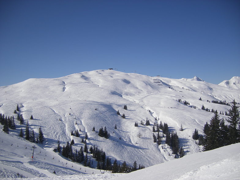
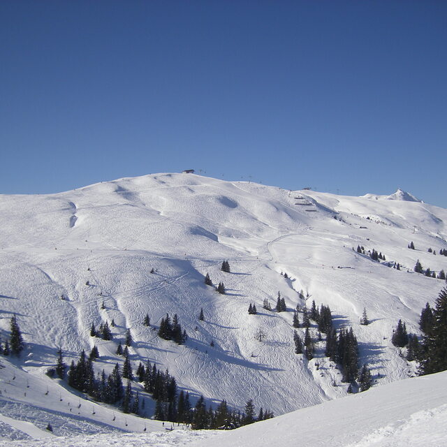
Latest snow reports near Mittersill:
| Top snow depth: | — |
|---|---|
| Bottom snow depth: | — |
| Fresh snowfall depth: | 25 cm |
| Last snowfall: | 15 May 2026 |
| Snow Alerts | Create Alert |
0.0 | Bluebird Powder days Fresh snow, mostly sunny, light wind. |
|---|---|
0.1 | Powder days Fresh snow, limited sun, any wind. |
0.0 | Bluebird days Average snow, mostly sunny, light wind. |
The above table gives the weather forecast for Mittersill at the specific elevation of 1274 m. Our sophisticated weather models allow us to provide snow forecasts for the top, middle and bottom ski stations of Mittersill. To access the weather forecasts for the other elevations, use the tab navigation above the table. For a wider view of the weather, check out the Weather Map of Austria.
Click here to read further information on freezing levels and how we forecast our temperatures.
Overall 4.3 Based on 2 votes and 1 review
What a fantastic traditional Austrian town! Great slopes, always excellent snow and manages to avoid the crowds of nearby Kitzbuhel. Mittersill has lovely mountain restaurants and very friendly staff! A great place for family skiing.
Rolland from United Kingdom writes:
What a fantastic traditional Austrian town! Great slopes, always excellent snow and manages to avoid the crowds of nearby Kitzbuhel. Mittersill has lovely mountain restaurants and very friendly staff!
A great place for family skiing.


 Nearest