


Global Weekly Snow Roundup #314
Weekly Global Snow News, updated 14 May 2026: Fresh snowfall in Argentina, Australia and Lesotho signals winter’s approach, while Japan maintains the world’s deepest snowpack.

Next 3 days weather summary:Moderate rain (total 16.0mm), heaviest on Mon morning. Very mild (max 10°C on Sun afternoon, min 2°C on Sun morning). Wind will be generally light. | Days 4-6 weather summary:Some drizzle, heaviest during Wed afternoon. Warm (max 20°C on Fri afternoon, min 7°C on Wed morning). Wind will be generally light. | |||||||||||||||||
Sunday 17 | Monday 18 | Tuesday 19 | Wednesday 20 | Thursday 21 | Friday 22 | |||||||||||||
AM | PM | night | AM | PM | night | AM | PM | night | AM | PM | night | AM | PM | night | AM | PM | night | |
some clouds | cloudy | some clouds | light rain | light rain | light rain | light rain | light rain | light rain | some clouds | rain shwrs | some clouds | clear | some clouds | clear | clear | clear | clear | |
km/h | ||||||||||||||||||
Snow map |  |  |  |  |  |  | ||||||||||||
— | — | — | — | — | — | — | — | — | — | — | — | — | — | — | — | — | — | |
— | — | — | 2 | 4 | 3 | 1 | 3 | 3 | — | 1 | — | — | — | — | — | — | — | |
max °C | 8 | 10 | 7 | 5 | 8 | 7 | 6 | 7 | 8 | 12 | 14 | 12 | 16 | 18 | 14 | 18 | 20 | 16 |
min °C | 2 | 9 | 3 | 5 | 7 | 4 | 5 | 6 | 6 | 7 | 14 | 7 | 10 | 18 | 9 | 12 | 19 | 10 |
1 | 8 | 3 | 5 | 6 | 4 | 5 | 5 | 6 | 7 | 14 | 6 | 10 | 18 | 9 | 12 | 19 | 10 | |
49 | 53 | 73 | 91 | 68 | 94 | 89 | 90 | 87 | 77 | 58 | 79 | 53 | 56 | 76 | 55 | 55 | 73 | |
2250 | 2400 | 2150 | 2050 | 2300 | 2100 | 2350 | 2600 | 2600 | 2800 | 2950 | 3450 | 3700 | 3800 | 3950 | 4050 | 4000 | 4050 | |
5:56 | — | — | 5:56 | — | — | 5:54 | — | — | 5:52 | — | — | 5:52 | — | — | 5:50 | — | — | |
— | — | 9:00 | — | — | 9:00 | — | — | 9:01 | — | — | 9:02 | — | — | 9:04 | — | — | 9:05 | |
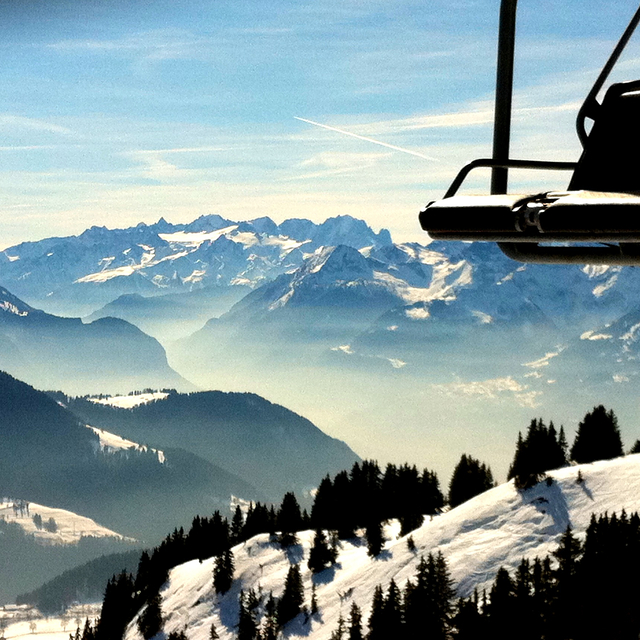
Latest snow reports near Leysin:
| Top snow depth: | — |
|---|---|
| Bottom snow depth: | — |
| Fresh snowfall depth: | 10 cm |
| Last snowfall: | 16 May 2026 |
| Snow Alerts | Create Alert |
0.0 | Bluebird Powder days Fresh snow, mostly sunny, light wind. |
|---|---|
0.0 | Powder days Fresh snow, limited sun, any wind. |
0.0 | Bluebird days Average snow, mostly sunny, light wind. |
The above table gives the weather forecast for Leysin at the specific elevation of 1250 m. Our sophisticated weather models allow us to provide snow forecasts for the top, middle and bottom ski stations of Leysin. To access the weather forecasts for the other elevations, use the tab navigation above the table. For a wider view of the weather, check out the Weather Map of Switzerland.
Click here to read further information on freezing levels and how we forecast our temperatures.
Overall 4.0 Based on 17 votes and 16 reviews
Just returned from a week of ski holiday in Leysin, from Dec 28 to Jan 4, this is our first time in Leysin, but we have being skiing across the other side of the valley in Villars for many years. Compared with Villars, Leysin seem to attract fewer skiers, which is fine with us; less crowded at the lift chair waiting lines. In general, the ski area is okay. However, the cable car access is not very user friendly. You need to climb two levels of stairs to get to the cable car; a pain in the neck when you have the ski boots on. For the slope, in general, is quite okay when there is snow. We are fortunate because most slope are not open until Dec 28 2013 due to lack of snow.
Family of 4 from Switzerland writes:
Just returned from a week of ski holiday in Leysin, from Dec 28 to Jan 4, this is our first time in Leysin, but we have being skiing across the other side of the valley in Villars for many years.
Compared with Villars, Leysin seem to attract fewer skiers, which is fine with us; less crowded at the lift chair waiting lines.
In general, the ski area is okay. However, the cable car access is not very user friendly. You need to climb two levels of stairs to get to the cable car; a pain in the neck when you have the ski boots on.
For the slope, in general, is quite okay when there is snow. We are fortunate because most slope are not open until Dec 28 2013 due to lack of snow.


 Nearest