


View forecast
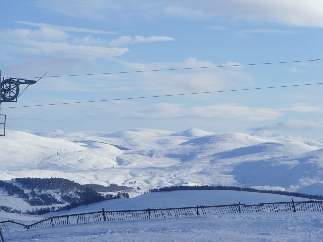
The Lecht at 640 m altitude
Issued by Snow-Forecast.com at: 6 pm (local time) / 26 Apr 2024
Now
Fri 26 | Saturday 27 | Sunday 28 | Monday 29 | Tuesday 30 | Wednesday 1 | Thursday 2 | ||||||||||||||
PM | night | AM | PM | night | AM | PM | night | AM | PM | night | AM | PM | night | AM | PM | night | AM | PM | night | |
light snow | light snow | light rain | rain shwrs | some clouds | light snow | light snow | snow shwrs | cloudy | light rain | some clouds | cloudy | rain shwrs | cloudy | light rain | light rain | light rain | cloudy | cloudy | light rain | |
km/h | ||||||||||||||||||||
Snow map | 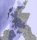 | 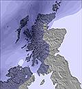 | 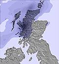 | 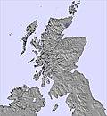 | 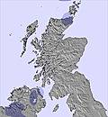 | 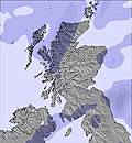 | 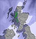 | |||||||||||||
1.0 | — | — | — | — | — | 2.0 | — | — | — | — | — | — | — | — | — | — | — | — | — | |
— | — | 1.0 | 1.0 | — | — | — | — | — | 1.0 | — | — | 2.0 | — | 2.0 | 4 | 4 | — | — | 1.0 | |
max°C | 2 | 0 | 4 | 5 | 0 | 2 | 1 | 1 | 6 | 5 | 4 | 9 | 9 | 6 | 7 | 7 | 7 | 10 | 10 | 7 |
min°C | 2 | -1 | 3 | 4 | -2 | 2 | 1 | 0 | 5 | 5 | 2 | 6 | 7 | 5 | 6 | 7 | 6 | 8 | 9 | 6 |
2 | -4 | 1 | 1 | -5 | -2 | -4 | -6 | 0 | 0 | -4 | 1 | 2 | 2 | 2 | 4 | 2 | 5 | 7 | 3 | |
80 | 93 | 81 | 67 | 72 | 86 | 98 | 69 | 86 | 93 | 93 | 79 | 81 | 96 | 99 | 98 | 90 | 99 | 89 | 92 | |
850 | 650 | 850 | 1100 | 600 | 800 | 900 | 1000 | 1150 | 1350 | 1500 | 1400 | 1800 | 1950 | 2400 | 2450 | 2650 | 2500 | 2700 | 2550 | |
— | — | 5:31 | — | — | 5:30 | — | — | 5:26 | — | — | 5:24 | — | — | 5:22 | — | — | 5:20 | — | — | |
8:46 | — | — | 8:49 | — | — | 8:51 | — | — | 8:53 | — | — | 8:55 | — | — | 8:58 | — | — | 9:00 | — | |
Next 0-3 days weather summary:
Light rain (total 2.0mm) at first, then becoming colder with a dusting of snow on Sun afternoon. Freeze-thaw conditions (max 6°C on Mon morning, min -2°C on Sat night). Winds increasing (calm on Fri afternoon, fresh winds from the WNW by Sun night).
Next 4-6 days weather summary:
Moderate rain (total 13.0mm), heaviest on Wed afternoon. Very mild (max 10°C on Thu morning, min 2°C on Mon night). Winds decreasing (fresh winds from the SE on Tue afternoon, light winds from the ESE by Thu morning).
Popular The Lecht Pages
Snow Radar
Latest snow reports near The Lecht:
The Lecht Snow Conditions
| Top snow depth: | 0 cm |
|---|---|
| Bottom snow depth: | 0 cm |
| Fresh snowfall depth: | 4 cm |
| Last snowfall: | 25 Apr 2024 |
| Snow Alerts | Create Alert |
Other resorts in United Kingdom are reporting: powder (0) / good piste (0)
Snow-Forecast Partner Offers
Show your business here
Snow History
Week 4 of April has on average:
0.0 | Bluebird Powder days Fresh snow, mostly sunny, light wind. |
|---|---|
0.1 | Powder days Fresh snow, limited sun, any wind. |
0.0 | Bluebird days Average snow, mostly sunny, light wind. |

The Lecht Forecast Snowfall


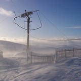
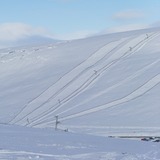
The Lecht Resort Webcam
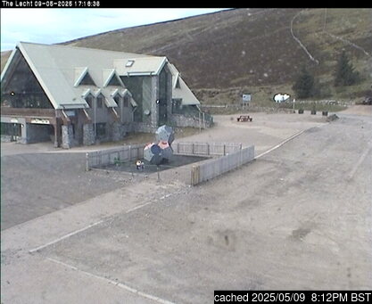
- today

- 2pm yesterday

- 2 days ago

- 3 days ago

- 4 days ago

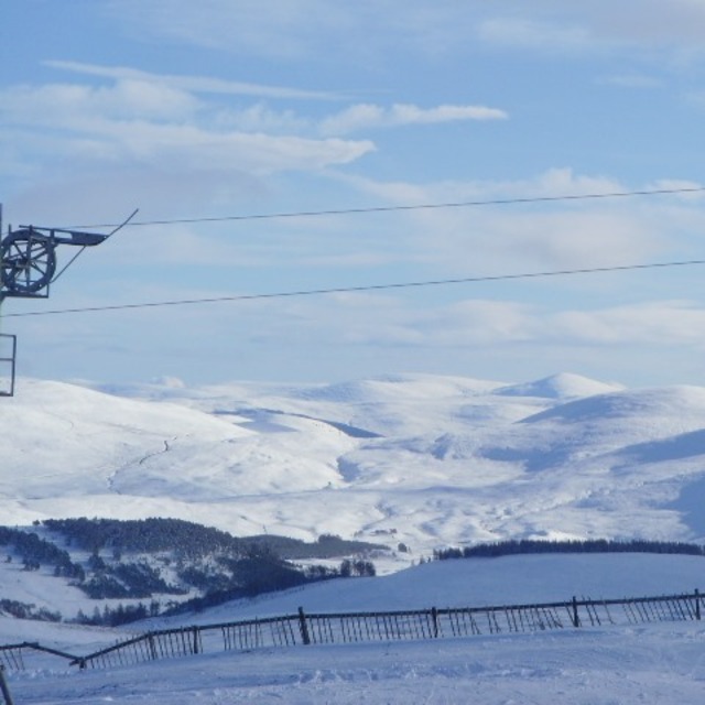
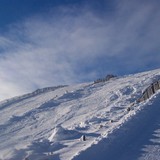
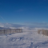
Photos of The Lecht
Other resorts in United Kingdom are reporting: powder (0) / good piste (0)
The above table gives the weather forecast for The Lecht at the specific elevation of 640 m. Our sophisticated weather models allow us to provide snow forecasts for the top, middle and bottom ski stations of The Lecht. To access the weather forecasts for the other elevations, use the tab navigation above the table. For a wider view of the weather, check out the Weather Map of United Kingdom.
Click here to read further information on freezing levels and how we forecast our temperatures.
Visitor Reviews of The Lecht
Overall 2.5 Based on 9 votes and 17 reviews
- Snowsure
- Variety of pistes
- Vote
- Peerie Mouse from United Kingdom writes:
We are a family of 5. One adult had skied many years ago, rest of us never tried before. We pre booked equipment and one lesson to start with. Ian was a great instructors and after 1 hour we were all hooked. Skied over the next 5 days, 2 hours instruction with Duncan each day (well worth doing this), he managed to accommodate both adults and all 3 children, all with varying ability and confidence. Ideal resort for our first experience of skiing, friendly staff, loved it all!
Visitor Reviews of The Lecht
Peerie Mouse from United Kingdom writes:
We are a family of 5. One adult had skied many years ago, rest of us never tried before. We pre booked equipment and one lesson to start with. Ian was a great instructors and after 1 hour we were all hooked. Skied over the next 5 days, 2 hours instruction with Duncan each day (well worth doing this), he managed to accommodate both adults and all 3 children, all with varying ability and confidence. Ideal resort for our first experience of skiing, friendly staff, loved it all!
Free Snow-Forecast.com weather widget for your website
The The Lecht skiing weather widget is available to embed on external websites free of charge. It provides a daily summary of our The Lecht snow forecast and current weather conditions. Simply go to the feed configuration page and follow the 3 simple steps to grab the custom html code snippet and paste it into your own site. You can choose the snow forecast elevation (summit, mid-mountain or bottom lift) and metric/imperial units for the snow forecast feed to suit your own website…. Click here to get the code.
View detailed snow forecast for The Lecht at:
snow-forecast.com

 Nearest