

Global Weekly Snow Roundup #314
Weekly Global Snow News, updated 14 May 2026: Fresh snowfall in Argentina, Australia and Lesotho signals winter’s approach, while Japan maintains the world’s deepest snowpack.

Next 3 days weather summary:Moderate rain (total 13.0mm), heaviest on Mon night. Freeze-thaw conditions (max 8°C on Sun afternoon, min 0°C on Sat morning). Wind will be generally light. | Days 4-6 weather summary:Moderate rain (total 15.0mm), heaviest on Tue night. Very mild (max 15°C on Thu afternoon, min 5°C on Tue morning). Wind will be generally light. | |||||||||||||||||
Saturday 16 | Sunday 17 | Monday 18 | Tuesday 19 | Wednesday 20 | Thursday 21 | |||||||||||||
AM | PM | night | AM | PM | night | AM | PM | night | AM | PM | night | AM | PM | night | AM | PM | night | |
snow shwrs | light snow | rain shwrs | some clouds | cloudy | cloudy | cloudy | light rain | mod. rain | light rain | light rain | mod. rain | light rain | rain shwrs | some clouds | some clouds | clear | clear | |
km/h | ||||||||||||||||||
Snow map |  |  |  |  |  |  | ||||||||||||
— | 1 | — | — | — | — | — | — | — | — | — | — | — | — | — | — | — | — | |
— | 2 | 1 | — | — | — | — | 4 | 6 | 1 | 3 | 7 | 2 | 2 | — | — | — | — | |
max °C | 1 | 3 | 3 | 4 | 8 | 7 | 7 | 8 | 7 | 6 | 7 | 7 | 8 | 12 | 10 | 12 | 15 | 14 |
min °C | 0 | 2 | 1 | 2 | 7 | 6 | 6 | 8 | 5 | 5 | 6 | 7 | 7 | 10 | 9 | 10 | 14 | 12 |
0 | 0 | 1 | 2 | 6 | 6 | 5 | 6 | 2 | 3 | 4 | 6 | 7 | 9 | 8 | 10 | 14 | 12 | |
85 | 76 | 80 | 77 | 60 | 67 | 71 | 71 | 84 | 91 | 91 | 91 | 86 | 60 | 75 | 58 | 56 | 65 | |
1550 | 1800 | 1700 | 2100 | 2350 | 2250 | 2300 | 2400 | 2200 | 2400 | 2700 | 2500 | 2600 | 2900 | 3450 | 3650 | 3750 | 3950 | |
6:00 | — | — | 5:58 | — | — | 5:56 | — | — | 5:56 | — | — | 5:54 | — | — | 5:54 | — | — | |
— | — | 9:00 | — | — | 9:00 | — | — | 9:01 | — | — | 9:02 | — | — | 9:04 | — | — | 9:05 | |
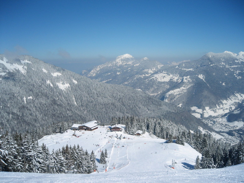
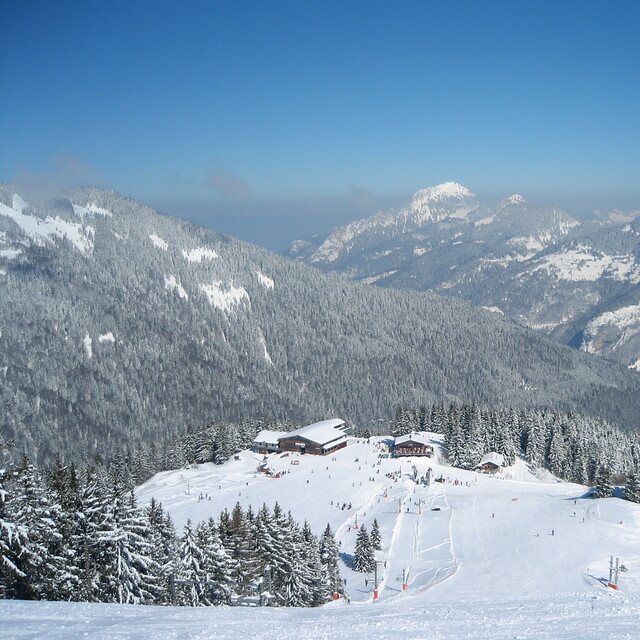
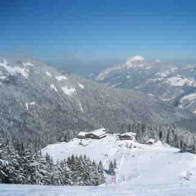
Latest snow reports near Saint-Jean d'Aulps La Grande Terche:
Resort is closed for the season. Snowing lightly, refreshing pistes. from La Giettaz en Aravis
| Top snow depth: | — |
|---|---|
| Bottom snow depth: | — |
| Fresh snowfall depth: | 10 cm |
| Last snowfall: | 15 May 2026 |
| Snow Alerts | Create Alert |
0.0 | Bluebird Powder days Fresh snow, mostly sunny, light wind. |
|---|---|
0.0 | Powder days Fresh snow, limited sun, any wind. |
0.0 | Bluebird days Average snow, mostly sunny, light wind. |
The above table gives the weather forecast for Saint-Jean d'Aulps La Grande Terche at the specific elevation of 1362 m. Our sophisticated weather models allow us to provide snow forecasts for the top, middle and bottom ski stations of Saint-Jean d'Aulps La Grande Terche. To access the weather forecasts for the other elevations, use the tab navigation above the table. For a wider view of the weather, check out the Weather Map of France.
Click here to read further information on freezing levels and how we forecast our temperatures.
Overall 4.1 Based on 14 votes and 10 reviews
St Jean D'Aulps La Grande Terche is a real gem. Great for beginners and intermediates but hardcore skiers may be left wanting. Ski the circuit and check out the bars and restaurants en-route. They are all good. Sadly, The Cowshed is no more but La Licorne and Chez Minet are both excellent French owned restaurants and lunch in L'Embuscade is my particular mid-circuit favourite. Was just there on Jan 19th and it was crowd-free. I might be biased; I bought a place there 4 seasons ago and still loving it!
Lea Smart from United Kingdom writes:
St Jean D'Aulps La Grande Terche is a real gem. Great for beginners and intermediates but hardcore skiers may be left wanting. Ski the circuit and check out the bars and restaurants en-route. They are all good. Sadly, The Cowshed is no more but La Licorne and Chez Minet are both excellent French owned restaurants and lunch in L'Embuscade is my particular mid-circuit favourite. Was just there on Jan 19th and it was crowd-free. I might be biased; I bought a place there 4 seasons ago and still loving it!
Read 9 more reviews of Saint-Jean d'Aulps La Grande Terche or submit your own


 Nearest