
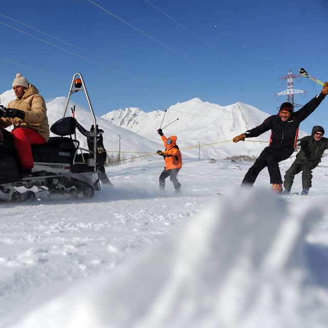
Ski Lessons by SkiBro
BOOK NOW
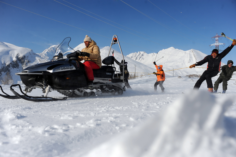
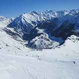
Ski lessons in La Thuile
Book now


La Thuile Weather (Next 3 days): The snow forecast for La Thuile is: A heavy fall of snow, heaviest during Thu afternoon. Freeze-thaw conditions (max 1°C on Tue afternoon, min -4°C on Thu afternoon). Wind will be generally light.
La Thuile Weather (Days 4-6): A light covering of new snow, mostly falling on Thu night. Freeze-thaw conditions (max 2°C on Sun morning, min -6°C on Thu night). Wind will be generally light.
| Resort | Snow Depth | Temp. (°C) | Wind (km/h) | Weather | ||
|---|---|---|---|---|---|---|
| Top Lift: | 0.0 m | 0 | ||||
| Middle Lift: | 3 | |||||
| Bottom Lift: | 0.0 m | 6 |
Latest snow reports near La Thuile:
It is snowing heavily in La Giettaz en Aravis. from La Giettaz en Aravis
Resort closed for the season. See you this summer! from La Giettaz en Aravis

Tuesday 30 | Wednesday 1 | Thursday 2 | Friday 3 | Saturday 4 | Sunday 5 | ||||||||||||||
night | AM | PM | night | AM | PM | night | AM | PM | night | AM | PM | night | AM | PM | night | AM | PM | night | |
snow shwrs | cloudy | light snow | light snow | light snow | mod. snow | light snow | light snow | mod. snow | mod. snow | some clouds | light snow | snow shwrs | cloudy | light snow | snow shwrs | cloudy | light snow | light snow | |
km/h | |||||||||||||||||||
Snow map |  |  |  |  |  |  |  | ||||||||||||
— | — | — | 2.0 | 4 | 6 | 3 | 4 | 6 | 5 | — | 2.0 | — | — | — | — | — | 1.0 | 1.0 | |
— | — | — | — | — | — | — | — | — | — | — | — | — | — | — | — | — | — | — | |
max°C | 0 | 0 | 1 | 0 | -1 | -1 | -1 | -2 | -2 | -5 | -4 | -4 | -3 | 0 | 0 | 0 | 2 | 1 | 1 |
min°C | -1 | 0 | 1 | -1 | -1 | -2 | -2 | -2 | -4 | -6 | -5 | -4 | -4 | -1 | 0 | 0 | 1 | 1 | 0 |
-5 | -4 | -3 | -5 | -6 | -7 | -6 | -5 | -7 | -10 | -8 | -6 | -8 | -3 | -2 | -3 | -1 | 1 | -2 | |
85 | 85 | 88 | 85 | 95 | 92 | 97 | 98 | 97 | 90 | 73 | 93 | 53 | 70 | 98 | 77 | 75 | 95 | 98 | |
2550 | 2700 | 2750 | 2550 | 2350 | 2450 | 2300 | 2250 | 1950 | 1250 | 2000 | 2100 | 1450 | 2600 | 2600 | 2650 | 2900 | 2850 | 2700 | |
— | 6:20 | — | — | 6:18 | — | — | 6:16 | — | — | 6:16 | — | — | 6:13 | — | — | 6:13 | — | — | |
— | — | — | 8:37 | — | — | 8:39 | — | — | 8:40 | — | — | 8:42 | — | — | 8:43 | — | — | 8:45 | |
A heavy fall of snow, heaviest during Thu afternoon. Freeze-thaw conditions (max 1°C on Tue afternoon, min -4°C on Thu afternoon). Wind will be generally light.
A light covering of new snow, mostly falling on Thu night. Freeze-thaw conditions (max 2°C on Sun morning, min -6°C on Thu night). Wind will be generally light.
Latest snow reports near La Thuile:
It is snowing heavily in La Giettaz en Aravis. from La Giettaz en Aravis
Resort closed for the season. See you this summer! from La Giettaz en Aravis
| Top snow depth: | 0 cm |
|---|---|
| Bottom snow depth: | 0 cm |
| Fresh snowfall depth: | 7 cm |
| Last snowfall: | 28 Apr 2024 |
| Snow Alerts | Create Alert |
0.1 | Bluebird Powder days Fresh snow, mostly sunny, light wind. |
|---|---|
1.7 | Powder days Fresh snow, limited sun, any wind. |
0.6 | Bluebird days Average snow, mostly sunny, light wind. |


The above table gives the weather forecast for La Thuile at the specific elevation of 2642 m. Our sophisticated weather models allow us to provide snow forecasts for the top, middle and bottom ski stations of La Thuile. To access the weather forecasts for the other elevations, use the tab navigation above the table. For a wider view of the weather, check out the Weather Map of Italy.
Click here to read further information on freezing levels and how we forecast our temperatures.
Overall 3.8 Based on 32 votes and 36 reviews
Mio figlio in data 30 Dicembre '23 è caduto sulle piste, fortunatamente senza conseguenze tranne che per il portafoglio. Al pronto soccorso hanno messo un tutore al braccio che ritroviamo in fattura a 87€, mi chiedo da quando e se possono vendere ausilii. Oltre ad aver considerato un accesso al pronto soccorso ( ticket 50€ perchè fuori regione) come una visita specialistica (130 €) hanno fatto pagare le radiografie (94 €). Al soccorso pista si sono rifiutati poi di consegnare la tavola da snow fino all'avvenuto pagamento del soccorso piste (200 €), tanto che è stata incaricata la BRT nei giorni successivi per il ritiro a nostre spese (59 €). Ho scritto sia al sindaco di La Thuille che all urp della Valle d'Aosta fino a oggi senza risposta, saranno impegnati a cercare di capire perché perdono turisti ogni anno! Lascio a chi legge ogni considerazione sul comportamento degli addetti alle piste. 570 € di costi mi sembrano eccessivi oltre a giornaliero, cibo .... Facile approfittarsi dei ragazzini, purtroppo sono troppo vecchio, troppo stanco, e anche troppo cieco. E se fossi l'uomo che ero 5 anni fa, ooh io andrei col lanciafiamme su quelle piste!
Vincenzo from Italy writes:
Mio figlio in data 30 Dicembre '23 è caduto sulle piste, fortunatamente senza conseguenze tranne che per il portafoglio.
Al pronto soccorso hanno messo un tutore al braccio che ritroviamo in fattura a 87€,
mi chiedo da quando e se possono vendere ausilii. Oltre ad aver considerato un accesso al pronto soccorso ( ticket 50€ perchè fuori regione) come una visita specialistica (130 €) hanno fatto pagare le radiografie (94 €).
Al soccorso pista si sono rifiutati poi di consegnare la tavola da snow fino all'avvenuto pagamento del soccorso piste (200 €), tanto che è stata incaricata la BRT nei giorni successivi per il ritiro a nostre spese (59 €).
Ho scritto sia al sindaco di La Thuille che all urp della Valle d'Aosta fino a oggi senza risposta, saranno impegnati a cercare di capire perché perdono turisti ogni anno!
Lascio a chi legge ogni considerazione sul comportamento degli addetti alle piste.
570 € di costi mi sembrano eccessivi oltre a giornaliero, cibo ....
Facile approfittarsi dei ragazzini, purtroppo sono troppo vecchio, troppo stanco, e anche troppo cieco. E se fossi l'uomo che ero 5 anni fa, ooh io andrei col lanciafiamme su quelle piste!
The La Thuile skiing weather widget is available to embed on external websites free of charge. It provides a daily summary of our La Thuile snow forecast and current weather conditions. Simply go to the feed configuration page and follow the 3 simple steps to grab the custom html code snippet and paste it into your own site. You can choose the snow forecast elevation (summit, mid-mountain or bottom lift) and metric/imperial units for the snow forecast feed to suit your own website…. Click here to get the code.
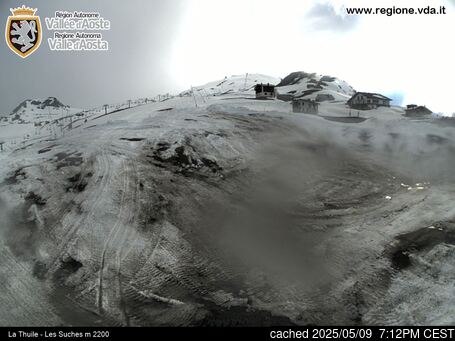
View detailed snow forecast for La Thuile at:
snow-forecast.com


 Nearest