

Global Weekly Snow Roundup #314
Weekly Global Snow News, updated 14 May 2026: Fresh snowfall in Argentina, Australia and Lesotho signals winter’s approach, while Japan maintains the world’s deepest snowpack.

Next 4 days weather summary:Mild with light rain (total 5.0mm) on Sun afternoon Becoming colder with a light covering of snow, mostly falling on Sun night. Freeze-thaw conditions (max 7°C on Mon afternoon, min -4°C on Sat night). Wind will be generally light. | Days 5-7 weather summary:Moderate rain (total 15.0mm), heaviest on Tue afternoon. Very mild (max 10°C on Wed afternoon, min 2°C on Mon night). Wind will be generally light. | |||||||||||||||
Saturday 16 | Sunday 17 | Monday 18 | Tuesday 19 | Wednesday 20 | ||||||||||||
night | AM | PM | night | AM | PM | night | AM | PM | night | AM | PM | night | AM | PM | night | |
light snow | light snow | light snow | snow shwrs | some clouds | light rain | snow shwrs | rain shwrs | light rain | light rain | light rain | rain shwrs | rain shwrs | rain shwrs | cloudy | light rain | |
km/h | ||||||||||||||||
Snow map | 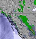 | 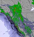 | 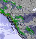 | 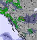 | 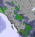 | 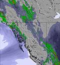 | ||||||||||
1 | 1 | 1 | — | — | — | 1 | — | — | — | — | — | — | — | — | — | |
— | — | — | — | — | 2 | — | 1 | 2 | 1 | 1 | 3 | 1 | 1 | — | 3 | |
max °C | 2 | -1 | 1 | 1 | 3 | 5 | 2 | 3 | 7 | 6 | 6 | 8 | 7 | 8 | 10 | 9 |
min °C | -2 | -2 | 0 | -4 | 0 | 5 | -2 | 1 | 6 | 2 | 4 | 8 | 2 | 4 | 9 | 4 |
-5 | -5 | -4 | -6 | -2 | 4 | -2 | 1 | 6 | 2 | 4 | 8 | 2 | 4 | 9 | 3 | |
78 | 83 | 79 | 79 | 68 | 46 | 90 | 80 | 52 | 65 | 66 | 55 | 73 | 75 | 47 | 71 | |
1850 | 1650 | 1850 | 1550 | 1800 | 2400 | 1850 | 1950 | 2450 | 2350 | 2350 | 2650 | 2550 | 2450 | 2850 | 2700 | |
— | 5:56 | — | — | 5:54 | — | — | 5:52 | — | — | 5:52 | — | — | 5:50 | — | — | |
— | — | — | 9:32 | — | — | 9:35 | — | — | 9:36 | — | — | 9:37 | — | — | 9:38 | |
Latest snow reports near Kicking Horse:
| Top snow depth: | — |
|---|---|
| Bottom snow depth: | — |
| Fresh snowfall depth: | 1 cm |
| Last snowfall: | 23 Apr 2026 |
| Snow Alerts | Create Alert |
0.0 | Bluebird Powder days Fresh snow, mostly sunny, light wind. |
|---|---|
0.1 | Powder days Fresh snow, limited sun, any wind. |
0.0 | Bluebird days Average snow, mostly sunny, light wind. |
The above table gives the weather forecast for Kicking Horse at the specific elevation of 1848 m. Our sophisticated weather models allow us to provide snow forecasts for the top, middle and bottom ski stations of Kicking Horse. To access the weather forecasts for the other elevations, use the tab navigation above the table. For a wider view of the weather, check out the Weather Map of Canada.
Click here to read further information on freezing levels and how we forecast our temperatures.
Overall 3.7 Based on 87 votes and 68 reviews
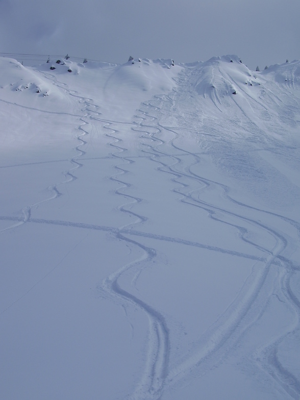
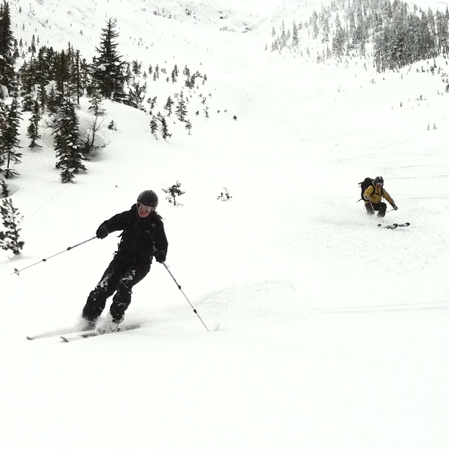
I've skied there the last 3 seasons for 3-5 weeks of the year both in December and March. The terrain is unbelievably good. No lift lines and you can ski powder for days after it snows. I've guessing most people who ski there don't post reviews because they don't want lift lines. 5 peaks you can ski all in bounds. 3 of them you have to hike to but between 15 minutes and 40 minutes boot pack. All inbounds. If you're an advanced skier it's a skiers paradise.
BTA from Canada writes:
I've skied there the last 3 seasons for 3-5 weeks of the year both in December and March. The terrain is unbelievably good. No lift lines and you can ski powder for days after it snows. I've guessing most people who ski there don't post reviews because they don't want lift lines. 5 peaks you can ski all in bounds. 3 of them you have to hike to but between 15 minutes and 40 minutes boot pack. All inbounds. If you're an advanced skier it's a skiers paradise.


 Nearest