The snow forecast for Kaprun is: Mostly dry. Very mild (max 13°C on Fri morning, min 3°C on Fri night). Wind will be generally light.
Kaprun Weather (Next 3 days): The snow forecast for Kaprun is: Mostly dry. Very mild (max 13°C on Fri morning, min 3°C on Fri night). Wind will be generally light.
Kaprun Weather (Days 4-6): Light rain (total 3.0mm), mostly falling on Mon afternoon. Very mild (max 13°C on Wed morning, min 4°C on Mon night). Wind will be generally light.
TODAY + TOMORROW: Retro Week in Itter & Hopfgarten with LIVE MUSIC at various huts. -> Need a retro outfit? You'll find what you're looking for at the pop-up store today at the KRAFTalm hut. There will also be LIVE MUSIC in Westendorf, Ellmau and Söll.
TOMORROW SAT: Early bird start from 7:30 a.m. in SkiWelt Westendorf + Brixen | Retro Shred Day at BIG PLAYGROUND Westendorf
WED-SAT: NIGHT SKIING in Söll | NIGHT TOBOGGANING in Söll + Going from Westendorf
The above table gives the weather forecast for Kaprun at the specific elevation of 911 m. Our sophisticated weather models allow us to provide snow forecasts for the top, middle and bottom ski stations of Kaprun. To access the weather forecasts for the other elevations, use the tab navigation above the table. For a wider view of the weather, check out the Weather Map of Austria.
Click here to read further information on freezing levels and how we forecast our temperatures.
We had a week's skiing basing ourselves in Maishofen which is between Zell am See and Saalfelden. We bought the Salzburg Super Ski Card which is only about 15 Euros more than the standard pass for Saalbach/Hinterglemm and is excellent value as it gives access to Kaprun, Zell, Saalbach, the whole of the Ski Amade area, Kitzbuhel and about a dozen other resorts. We had one day at Kaprun and one day at Zell.
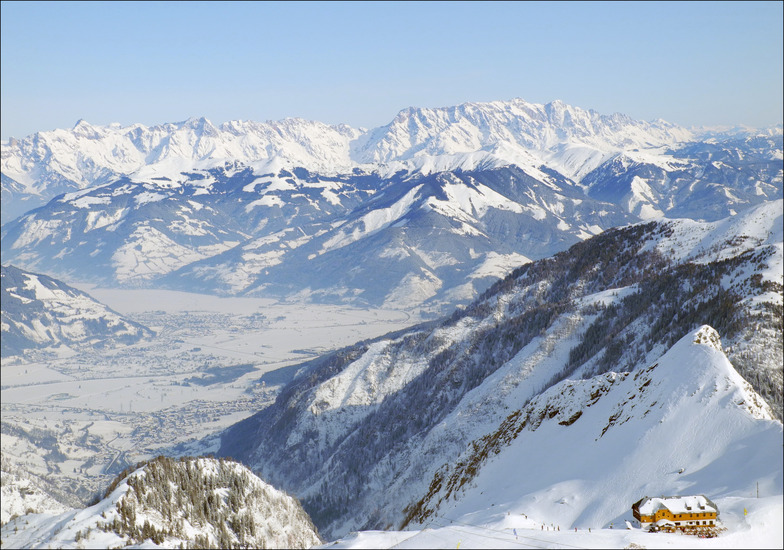
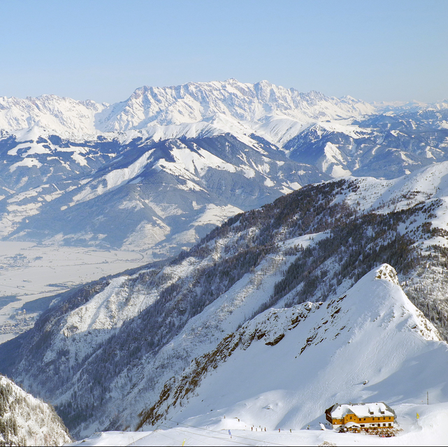
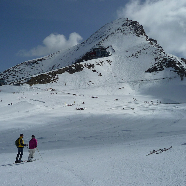
Kaprun is very good for intermediates and good beginners. However, make sure that you go there when the wind is not blowing hard. There were no queues at the bottom of the mountain, but if the higher lifts are closed because of wind (which they were on and off all day when we were there) then the queue for the Gletscherjet 2 becomes very long. If you can put up with the T bars the runs on either side of the Kitzlifte are wide and will flatter your technique; great cruising territory. The trip to the summit (and museum) is well worth it for the view. One drawback in that the only easy piste back to the gondola mid station gets really busy during mid/late afternoon and many beginners would find it quite difficult.
If you're going to Zell and using the Areitbahn, get there early i.e. before 9 a.m. This was the longest queue we experienced all week; about 45 mins to the top of the mountain. However, once up, the queues dissipate as people spread out and there's plenty of easy cruising. Black run 9 is a soft touch, although the blacks lower down towards the resort tend to be a bit icy. It was fairly busy when we were there so many of the blues and most of the reds have pretty big bumps on them by mid afternoon. As it faces more or less due south, piste 4 back down to the Areitbahn car park gets heavy by late afternoon. In summary, the Kaprun/Zell combination probably have just enough to keep a competent intermediate happy for a week.
We had a week's skiing basing ourselves in Maishofen which is between Zell am See and Saalfelden. We bought the Salzburg Super Ski Card which is only about 15 Euros more than the standard pass for Saalbach/Hinterglemm and is excellent value as it gives access to Kaprun, Zell, Saalbach, the whole of the Ski Amade area, Kitzbuhel and about a dozen other resorts. We had one day at Kaprun and one day at Zell.
Kaprun is very good for intermediates and good beginners. However, make sure that you go there when the wind is not blowing hard. There were no queues at the bottom of the mountain, but if the higher lifts are closed because of wind (which they were on and off all day when we were there) then the queue for the Gletscherjet 2 becomes very long. If you can put up with the T bars the runs on either side of the Kitzlifte are wide and will flatter your technique; great cruising territory. The trip to the summit (and museum) is well worth it for the view. One drawback in that the only easy piste back to the gondola mid station gets really busy during mid/late afternoon and many beginners would find it quite difficult.
If you're going to Zell and using the Areitbahn, get there early i.e. before 9 a.m. This was the longest queue we experienced all week; about 45 mins to the top of the mountain. However, once up, the queues dissipate as people spread out and there's plenty of easy cruising. Black run 9 is a soft touch, although the blacks lower down towards the resort tend to be a bit icy. It was fairly busy when we were there so many of the blues and most of the reds have pretty big bumps on them by mid afternoon. As it faces more or less due south, piste 4 back down to the Areitbahn car park gets heavy by late afternoon. In summary, the Kaprun/Zell combination probably have just enough to keep a competent intermediate happy for a week.
Free Snow-Forecast.com weather widget for your website
Embed the Kaprun weather widget on your site for free. It provides a weekly snapshot of snow and rain conditions across all elevations. Follow the two quick steps to grab your custom code and paste it into your site. Choose between metric or imperial units. Click here to get the code.


 Nearest