

Global Weekly Snow Roundup #314
Weekly Global Snow News, updated 14 May 2026: Fresh snowfall in Argentina, Australia and Lesotho signals winter’s approach, while Japan maintains the world’s deepest snowpack.

Next 3 days weather summary:Heavy rain (total 24.0mm), heaviest during Mon afternoon. Freeze-thaw conditions (max 11°C on Sun afternoon, min -2°C on Sat night). Wind will be generally light. | Days 4-6 weather summary:Moderate rain (total 10.0mm), heaviest on Tue afternoon. Very mild (max 18°C on Thu afternoon, min 7°C on Tue morning). Wind will be generally light. | |||||||||||||||||
Saturday 16 | Sunday 17 | Monday 18 | Tuesday 19 | Wednesday 20 | Thursday 21 | |||||||||||||
AM | PM | night | AM | PM | night | AM | PM | night | AM | PM | night | AM | PM | night | AM | PM | night | |
rain shwrs | light rain | rain shwrs | clear | light rain | light rain | light rain | mod. rain | light rain | some clouds | light rain | light rain | cloudy | light rain | some clouds | some clouds | some clouds | some clouds | |
km/h | ||||||||||||||||||
Snow map |  |  |  |  |  |  | ||||||||||||
— | — | — | — | — | — | — | — | — | — | — | — | — | — | — | — | — | — | |
1 | 3 | 1 | — | 1 | 4 | 1 | 10 | 3 | — | 3 | 5 | — | 2 | — | — | — | — | |
max °C | 5 | 6 | 4 | 9 | 11 | 9 | 9 | 8 | 7 | 11 | 12 | 10 | 13 | 15 | 13 | 15 | 18 | 14 |
min °C | 2 | 6 | -2 | 5 | 11 | 5 | 8 | 7 | 3 | 7 | 10 | 8 | 9 | 15 | 7 | 11 | 18 | 10 |
2 | 4 | -2 | 5 | 11 | 4 | 8 | 7 | 3 | 7 | 10 | 8 | 9 | 15 | 7 | 11 | 18 | 10 | |
77 | 84 | 79 | 63 | 70 | 88 | 86 | 98 | 87 | 80 | 99 | 94 | 82 | 77 | 80 | 65 | 59 | 55 | |
1600 | 1750 | 1300 | 2200 | 2500 | 2200 | 2250 | 2200 | 1950 | 2450 | 2600 | 2650 | 2850 | 3000 | 3300 | 3450 | 3450 | 3900 | |
5:52 | — | — | 5:52 | — | — | 5:50 | — | — | 5:48 | — | — | 5:48 | — | — | 5:47 | — | — | |
— | — | 8:54 | — | — | 8:57 | — | — | 8:58 | — | — | 8:59 | — | — | 9:00 | — | — | 9:00 | |
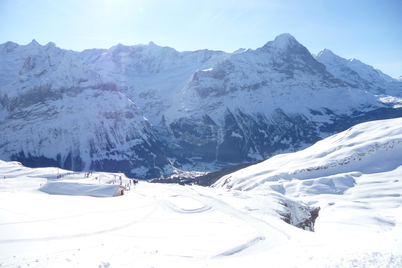
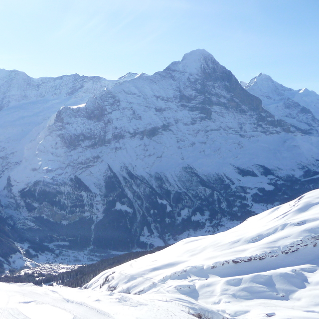
Latest snow reports near Grindelwald:
Shower light rain shower reported from Alpnach Airport at 444 metres elevation only 4 kms SE of Pilatus / Luzern but it is forecast cold enough for snow at higher elevations in the ski area from Pilatus / Luzern
Light rain reported from Alpnach Airport at 444 metres elevation only 4 kms SE of Pilatus / Luzern but it is forecast cold enough for snow at higher elevations in the ski area from Pilatus / Luzern
| Top snow depth: | — |
|---|---|
| Bottom snow depth: | — |
| Fresh snowfall depth: | 12 cm |
| Last snowfall: | 15 May 2026 |
| Snow Alerts | Create Alert |
0.0 | Bluebird Powder days Fresh snow, mostly sunny, light wind. |
|---|---|
0.0 | Powder days Fresh snow, limited sun, any wind. |
0.0 | Bluebird days Average snow, mostly sunny, light wind. |
The above table gives the weather forecast for Grindelwald at the specific elevation of 945 m. Our sophisticated weather models allow us to provide snow forecasts for the top, middle and bottom ski stations of Grindelwald. To access the weather forecasts for the other elevations, use the tab navigation above the table. For a wider view of the weather, check out the Weather Map of Switzerland.
Click here to read further information on freezing levels and how we forecast our temperatures.
Overall 4.4 Based on 37 votes and 13 reviews
Well, Grindelwald is not as pretty as Wengen but I won't call it ugly. Stayed at the Kirschbuhl hotel; 120 euros a night, breakfast included; this was in February 2017. The breakfast was superb and the view through the mountains to the Eiger just mind blowing. The suppers were fabulous but a tad expensive. Hey, fabulous food is almost never cheap. This is a 4 star hotel but having supper and looking out to the moonlight drenched snowy mountains is just amazing; they seem so immediate. The staff at the hotel were incredible and jolly helpful. Heh, heh the cake and pastries at tea time were free and freshly baked. There are lots of good cheap restaurants, actually dirt cheap if you compare them to Zermatt, Verbier, Saas Fee and Crans Montana.
ettienne nel from Germany writes:
Well, Grindelwald is not as pretty as Wengen but I won't call it ugly. Stayed at the Kirschbuhl hotel; 120 euros a night, breakfast included; this was in February 2017. The breakfast was superb and the view through the mountains to the Eiger just mind blowing. The suppers were fabulous but a tad expensive. Hey, fabulous food is almost never cheap. This is a 4 star hotel but having supper and looking out to the moonlight drenched snowy mountains is just amazing; they seem so immediate. The staff at the hotel were incredible and jolly helpful. Heh, heh the cake and pastries at tea time were free and freshly baked. There are lots of good cheap restaurants, actually dirt cheap if you compare them to Zermatt, Verbier, Saas Fee and Crans Montana.


 Nearest