

Global Weekly Snow Roundup #314
Weekly Global Snow News, updated 14 May 2026: Fresh snowfall in Argentina, Australia and Lesotho signals winter’s approach, while Japan maintains the world’s deepest snowpack.

Next 3 days weather summary:A moderate fall of snow, heaviest on Mon afternoon. Temperatures will be below freezing (max 0°C on Sun afternoon, min -8°C on Sat morning). Wind will be generally light. | Days 4-6 weather summary:A dusting of snow turning to light rain (total 2.0mm) on Wed afternoon. Freeze-thaw conditions (max 8°C on Thu night, min -1°C on Tue morning). Wind will be generally light. | |||||||||||||||||
Saturday 16 | Sunday 17 | Monday 18 | Tuesday 19 | Wednesday 20 | Thursday 21 | |||||||||||||
AM | PM | night | AM | PM | night | AM | PM | night | AM | PM | night | AM | PM | night | AM | PM | night | |
snow shwrs | light snow | snow shwrs | clear | light snow | light snow | light snow | mod. snow | light snow | some clouds | light snow | light snow | cloudy | light rain | some clouds | some clouds | some clouds | some clouds | |
km/h | ||||||||||||||||||
Snow map |  |  |  |  |  |  | ||||||||||||
— | 2 | — | — | — | 1 | — | 6 | 2 | — | 1 | 2 | — | — | — | — | — | — | |
— | — | — | — | — | — | — | — | — | — | — | — | — | 2 | — | — | — | — | |
max °C | -7 | -5 | -5 | -2 | 0 | -1 | -2 | -1 | -2 | 0 | 1 | 1 | 2 | 4 | 4 | 6 | 7 | 8 |
min °C | -8 | -6 | -6 | -3 | -1 | -2 | -2 | -2 | -3 | -1 | 1 | 1 | 1 | 4 | 3 | 4 | 7 | 7 |
-12 | -10 | -8 | -3 | -1 | -4 | -2 | -5 | -3 | -1 | 1 | -2 | -2 | 2 | 1 | 2 | 6 | 7 | |
83 | 84 | 74 | 52 | 85 | 92 | 94 | 97 | 88 | 79 | 98 | 94 | 77 | 84 | 59 | 40 | 62 | 30 | |
1600 | 1750 | 1300 | 2200 | 2500 | 2200 | 2250 | 2200 | 1950 | 2450 | 2600 | 2650 | 2850 | 3000 | 3300 | 3450 | 3450 | 3900 | |
5:52 | — | — | 5:52 | — | — | 5:50 | — | — | 5:48 | — | — | 5:48 | — | — | 5:47 | — | — | |
— | — | 8:54 | — | — | 8:57 | — | — | 8:58 | — | — | 8:59 | — | — | 9:00 | — | — | 9:00 | |
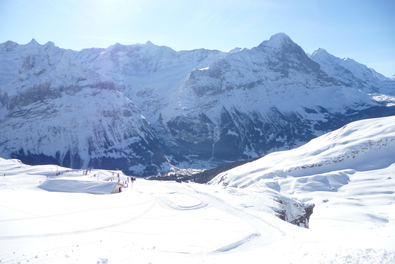
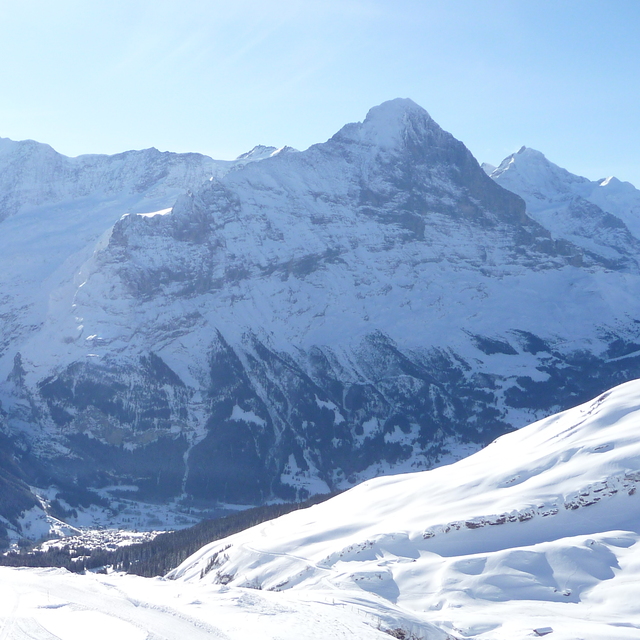
Latest snow reports near Grindelwald:
Shower light rain shower reported from Alpnach Airport at 444 metres elevation only 4 kms SE of Pilatus / Luzern but it is forecast cold enough for snow at higher elevations in the ski area from Pilatus / Luzern
Light rain reported from Alpnach Airport at 444 metres elevation only 4 kms SE of Pilatus / Luzern but it is forecast cold enough for snow at higher elevations in the ski area from Pilatus / Luzern
| Top snow depth: | — |
|---|---|
| Bottom snow depth: | — |
| Fresh snowfall depth: | 12 cm |
| Last snowfall: | 15 May 2026 |
| Snow Alerts | Create Alert |
0.3 | Bluebird Powder days Fresh snow, mostly sunny, light wind. |
|---|---|
0.6 | Powder days Fresh snow, limited sun, any wind. |
0.3 | Bluebird days Average snow, mostly sunny, light wind. |
The above table gives the weather forecast for Grindelwald at the specific elevation of 2473 m. Our sophisticated weather models allow us to provide snow forecasts for the top, middle and bottom ski stations of Grindelwald. To access the weather forecasts for the other elevations, use the tab navigation above the table. For a wider view of the weather, check out the Weather Map of Switzerland.
Click here to read further information on freezing levels and how we forecast our temperatures.
Overall 4.4 Based on 37 votes and 13 reviews
Very disappointed with Grindelwald. It feels like a cheap tourist village but with exorbitant costs. Not value for money and not worth it. Full of non-skiing Asian tourists who clog up the lift systems for insta opportunities. If you manage to get on the mountain the skiing is ok but very crowded. People skiing far too fast on blue runs. Better options in Austria in my opinion and better value for money.
Dan from United Arab Emirates writes:
Very disappointed with Grindelwald. It feels like a cheap tourist village but with exorbitant costs. Not value for money and not worth it. Full of non-skiing Asian tourists who clog up the lift systems for insta opportunities.
If you manage to get on the mountain the skiing is ok but very crowded. People skiing far too fast on blue runs. Better options in Austria in my opinion and better value for money.


 Nearest