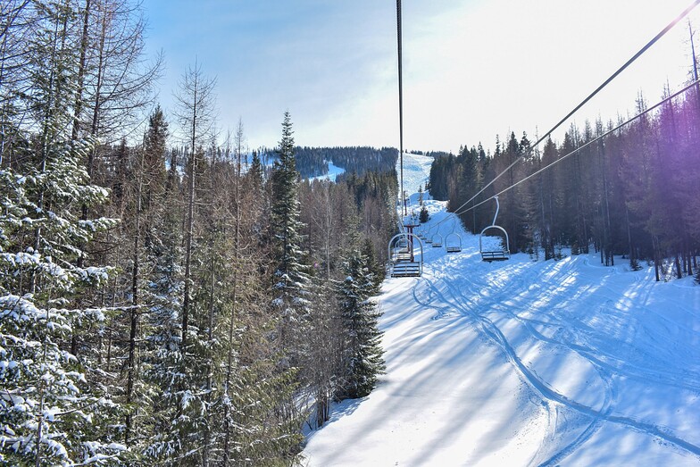


Global Weekly Snow Roundup #314
Weekly Global Snow News, updated 14 May 2026: Fresh snowfall in Argentina, Australia and Lesotho signals winter’s approach, while Japan maintains the world’s deepest snowpack.

Next 4 days weather summary:A dusting of snow giving way to moderate rain (total 14.0mm) heaviest on Sat afternoon. Freeze-thaw conditions (max 9°C on Sun afternoon, min -2°C on Sat morning). Wind will be generally light. | Days 5-7 weather summary:Mostly dry. Very mild (max 15°C on Thu afternoon, min 5°C on Tue morning). Mainly fresh winds. | |||||||||||||||
Saturday 16 | Sunday 17 | Monday 18 | Tuesday 19 | Wednesday 20 | ||||||||||||
night | AM | PM | night | AM | PM | night | AM | PM | night | AM | PM | night | AM | PM | night | |
snow shwrs | light snow | risk thun- der | light snow | rain shwrs | rain shwrs | rain shwrs | risk thun- der | light rain | cloudy | clear | cloudy | some clouds | clear | some clouds | some clouds | |
km/h | ||||||||||||||||
Snow map | 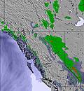 | 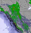 | 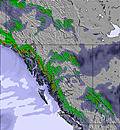 | 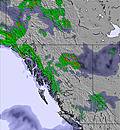 | 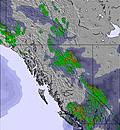 | 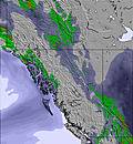 | ||||||||||
— | — | — | — | — | — | — | — | — | — | — | — | — | — | — | — | |
2 | — | 4 | 1 | 1 | 1 | 2 | 1 | 2 | — | — | — | — | — | — | — | |
max °C | 3 | -1 | 3 | 3 | 4 | 9 | 8 | 6 | 9 | 8 | 7 | 10 | 10 | 9 | 12 | 11 |
min °C | -1 | -2 | 2 | 1 | 1 | 6 | 5 | 4 | 7 | 7 | 5 | 10 | 8 | 7 | 12 | 9 |
-6 | -7 | 0 | -1 | -3 | 5 | 5 | 4 | 4 | 4 | 2 | 8 | 6 | 6 | 10 | 6 | |
89 | 92 | 71 | 95 | 67 | 41 | 57 | 68 | 64 | 53 | 59 | 48 | 53 | 61 | 44 | 58 | |
1600 | 1350 | 1800 | 1550 | 1950 | 2400 | 2300 | 2250 | 2400 | 2400 | 2350 | 2600 | 2600 | 2600 | 2800 | 3000 | |
— | 5:09 | — | — | 5:07 | — | — | 5:07 | — | — | 5:05 | — | — | 5:03 | — | — | |
— | — | — | 8:23 | — | — | 8:24 | — | — | 8:25 | — | — | 8:28 | — | — | 8:29 | |
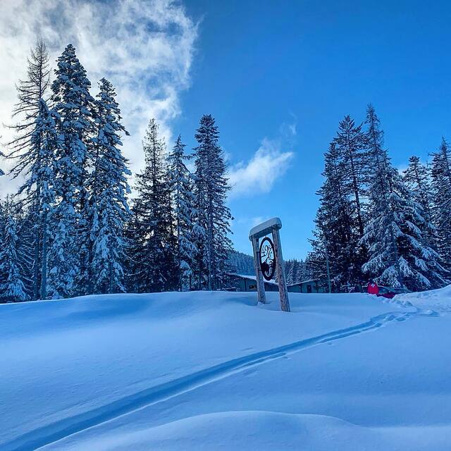
Latest snow reports near 49 Degrees North:
| Top snow depth: | — |
|---|---|
| Bottom snow depth: | — |
| Fresh snowfall depth: | — |
| Last snowfall: | 15 Apr 2026 |
| Snow Alerts | Create Alert |
0.0 | Bluebird Powder days Fresh snow, mostly sunny, light wind. |
|---|---|
0.0 | Powder days Fresh snow, limited sun, any wind. |
0.0 | Bluebird days Average snow, mostly sunny, light wind. |
The above table gives the weather forecast for 49 Degrees North at the specific elevation of 1478 m. Our sophisticated weather models allow us to provide snow forecasts for the top, middle and bottom ski stations of 49 Degrees North. To access the weather forecasts for the other elevations, use the tab navigation above the table. For a wider view of the weather, check out the Weather Map of United States.
Click here to read further information on freezing levels and how we forecast our temperatures.
Overall 3.8 Based on 11 votes and 2 reviews
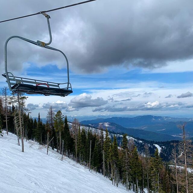
Hello fellow skiers! I've been skiing at 49' on and off for the past twelve seasons, most recently 28 February 2012. Cannot say enough about the service they provide and this year's conditions have been top notch. The ski host I spoke to was most helpful and the people in the office answered all my stupid questions. My only complaint is the new triple chair (#5) was not running the day I went and it opens a lot of great terrain. My only worry is that with the building of another new chair, their lift tickets are going to get pricey. It is a family type hill though so perhaps they can "hold the line" on price. It is some what isolated, as the previous writer noted, but I find that an advantage! Chewelah is close and Spokane about an hour or so away. Everyone should try 49' at least once!! Hopefully see ya there!! Good luck with the new lift!! P.S. I ski a great deal and all over the northwest US and Western Canada so I'd like to think I know what is going on out there!!
Rosco from Canada writes:
Hello fellow skiers! I've been skiing at 49' on and off for the past twelve seasons, most recently 28 February 2012. Cannot say enough about the service they provide and this year's conditions have been top notch. The ski host I spoke to was most helpful and the people in the office answered all my stupid questions. My only complaint is the new triple chair (#5) was not running the day I went and it opens a lot of great terrain. My only worry is that with the building of another new chair, their lift tickets are going to get pricey. It is a family type hill though so perhaps they can "hold the line" on price. It is some what isolated, as the previous writer noted, but I find that an advantage! Chewelah is close and Spokane about an hour or so away. Everyone should try 49' at least once!! Hopefully see ya there!! Good luck with the new lift!!
P.S. I ski a great deal and all over the northwest US and Western Canada so I'd like to think I know what is going on out there!!


 Nearest