

America’s Next Indoor Snow Centre Takes Shape
Construction of a new indoor snow centre for skiers, boarders and tubers appears to be making good progress at Heritage Farm in Wayne County, West Virginia.

Next 3 days weather summary:Moderate rain (total 14.0mm), heaviest on Sun afternoon. Very mild (max 15°C on Mon afternoon, min 8°C on Tue night). Wind will be generally light. | Days 4-6 weather summary:Moderate rain (total 14.0mm), heaviest on Thu morning. Very mild (max 17°C on Wed afternoon, min 7°C on Thu night). Wind will be generally light. | ||||||||||||||||
Sun 19 | Monday 20 | Tuesday 21 | Wednesday 22 | Thursday 23 | Friday 24 | ||||||||||||
PM | night | AM | PM | night | AM | PM | night | AM | PM | night | AM | PM | night | AM | PM | night | |
rain shwrs | rain shwrs | some clouds | rain shwrs | rain shwrs | some clouds | rain shwrs | rain shwrs | clear | some clouds | some clouds | light rain | t-storm risk | rain shwrs | clear | clear | clear | |
km/h | |||||||||||||||||
Snow map |  |  |  |  |  |  | |||||||||||
— | — | — | — | — | — | — | — | — | — | — | — | — | — | — | — | — | |
mm | 5 | 1 | — | 3 | 1 | — | 2 | 2 | — | — | — | 3 | 5 | 6 | — | — | — |
max °C | 13 | 12 | 14 | 15 | 13 | 13 | 14 | 11 | 13 | 17 | 13 | 10 | 10 | 9 | 12 | 16 | 14 |
min °C | 12 | 9 | 11 | 15 | 9 | 10 | 13 | 8 | 9 | 16 | 10 | 9 | 10 | 7 | 8 | 15 | 10 |
chill °C | 11 | 9 | 11 | 15 | 9 | 10 | 12 | 8 | 9 | 16 | 10 | 8 | 9 | 6 | 8 | 15 | 10 |
Humid % | 79 | 92 | 66 | 67 | 82 | 66 | 66 | 83 | 50 | 39 | 71 | 90 | 88 | 90 | 53 | 39 | 73 |
Freeze m | 3400 | 3350 | 3250 | 3400 | 3300 | 3150 | 3000 | 2650 | 3200 | 3300 | 3000 | 2800 | 2800 | 2500 | 2850 | 3150 | 3250 |
— | — | 5:28 | — | — | 5:30 | — | — | 5:31 | — | — | 5:33 | — | — | 5:33 | — | — | |
— | 8:55 | — | — | 8:54 | — | — | 8:53 | — | — | 8:52 | — | — | 8:52 | — | — | 8:50 | |
Go pro and carve into:
Avalanche information: European Avalanche Warning Services (EAWS)
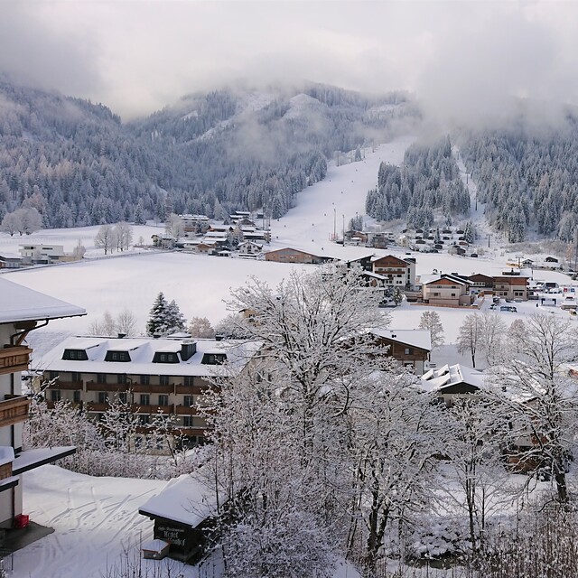
Latest snow reports near Flachau-Reitdorf:
| Top snow depth: | 0 cm |
|---|---|
| Bottom snow depth: | 0 cm |
| Fresh snowfall depth: | — |
| Last snowfall: | 10 Jun 2026 |
| Snow Alerts | Create Alert |
0.0 | Bluebird Powder days Fresh snow, mostly sunny, light wind. |
|---|---|
0.0 | Powder days Fresh snow, limited sun, any wind. |
0.0 | Bluebird days Average snow, mostly sunny, light wind. |
The above table gives the weather forecast for Flachau-Reitdorf at the specific elevation of 1372 m. Our sophisticated weather models allow us to provide snow forecasts for the top, middle and bottom ski stations of Flachau-Reitdorf. To access the weather forecasts for the other elevations, use the tab navigation above the table. For a wider view of the weather, check out the Weather Map of Austria.
Click here to read further information on freezing levels and how we forecast our temperatures.
Overall 4.5 Based on 16 votes and 9 reviews
Update to my previous review. The Snowspace Flachau completed the link to Kleinarl last summer. This new Panoramabahn increases the pistes to over 210km spread across the villages of Alpendorf, Wagrain, Flacahu, Kleinarl and Zauchensee. New uplifts in Wagrain have increased capacity in the middle of Snowspace so it is quick and easy to get on the mountains.
Simon from Austria writes:
Update to my previous review. The Snowspace Flachau completed the link to Kleinarl last summer. This new Panoramabahn increases the pistes to over 210km spread across the villages of Alpendorf, Wagrain, Flacahu, Kleinarl and Zauchensee. New uplifts in Wagrain have increased capacity in the middle of Snowspace so it is quick and easy to get on the mountains.


 Nearest