
Solitude Sets Record-Breaking Season With 178 Days of Skiing
Updated April 30, 2025: North America holds strong with over 30 ski areas still spinning lifts—snowy peaks in the West, deep bases in the Midwest, and sunny spring turns coast to coast.
Please sign in with your Snow-Forecast account details below.

Filzmoos Weather (Next 3 days): The snow forecast for Filzmoos is: Moderate rain (total 13.0mm), heaviest on Sat afternoon. Very mild (max 18°C on Fri afternoon, min 11°C on Thu morning). Wind will be generally light.
Filzmoos Weather (Days 4-6): Heavy rain (total 26.0mm), heaviest during Sun night. Later becoming colder with a dusting of snow on Mon night. Very mild (max 18°C on Sun afternoon, min 1°C on Mon night). Wind will be generally light.
| Resort | Snow Depth | Temp. (°C) | Wind (km/h) | Weather | ||
|---|---|---|---|---|---|---|
| Top Lift: | 8 | |||||
| Middle Lift: | 10 | |||||
| Bottom Lift: | 8 |
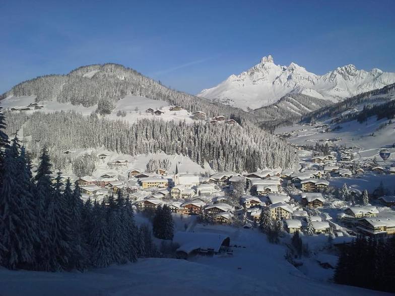
Latest snow reports near Filzmoos:

Thursday 1 | Friday 2 | Saturday 3 | Sunday 4 | Monday 5 | Tuesday 6 | Wednesday 7 | |||||||||||||||
AM | PM | night | AM | PM | night | AM | PM | night | AM | PM | night | AM | PM | night | AM | PM | night | AM | PM | night | |
clear | clear | clear | clear | clear | rain shwrs | risk thun- der | risk thun- der | light rain | some clouds | risk thun- der | heavy rain | light rain | light rain | light snow | light snow | light rain | light rain | light rain | light rain | light snow | |
km/h | |||||||||||||||||||||
Snow map |  |  |  |  |  |  |  | ||||||||||||||
— | — | — | — | — | — | — | — | — | — | — | — | — | — | 2.0 | 1.0 | — | — | — | — | 4 | |
— | — | — | — | — | 2.0 | 1.0 | 5 | 5 | — | 2.0 | 12 | 3 | 4 | 2.0 | — | 1.0 | 2.0 | 2.0 | 4 | — | |
max°C | 14 | 17 | 14 | 16 | 18 | 16 | 15 | 14 | 14 | 15 | 18 | 11 | 7 | 4 | 2 | 2 | 4 | 4 | 3 | 3 | 1 |
min°C | 11 | 17 | 11 | 12 | 18 | 13 | 14 | 13 | 11 | 11 | 17 | 7 | 6 | 3 | 1 | 1 | 4 | 3 | 3 | 2 | 1 |
11 | 17 | 10 | 12 | 18 | 13 | 14 | 13 | 10 | 11 | 17 | 7 | 4 | 0 | -1 | 1 | 4 | 3 | 2 | 1 | 0 | |
48 | 36 | 68 | 48 | 43 | 66 | 62 | 77 | 88 | 55 | 56 | 99 | 97 | 99 | 99 | 95 | 95 | 99 | 99 | 99 | 100 | |
3050 | 3200 | 3250 | 3200 | 3500 | 3500 | 3350 | 3300 | 3100 | 3200 | 3400 | 2900 | 2600 | 2000 | 1500 | 1700 | 2150 | 1900 | 1900 | 1750 | 1500 | |
5:50 | — | — | 5:48 | — | — | 5:47 | — | — | 5:45 | — | — | 5:43 | — | — | 5:41 | — | — | 5:41 | — | — | |
— | — | 8:15 | — | — | 8:17 | — | — | 8:19 | — | — | 8:20 | — | — | 8:22 | — | — | 8:22 | — | — | 8:23 | |
Moderate rain (total 13.0mm), heaviest on Sat afternoon. Very mild (max 18°C on Fri afternoon, min 11°C on Thu morning). Wind will be generally light.
Heavy rain (total 26.0mm), heaviest during Sun night. Later becoming colder with a dusting of snow on Mon night. Very mild (max 18°C on Sun afternoon, min 1°C on Mon night). Wind will be generally light.
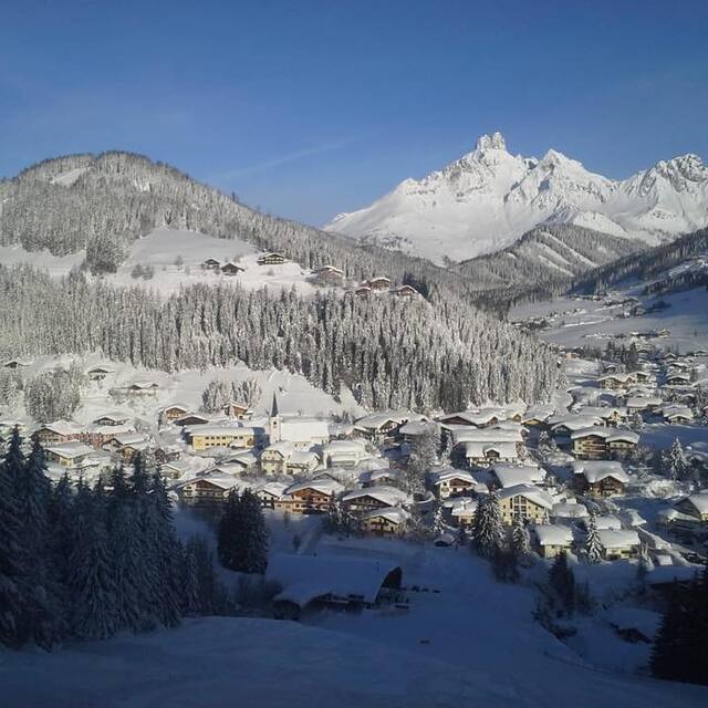
Latest snow reports near Filzmoos:
| Top snow depth: | — |
|---|---|
| Bottom snow depth: | — |
| Fresh snowfall depth: | — |
| Last snowfall: | 25 Apr 2025 |
| Snow Alerts | Create Alert |
0.0 | Bluebird Powder days Fresh snow, mostly sunny, light wind. |
|---|---|
0.1 | Powder days Fresh snow, limited sun, any wind. |
0.0 | Bluebird days Average snow, mostly sunny, light wind. |
The above table gives the weather forecast for Filzmoos at the specific elevation of 1351 m. Our sophisticated weather models allow us to provide snow forecasts for the top, middle and bottom ski stations of Filzmoos. To access the weather forecasts for the other elevations, use the tab navigation above the table. For a wider view of the weather, check out the Weather Map of Austria.
Click here to read further information on freezing levels and how we forecast our temperatures.
Overall 4.3 Based on 12 votes and 15 reviews
A wonderful village, a population of only 1400 people. Easy access to many other resorts provides excellent skiiing for all standards of skier. I have enjoyed many holidays in Filzmoos and my skiing has improved no end.
Alan Goodgame from United Kingdom writes:
A wonderful village, a population of only 1400 people. Easy access to many other resorts provides excellent skiiing for all standards of skier.
I have enjoyed many holidays in Filzmoos and my skiing has improved no end.
The Filzmoos skiing weather widget is available to embed on external websites free of charge. It provides a daily summary of our Filzmoos snow forecast and current weather conditions. Simply go to the feed configuration page and follow the 3 simple steps to grab the custom html code snippet and paste it into your own site. You can choose the snow forecast elevation (summit, mid-mountain or bottom lift) and metric/imperial units for the snow forecast feed to suit your own website…. Click here to get the code.
View detailed snow forecast for Filzmoos at:
snow-forecast.com


 Nearest