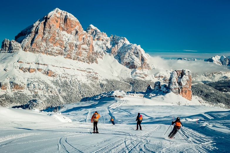

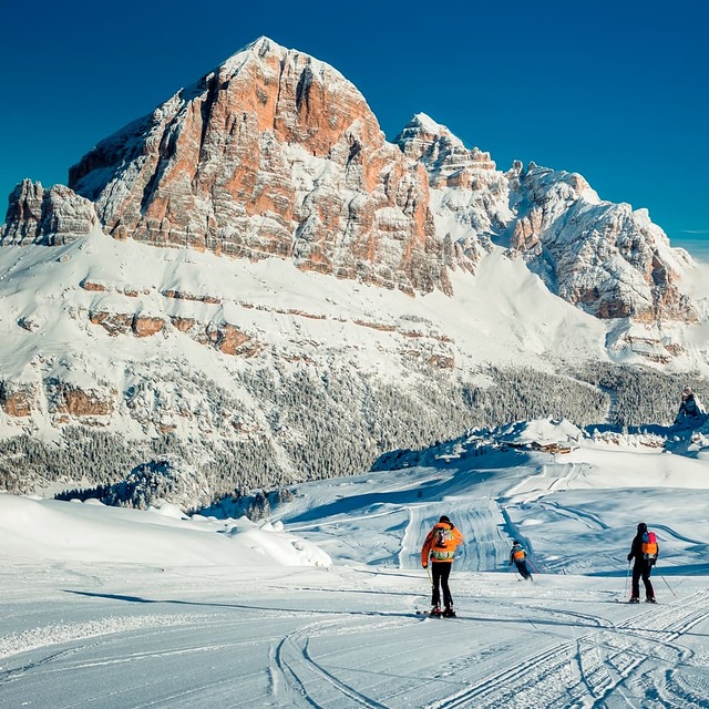
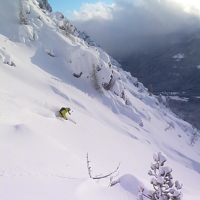
Freeride Added To 2030 Olympic Winter Games
The IOC has today announced a swathe of decisions ahead of the Alpes 2030 Winter Olympics and Paralympics in the French Alps.

Next 4 days weather summary:Moderate rain (total 12.0mm), heaviest on Wed night. Very mild (max 13°C on Thu afternoon, min 6°C on Mon night). Wind will be generally light. | Days 5-7 weather summary:Heavy rain (total 30.0mm), heaviest during Sat night. Very mild (max 13°C on Fri afternoon, min 9°C on Sat night). Wind will be generally light. | |||||||||||||||
Tuesday 28 | Wednesday 29 | Thursday 30 | Friday 31 | Saturday 1 | ||||||||||||
night | AM | PM | night | AM | PM | night | AM | PM | night | AM | PM | night | AM | PM | night | |
rain shwrs | clear | some clouds | clear | clear | t-storm risk | rain shwrs | clear | t-storm risk | rain shwrs | clear | t-storm risk | rain shwrs | clear | t-storm risk | rain shwrs | |
km/h | ||||||||||||||||
Snow map |  |  |  |  |  |  | ||||||||||
— | — | — | — | — | — | — | — | — | — | — | — | — | — | — | — | |
mm | 2 | — | — | — | — | 3 | 6 | — | 1 | 1 | — | 3 | 7 | — | 3 | 14 |
max °C | 7 | 8 | 10 | 11 | 10 | 10 | 10 | 10 | 13 | 12 | 12 | 13 | 11 | 12 | 13 | 10 |
min °C | 6 | 7 | 10 | 10 | 10 | 10 | 9 | 10 | 13 | 11 | 12 | 11 | 10 | 11 | 11 | 9 |
chill °C | 5 | 6 | 10 | 10 | 10 | 10 | 8 | 10 | 13 | 11 | 12 | 10 | 10 | 11 | 10 | 8 |
Humid % | 83 | 70 | 80 | 65 | 70 | 82 | 71 | 65 | 54 | 63 | 50 | 78 | 56 | 57 | 77 | 74 |
Freeze m | 4100 | 4200 | 4500 | 4550 | 4350 | 4450 | 4450 | 4450 | 4700 | 4600 | 4650 | 4650 | 4650 | 4650 | 4650 | 4500 |
— | 5:46 | — | — | 5:47 | — | — | 5:48 | — | — | 5:50 | — | — | 5:50 | — | — | |
— | — | — | 8:47 | — | — | 8:46 | — | — | 8:45 | — | — | 8:44 | — | — | 8:43 | |
Go pro and carve into:
Avalanche information: European Avalanche Warning Services (EAWS)
Latest snow reports near Cortina:
| Top snow depth: | 0 cm |
|---|---|
| Bottom snow depth: | 0 cm |
| Fresh snowfall depth: | — |
| Last snowfall: | 10 Jun 2026 |
| Snow Alerts | Create Alert |
0.0 | Bluebird Powder days Fresh snow, mostly sunny, light wind. |
|---|---|
0.4 | Powder days Fresh snow, limited sun, any wind. |
0.1 | Bluebird days Average snow, mostly sunny, light wind. |
The above table gives the weather forecast for Cortina at the specific elevation of 2932 m. Our sophisticated weather models allow us to provide snow forecasts for the top, middle and bottom ski stations of Cortina. To access the weather forecasts for the other elevations, use the tab navigation above the table. For a wider view of the weather, check out the Weather Map of Italy.
Click here to read further information on freezing levels and how we forecast our temperatures.
Overall 3.7 Based on 23 votes and 7 reviews
Cortina is beautiful. Lots of diverse runs to explore in stunning dolomite scenery. The beginner areas of Socrepes and Pocol are perfect, and at a reasonable altitude offer lovely sunny tree-lined pistes, with no queues throughout our stay. The only issue is getting your head around the free buses. Perhaps less of an issue if staying in Cortina itself. However, we stayed in the nearby village of San Vito Di Cadore. Part of the area and offers cheaper accommodation for those on a budget, whilst still connected with a free bus. Fly in to Treviso/Venice and take the train to Calalzo, and the local bus towards Cortina. Trains are comfortable, reliable and offer great views. Transfer is not quick, but was rather enjoyable. It is possible to take the Cortina express bus as an alternative. The central bus station in Cortina is next to the ski pass shop.
Sam W from United Kingdom writes:
Cortina is beautiful. Lots of diverse runs to explore in stunning dolomite scenery.
The beginner areas of Socrepes and Pocol are perfect, and at a reasonable altitude offer lovely sunny tree-lined pistes, with no queues throughout our stay.
The only issue is getting your head around the free buses. Perhaps less of an issue if staying in Cortina itself. However, we stayed in the nearby village of San Vito Di Cadore. Part of the area and offers cheaper accommodation for those on a budget, whilst still connected with a free bus.
Fly in to Treviso/Venice and take the train to Calalzo, and the local bus towards Cortina. Trains are comfortable, reliable and offer great views. Transfer is not quick, but was rather enjoyable. It is possible to take the Cortina express bus as an alternative.
The central bus station in Cortina is next to the ski pass shop.


 Nearest