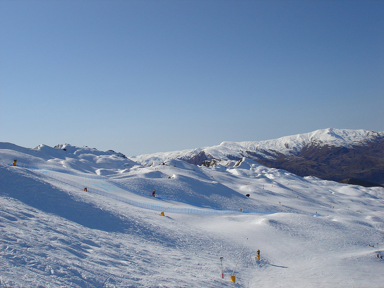
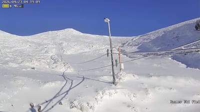
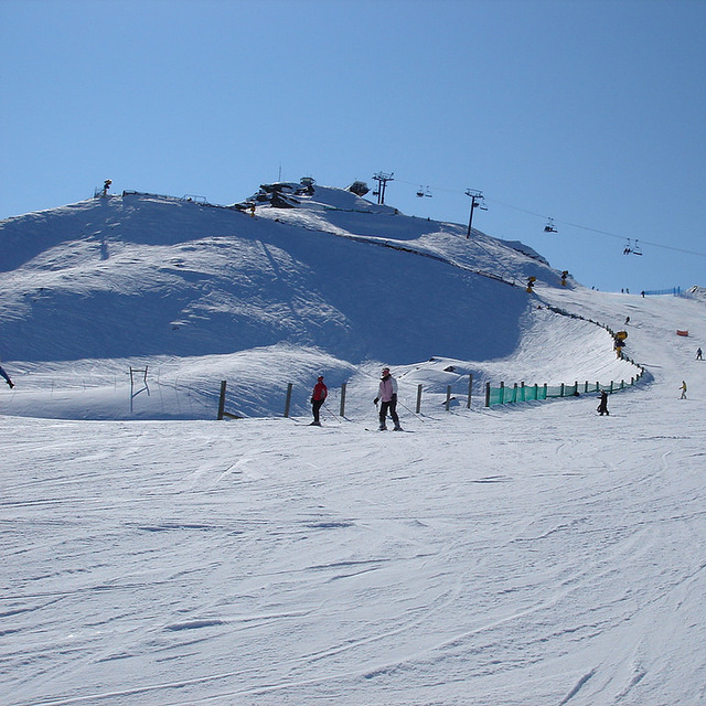
Coronet Peak snow
Ski New Zealand

Coronet Peak Snow Forecast

Weather Forecast for Coronet Peak at 1187 m
Issued: 11 am  12 Jul 2025 (local time)

New snow in Coronet Peak

2.0cm0.8in
Sat 12th (PM)
The snow forecast for Coronet Peak is: A moderate fall of snow, heaviest on Mon night. Freeze-thaw conditions (max 1°C on Sat morning, min -2°C on Sat night). Wind will be generally light.

Coronet Peak Weather (Next 3 days): The snow forecast for Coronet Peak is: A moderate fall of snow, heaviest on Mon night. Freeze-thaw conditions (max 1°C on Sat morning, min -2°C on Sat night). Wind will be generally light.

Coronet Peak Weather (Days 4-6): A dusting of new snow. Freeze-thaw conditions (max 1°C on Wed afternoon, min -4°C on Tue afternoon). Wind will be generally light.


Coronet Peak Live Weather

ResortSnow DepthTemp. (°C)Wind (km/h)Weather
Top Lift: 0.7m
-1
20
light snow
Middle Lift: 
0
15
light snow
Bottom Lift: 0.15m
0
15
light snow
Powered by Snow-Forecast.comSnow-Forecast.com
6 Day Forecast
Issued: 11 am 12 Jul 2025 / Updates in ::
Change Forecast Height
Choose Forecast
Last 6 daysScroll left for last 6 daysNow
Saturday
12
Sunday
13
Monday
14
Tuesday
15
Wednesday
16
Thursday
17
Friday
18
AM
PM
night
AM
PM
night
AM
PM
night
AM
PM
night
AM
PM
night
AM
PM
night
AM
PM
night
light snow
light snow
snow showers
light snow
light snow
light snow
cloud
cloud
snow showers
light snow
snow showers
part cloud
cloud
cloud
cloud
cloud
light snow
light snow
snow showers
clear
part cloud
light snow
light snow
snow shwrs
light snow
light snow
light snow
cloudy
cloudy
snow shwrs
light snow
snow shwrs
some clouds
cloudy
cloudy
cloudy
cloudy
light snow
light snow
snow shwrs
clear
some clouds
 km/h
10
NE
15
N
10
N
5
E
5
ENE
5
NNW
5
NW
10
NW
15
NNE
10
W
10
WNW
5
WNW
5
NNW
5
NNW
5
E
10
SSE
15
S
5
SSE
5
NW
5
SW
5
WSW
Snow map
 cm 
1
2
1
2
3
2
2
1
2
1
 mm 
max°C
1
1
0
-1
-1
-1
0
0
-1
0
0
-4
0
1
-2
-1
-1
-2
-1
0
-3
min°C
0
1
-2
-1
-1
-2
-2
0
-2
-1
-4
-4
-2
-1
-2
-1
-2
-3
-3
-3
-3
chill°C 
-4
-3
-5
-4
-3
-2
-4
-3
-6
-4
-7
-7
-4
-1
-2
-4
-6
-5
-6
-6
-5
Humid% 
99
99
96
80
97
98
94
98
88
92
87
67
63
63
56
60
96
97
64
77
54
Freezing level (m
1550
1400
1350
1250
1100
1150
1200
1300
1250
1200
1200
900
1250
1350
1450
1250
1000
950
1400
1300
1600
topliftbotliftSea lvl1000m2000m3000m4000m5000m
-1-1-2-3-3-3-2-2-3-3-4-3-2-2-2-3-4-4-2-2-111-1-1-1-2-10-2-1-2-4-10-2-1-2-3-2-2-3
Sunrise
8:19
8:18
8:18
8:18
8:18
8:17
8:15
Sunset
5:20
5:21
5:22
5:22
5:23
5:24
5:25

Snow Radar

Submit a report Eyeball Reporter

Latest snow reports near Coronet Peak:

  • 20 km away from Coronet Peak

    1 hour ago
    Is it snowing?

    It is snowing steadily at Cardrona. from Cardrona

  • 15 km away from Coronet Peak

    21 hours ago
    weather station observation

    Moderate to heavy rain showers reported from QueenstownAeroAws at 357 metres elevation 7 kms WNW of Remarkables but it is forecast cold enough for snow at the ski area from Remarkables

Coronet Peak Snow Conditions

Top snow depth:70cm
Bottom snow depth:15cm
Fresh snowfall depth:4cm
Last snowfall:11 Jul 2025
Snow AlertsCreate Alert
Other resorts in New Zealand are reporting: powder (0) / good piste (0)

Snow-Forecast Partner Offers

Snow History

Week 2 of July has on average:
0.2
Bluebird Powder days
Fresh snow, mostly sunny, light wind.
0.7
Powder days
Fresh snow, limited sun, any wind.
0.4
Bluebird days
Average snow, mostly sunny, light wind.


Snow-Forecast Partner Offers