

Global Weekly Snow Roundup #314
Weekly Global Snow News, updated 14 May 2026: Fresh snowfall in Argentina, Australia and Lesotho signals winter’s approach, while Japan maintains the world’s deepest snowpack.

Next 4 days weather summary:A dusting of new snow. Temperatures will be below freezing (max -1°C on Sun afternoon, min -9°C on Fri night). Wind will be generally light. | Days 5-7 weather summary:A dusting of new snow. Freeze-thaw conditions (max 3°C on Wed afternoon, min -3°C on Mon night). Wind will be generally light. | |||||||||||||||
Saturday 16 | Sunday 17 | Monday 18 | Tuesday 19 | Wednesday 20 | ||||||||||||
night | AM | PM | night | AM | PM | night | AM | PM | night | AM | PM | night | AM | PM | night | |
light snow | cloudy | light snow | light snow | some clouds | snow shwrs | light snow | light snow | light snow | light snow | light snow | light snow | light snow | some clouds | cloudy | cloudy | |
km/h | ||||||||||||||||
Snow map | 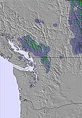 | 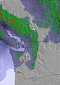 | 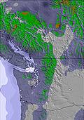 | 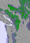 | 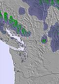 | 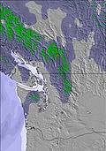 | ||||||||||
1 | — | — | 2 | — | — | — | — | — | — | — | — | — | — | — | — | |
— | — | — | — | — | — | — | — | — | — | — | — | — | — | — | — | |
max °C | -8 | -8 | -6 | -6 | -4 | -1 | -1 | -3 | -1 | -2 | -3 | -1 | -1 | 2 | 3 | 1 |
min °C | -9 | -9 | -7 | -6 | -6 | -2 | -3 | -4 | -2 | -3 | -3 | -2 | -2 | 0 | 3 | -1 |
-13 | -12 | -10 | -10 | -10 | -2 | -5 | -7 | -5 | -6 | -6 | -5 | -2 | -2 | -1 | -5 | |
91 | 71 | 84 | 94 | 72 | 67 | 78 | 58 | 83 | 93 | 92 | 83 | 80 | 47 | 80 | 82 | |
1000 | 1450 | 1850 | 1300 | 2000 | 2450 | 2050 | 2100 | 2350 | 2050 | 2050 | 2400 | 2200 | 2950 | 2950 | 2300 | |
— | 5:22 | — | — | 5:20 | — | — | 5:20 | — | — | 5:18 | — | — | 5:16 | — | — | |
— | — | — | 8:52 | — | — | 8:53 | — | — | 8:54 | — | — | 8:55 | — | — | 8:58 | |
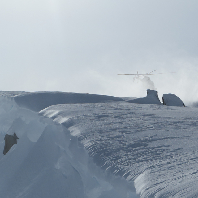
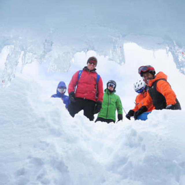
Latest snow reports near Coast Range Heliskiing:
Light rain reported from Whistler Airport at 325 metres elevation one km N of Whistler Blackcomb but it is forecast cold enough for snow at higher elevations in the ski area from Whistler Blackcomb
Shower light rain shower reported from Whistler Airport at 325 metres elevation one km N of Whistler Blackcomb but it is forecast cold enough for snow at higher elevations in the ski area from Whistler Blackcomb
| Top snow depth: | — |
|---|---|
| Bottom snow depth: | — |
| Fresh snowfall depth: | 5 cm |
| Last snowfall: | 14 May 2026 |
| Snow Alerts | Create Alert |
0.6 | Bluebird Powder days Fresh snow, mostly sunny, light wind. |
|---|---|
0.9 | Powder days Fresh snow, limited sun, any wind. |
0.6 | Bluebird days Average snow, mostly sunny, light wind. |
The above table gives the weather forecast for Coast Range Heliskiing at the specific elevation of 2499 m. Our sophisticated weather models allow us to provide snow forecasts for the top, middle and bottom ski stations of Coast Range Heliskiing. To access the weather forecasts for the other elevations, use the tab navigation above the table. For a wider view of the weather, check out the Weather Map of Canada.
Click here to read further information on freezing levels and how we forecast our temperatures.


 Nearest