

Global Weekly Snow Roundup #314
Weekly Global Snow News, updated 14 May 2026: Fresh snowfall in Argentina, Australia and Lesotho signals winter’s approach, while Japan maintains the world’s deepest snowpack.

Next 3 days weather summary:Heavy rain (total 24.0mm), heaviest during Mon night. Mild temperatures (max 9°C on Sat morning, min 5°C on Sun night). Wind will be generally light. | Days 4-6 weather summary:Light rain (total 8.0mm), mostly falling on Tue morning. Freeze-thaw conditions (max 5°C on Thu morning, min 0°C on Tue night). Wind will be generally light. | |||||||||||||||||
Saturday 16 | Sunday 17 | Monday 18 | Tuesday 19 | Wednesday 20 | Thursday 21 | |||||||||||||
AM | PM | night | AM | PM | night | AM | PM | night | AM | PM | night | AM | PM | night | AM | PM | night | |
cloudy | some clouds | some clouds | cloudy | light rain | mod. rain | light rain | light rain | heavy rain | mod. rain | light rain | some clouds | clear | clear | clear | clear | clear | clear | |
km/h | ||||||||||||||||||
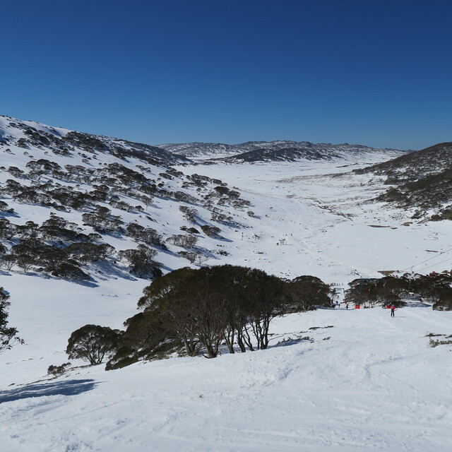
Snow map | 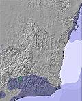 | 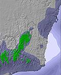 | 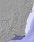 | 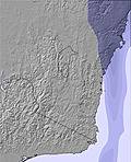 | 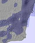 | 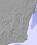 | ||||||||||||
— | — | — | — | — | — | — | — | — | — | — | — | — | — | — | — | — | — | |
— | — | — | — | 2 | 6 | 1 | 2 | 13 | 6 | 2 | — | — | — | — | — | — | — | |
max °C | 9 | 8 | 7 | 7 | 7 | 5 | 6 | 6 | 6 | 4 | 3 | 3 | 4 | 3 | 1 | 5 | 4 | 2 |
min °C | 7 | 7 | 7 | 7 | 6 | 5 | 5 | 6 | 5 | 4 | 3 | 0 | 1 | 1 | 0 | 2 | 2 | 1 |
4 | 4 | 4 | 5 | 3 | 1 | 3 | 5 | 4 | 1 | -1 | -4 | -3 | -3 | -4 | -1 | -2 | -3 | |
53 | 53 | 65 | 66 | 72 | 91 | 88 | 90 | 98 | 98 | 88 | 65 | 62 | 57 | 64 | 49 | 51 | 70 | |
2950 | 2950 | 3250 | 2950 | 2800 | 2750 | 3000 | 2850 | 2850 | 2700 | 2550 | 2500 | 2300 | 2400 | 2050 | 2800 | 2900 | 2900 | |
6:56 | — | — | 6:56 | — | — | 6:58 | — | — | 6:58 | — | — | 7:00 | — | — | 7:01 | — | — | |
— | 5:07 | — | — | 5:07 | — | — | 5:07 | — | — | 5:06 | — | — | 5:05 | — | — | 5:05 | — | |
Latest snow reports near Charlotte Pass:
| Top snow depth: | — |
|---|---|
| Bottom snow depth: | — |
| Fresh snowfall depth: | — |
| Last snowfall: | 7 May 2026 |
| Snow Alerts | Create Alert |
0.1 | Bluebird Powder days Fresh snow, mostly sunny, light wind. |
|---|---|
0.1 | Powder days Fresh snow, limited sun, any wind. |
0.3 | Bluebird days Average snow, mostly sunny, light wind. |

The above table gives the weather forecast for Charlotte Pass at the specific elevation of 1857 m. Our sophisticated weather models allow us to provide snow forecasts for the top, middle and bottom ski stations of Charlotte Pass. To access the weather forecasts for the other elevations, use the tab navigation above the table. For a wider view of the weather, check out the Weather Map of Australia.
Click here to read further information on freezing levels and how we forecast our temperatures.
Overall 2.7 Based on 4 votes and 13 reviews
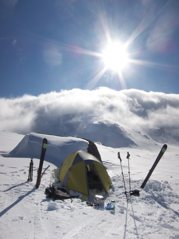
I've been skiing at Charlottes for 45 years. It is a fantastic place. It's rather limited for downhill but perfect for cross country skiing, alpine touring and snow shoeing. No other resort has such great access to the main range. It is perfect for kids because it is very difficult to lose them, everything slopes to the village and kids are easy to spot from the village. No cars. No crowds. No noise. Wonderful!
Dr Burns from Australia writes:
I've been skiing at Charlottes for 45 years. It is a fantastic place. It's rather limited for downhill but perfect for cross country skiing, alpine touring and snow shoeing. No other resort has such great access to the main range.
It is perfect for kids because it is very difficult to lose them, everything slopes to the village and kids are easy to spot from the village.
No cars. No crowds. No noise. Wonderful!


 Nearest