

Global Weekly Snow Roundup #314
Weekly Global Snow News, updated 14 May 2026: Fresh snowfall in Argentina, Australia and Lesotho signals winter’s approach, while Japan maintains the world’s deepest snowpack.

Next 3 days weather summary:Moderate rain (total 11.0mm), heaviest on Mon night. Freeze-thaw conditions (max 11°C on Mon afternoon, min -1°C on Sat morning). Wind will be generally light. | Days 4-6 weather summary:Light rain (total 2.0mm), mostly falling on Tue morning. Very mild (max 17°C on Thu afternoon, min 5°C on Tue night). Wind will be generally light. | |||||||||||||||||
Saturday 16 | Sunday 17 | Monday 18 | Tuesday 19 | Wednesday 20 | Thursday 21 | |||||||||||||
AM | PM | night | AM | PM | night | AM | PM | night | AM | PM | night | AM | PM | night | AM | PM | night | |
light snow | snow shwrs | clear | cloudy | some clouds | light rain | light rain | light rain | light rain | light rain | light rain | some clouds | cloudy | some clouds | clear | clear | some clouds | clear | |
km/h | ||||||||||||||||||
Snow map |  |  |  |  |  |  | ||||||||||||
— | — | — | — | — | — | — | — | — | — | — | — | — | — | — | — | — | — | |
— | 1 | — | — | — | 1 | 1 | 3 | 5 | 1 | 1 | — | — | — | — | — | — | — | |
max °C | 1 | 5 | 3 | 7 | 10 | 7 | 9 | 11 | 6 | 6 | 7 | 8 | 9 | 12 | 10 | 13 | 17 | 13 |
min °C | -1 | 3 | 0 | 3 | 10 | 4 | 6 | 10 | 4 | 6 | 7 | 5 | 6 | 12 | 7 | 9 | 16 | 9 |
-5 | 0 | -3 | 1 | 10 | 4 | 6 | 9 | 4 | 6 | 7 | 3 | 4 | 11 | 5 | 8 | 16 | 8 | |
85 | 61 | 79 | 63 | 54 | 69 | 66 | 53 | 71 | 83 | 85 | 93 | 84 | 70 | 75 | 54 | 51 | 60 | |
1500 | 1900 | 1800 | 2250 | 2500 | 2300 | 2400 | 2550 | 2350 | 2550 | 2800 | 2650 | 2750 | 3250 | 3700 | 3800 | 3850 | 4000 | |
6:05 | — | — | 6:05 | — | — | 6:03 | — | — | 6:03 | — | — | 6:01 | — | — | 6:01 | — | — | |
— | — | 8:59 | — | — | 9:00 | — | — | 9:00 | — | — | 9:02 | — | — | 9:04 | — | — | 9:05 | |
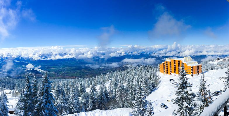
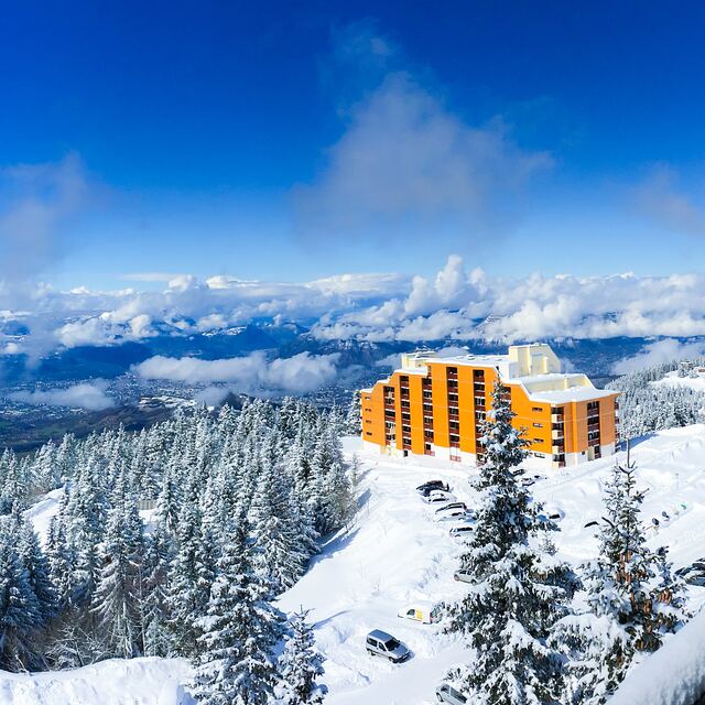
Latest snow reports near Chamrousse:
| Top snow depth: | — |
|---|---|
| Bottom snow depth: | — |
| Fresh snowfall depth: | 8 cm |
| Last snowfall: | 15 May 2026 |
| Snow Alerts | Create Alert |
0.0 | Bluebird Powder days Fresh snow, mostly sunny, light wind. |
|---|---|
0.0 | Powder days Fresh snow, limited sun, any wind. |
0.0 | Bluebird days Average snow, mostly sunny, light wind. |
The above table gives the weather forecast for Chamrousse at the specific elevation of 1400 m. Our sophisticated weather models allow us to provide snow forecasts for the top, middle and bottom ski stations of Chamrousse. To access the weather forecasts for the other elevations, use the tab navigation above the table. For a wider view of the weather, check out the Weather Map of France.
Click here to read further information on freezing levels and how we forecast our temperatures.
Overall 3.7 Based on 34 votes and 14 reviews
I have just been to Chamrousse again with my family. I have to say that it gets better and better every time we go. We stayed at the Domaine de l'Arselle which is ideal for families or groups travelling together. The place is very well kept and you can ski up to your apartment. The views from the balcony are just amazing. Highly recommend this place. Great for beginners as well as advanced skiers.
Paul Grezio from Germany writes:
I have just been to Chamrousse again with my family. I have to say that it gets better and better every time we go. We stayed at the Domaine de l'Arselle which is ideal for families or groups travelling together. The place is very well kept and you can ski up to your apartment. The views from the balcony are just amazing.
Highly recommend this place. Great for beginners as well as advanced skiers.


 Nearest