

Global Weekly Snow Roundup #314
Weekly Global Snow News, updated 14 May 2026: Fresh snowfall in Argentina, Australia and Lesotho signals winter’s approach, while Japan maintains the world’s deepest snowpack.

Next 3 days weather summary:A dusting of snow giving way to moderate rain (total 12.0mm) heaviest on Mon night. Freeze-thaw conditions (max 6°C on Sun afternoon, min -2°C on Sat morning). Wind will be generally light. | Days 4-6 weather summary:Moderate rain (total 16.0mm), heaviest on Tue night. Very mild (max 14°C on Thu afternoon, min 4°C on Tue morning). Wind will be generally light. | |||||||||||||||||
Saturday 16 | Sunday 17 | Monday 18 | Tuesday 19 | Wednesday 20 | Thursday 21 | |||||||||||||
AM | PM | night | AM | PM | night | AM | PM | night | AM | PM | night | AM | PM | night | AM | PM | night | |
snow shwrs | light snow | snow shwrs | some clouds | cloudy | cloudy | cloudy | light rain | mod. rain | light rain | light rain | mod. rain | light rain | rain shwrs | some clouds | some clouds | clear | clear | |
km/h | ||||||||||||||||||
Snow map |  |  |  |  |  |  | ||||||||||||
— | 1 | — | — | — | — | — | — | — | — | — | — | — | — | — | — | — | — | |
— | — | — | — | — | — | — | 5 | 7 | 1 | 3 | 8 | 2 | 2 | — | — | — | — | |
max °C | 0 | 1 | 1 | 3 | 6 | 5 | 6 | 6 | 5 | 4 | 6 | 5 | 6 | 10 | 9 | 11 | 14 | 12 |
min °C | -2 | 0 | -1 | 1 | 5 | 3 | 4 | 6 | 3 | 4 | 5 | 5 | 5 | 9 | 7 | 8 | 13 | 11 |
-2 | -2 | -1 | 1 | 4 | 1 | 3 | 4 | 0 | 3 | 3 | 3 | 5 | 8 | 6 | 8 | 13 | 11 | |
81 | 76 | 79 | 65 | 63 | 72 | 68 | 71 | 89 | 91 | 92 | 91 | 83 | 59 | 74 | 52 | 56 | 64 | |
1600 | 1850 | 1500 | 2150 | 2350 | 2200 | 2350 | 2400 | 2150 | 2450 | 2700 | 2500 | 2650 | 2850 | 3450 | 3650 | 3750 | 3950 | |
5:58 | — | — | 5:58 | — | — | 5:56 | — | — | 5:56 | — | — | 5:54 | — | — | 5:54 | — | — | |
— | — | 8:59 | — | — | 9:00 | — | — | 9:00 | — | — | 9:02 | — | — | 9:04 | — | — | 9:05 | |
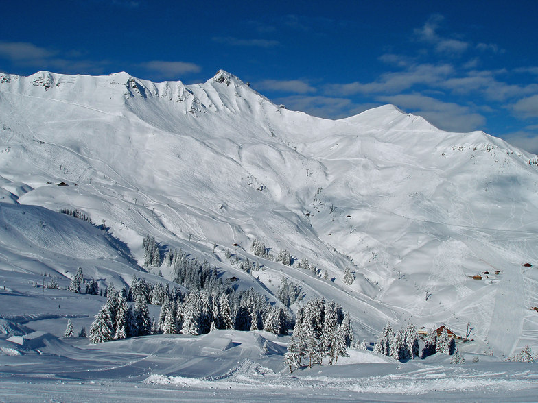
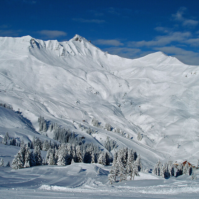
Latest snow reports near Champéry:
Resort is closed for the season. Snowing lightly, refreshing pistes. from La Giettaz en Aravis
| Top snow depth: | 122 cm |
|---|---|
| Bottom snow depth: | 93 cm |
| Fresh snowfall depth: | 18 cm |
| Last snowfall: | 15 May 2026 |
| Snow Alerts | Create Alert |
0.0 | Bluebird Powder days Fresh snow, mostly sunny, light wind. |
|---|---|
0.1 | Powder days Fresh snow, limited sun, any wind. |
0.0 | Bluebird days Average snow, mostly sunny, light wind. |

The above table gives the weather forecast for Champéry at the specific elevation of 1658 m. Our sophisticated weather models allow us to provide snow forecasts for the top, middle and bottom ski stations of Champéry. To access the weather forecasts for the other elevations, use the tab navigation above the table. For a wider view of the weather, check out the Weather Map of Switzerland.
Click here to read further information on freezing levels and how we forecast our temperatures.
Resort name is also written as Champery.
Overall 4.1 Based on 20 votes and 12 reviews
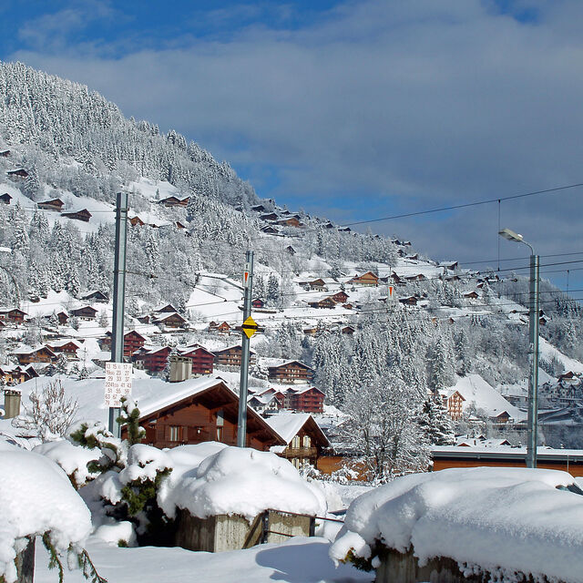
Champery is one of the best places from which to ski the Portes du Soleil ski area with masses of fast lifts and over 600km of well-treated pistes. It's easy to get right over to Les Gets, Avoriaz, Morzine, Chatel and Morgins. There is masses of new accommodation to rent from Avanthay or MDK immobiliers, (we stayed at Chamath with four bedrooms and sleeps 8 from Avanthays). Champery has become much livelier in the past few years with great restaurants and enough night-life and bars but without losing its village charm and beauty. It was just about the first ski village to be established over a century ago. If you only want to ski for 5 hours or half a day you can buy a 'Swiss side only' pass which covers Champery, Crozets, Champoussin, Morgins and right over to Torgon which overlooks Lake Geneva. And don't forget the famous Swiss Wall, one of the toughest black runs in Europe; not to be attempted after a long liquid lunch in one of the many restaurants on the pistes!. There are, of course, plenty of blues and reds with a few blacks to test you. Good luck and happy skiing.
Ross from United Kingdom writes:
Champery is one of the best places from which to ski the Portes du Soleil ski area with masses of fast lifts and over 600km of well-treated pistes. It's easy to get right over to Les Gets, Avoriaz, Morzine, Chatel and Morgins. There is masses of new accommodation to rent from Avanthay or MDK immobiliers, (we stayed at Chamath with four bedrooms and sleeps 8 from Avanthays).
Champery has become much livelier in the past few years with great restaurants and enough night-life and bars but without losing its village charm and beauty. It was just about the first ski village to be established over a century ago.
If you only want to ski for 5 hours or half a day you can buy a 'Swiss side only' pass which covers Champery, Crozets, Champoussin, Morgins and right over to Torgon which overlooks Lake Geneva. And don't forget the famous Swiss Wall, one of the toughest black runs in Europe; not to be attempted after a long liquid lunch in one of the many restaurants on the pistes!. There are, of course, plenty of blues and reds with a few blacks to test you.
Good luck and happy skiing.


 Nearest