
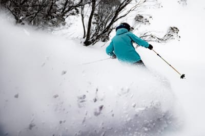
Late Season Storm Boosts Australia’s Bumper Season Even More
The latest in a series of major snowstorms has hit Australia’s ski slopes.
By using Snow-Forecast, you agree to our Terms & Services.
Don't have an account? Join now
Alternatively, you can now use your Outside account to sign in to any brand in the Outside digital ecosystem, including Snow-Forecast, Surf-Forecast, and Mountain-Forecast.


Cerro Catedral Weather (Next 3 days): The snow forecast for Cerro Catedral is: Light rain (total 2.0mm) at first, then becoming colder with a dusting of snow on Mon night. Freeze-thaw conditions (max 9°C on Sun afternoon, min -2°C on Mon night). Wind will be generally light.
Cerro Catedral Weather (Days 4-6): A moderate fall of snow, heaviest on Wed night. Freeze-thaw conditions (max 2°C on Thu afternoon, min -10°C on Wed night). Wind will be generally light.
| Resort | Snow Depth | Temp. (°C) | Wind (km/h) | Weather | ||
|---|---|---|---|---|---|---|
| Top Lift: | 0.05 m | -1 | ||||
| Middle Lift: | 0 | |||||
| Bottom Lift: | 0.4 m | 2 |
Latest snow reports near Cerro Catedral:
Limited skiing due to the lack of snow. Cloudy this morning, clearing later. from Cerro Catedral

Saturday 30 | Sunday 31 | Monday 1 | Tuesday 2 | Wednesday 3 | Thursday 4 | Friday 5 | |||||||||||||||
AM | PM | night | AM | PM | night | AM | PM | night | AM | PM | night | AM | PM | night | AM | PM | night | AM | PM | night | |
some clouds | cloudy | some clouds | some clouds | some clouds | some clouds | light rain | light rain | light snow | snow shwrs | light snow | light snow | light snow | light snow | snow shwrs | clear | clear | clear | clear | clear | clear | |
km/h | |||||||||||||||||||||
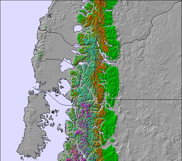
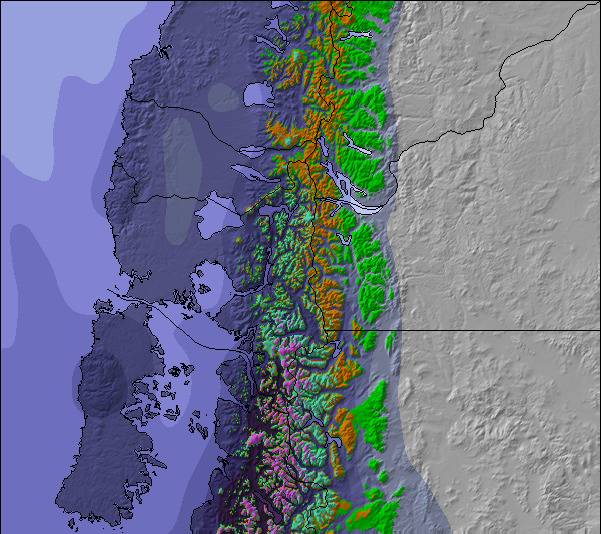
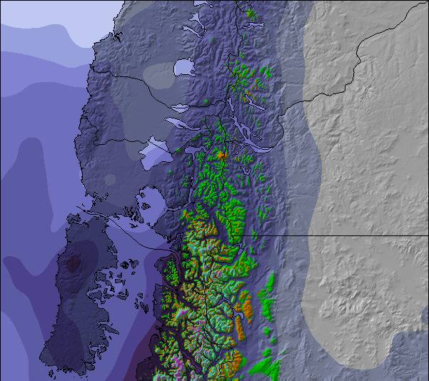
Snow map |  |  | 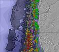 | 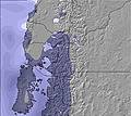 |  | 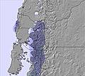 | 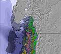 | ||||||||||||||
— | — | — | — | — | — | — | — | 2 | 2 | 2 | 1 | 2 | 1 | 3 | — | — | — | — | — | — | |
— | — | — | — | — | — | 1 | 1 | — | — | — | — | — | — | — | — | — | — | — | — | — | |
max°C | 6 | 7 | 3 | 5 | 9 | 5 | 6 | 6 | 2 | 0 | 0 | -3 | -1 | -1 | -5 | -1 | 2 | -3 | 4 | 6 | -1 |
min°C | 2 | 5 | 0 | 1 | 9 | 3 | 3 | 3 | -2 | -2 | -2 | -5 | -3 | -2 | -10 | -7 | 1 | -4 | -1 | 4 | -3 |
-1 | 2 | -2 | -1 | 8 | 0 | 0 | 0 | -5 | -6 | -7 | -10 | -9 | -2 | -13 | -7 | 1 | -6 | -4 | 2 | -7 | |
81 | 64 | 68 | 78 | 63 | 87 | 94 | 64 | 98 | 91 | 65 | 93 | 85 | 58 | 59 | 53 | 44 | 43 | 42 | 36 | 44 | |
1750 | 2600 | 2600 | 1500 | 2650 | 2000 | 1700 | 1950 | 1400 | 850 | 1100 | 500 | 700 | 1000 | 0 | 0 | 1250 | 1000 | 1750 | 2850 | 3300 | |
8:14 | — | — | 8:11 | — | — | 8:10 | — | — | 8:08 | — | — | 8:07 | — | — | 8:06 | — | — | 8:03 | — | — | |
— | 7:19 | — | — | 7:20 | — | — | 7:21 | — | — | 7:22 | — | — | 7:22 | — | — | 7:23 | — | — | 7:24 | — | |
Light rain (total 2.0mm) at first, then becoming colder with a dusting of snow on Mon night. Freeze-thaw conditions (max 9°C on Sun afternoon, min -2°C on Mon night). Wind will be generally light.
A moderate fall of snow, heaviest on Wed night. Freeze-thaw conditions (max 2°C on Thu afternoon, min -10°C on Wed night). Wind will be generally light.
Latest snow reports near Cerro Catedral:
Limited skiing due to the lack of snow. Cloudy this morning, clearing later. from Cerro Catedral
| Top snow depth: | 5 cm |
|---|---|
| Bottom snow depth: | 35 cm |
| Fresh snowfall depth: | — |
| Last snowfall: | 24 Aug 2025 |
| Snow Alerts | Create Alert |
0.0 | Bluebird Powder days Fresh snow, mostly sunny, light wind. |
|---|---|
0.1 | Powder days Fresh snow, limited sun, any wind. |
0.1 | Bluebird days Average snow, mostly sunny, light wind. |
The above table gives the weather forecast for Cerro Catedral at the specific elevation of 1159 m. Our sophisticated weather models allow us to provide snow forecasts for the top, middle and bottom ski stations of Cerro Catedral. To access the weather forecasts for the other elevations, use the tab navigation above the table. For a wider view of the weather, check out the Weather Map of Argentina.
Click here to read further information on freezing levels and how we forecast our temperatures.
Overall 3.5 Based on 199 votes and 265 reviews
Beautiful place with outstanding landscapes. Snow quality - good when you have it. Would say that 90% of the season you cannot ski all the way down. Expect to stop midway and get a lift to the base. Some days expect high winds and very low visibility. Mountain runs - fun tracks for intermediate level, beginners only at the base with huge crowds. Just a few for advanced, not really for advanced if you are looking for it. Infrastructure - very old lifts and I doubt about how secure they are. Missing investments. Poor resting areas for families to recovery from cold. Lets say there are none available. Only options are the small restaurants fully packed and you cannot sit unless you spend money. Personnel - general impression is bad. Had an issue with my lift card and had to buy a new one as there was zero intention by the local manager to solve it. I felt I was robbed as they did not refund 2 days of my lift pass. Overall Cost /Benefit - as expensive as any other American ski resorts but with much less infrastructure. Do not recommend as there are many other better options to go.
David from Argentina writes:
Beautiful place with outstanding landscapes.
Snow quality - good when you have it. Would say that 90% of the season you cannot ski all the way down. Expect to stop midway and get a lift to the base. Some days expect high winds and very low visibility.
Mountain runs - fun tracks for intermediate level, beginners only at the base with huge crowds. Just a few for advanced, not really for advanced if you are looking for it.
Infrastructure - very old lifts and I doubt about how secure they are. Missing investments. Poor resting areas for families to recovery from cold. Lets say there are none available. Only options are the small restaurants fully packed and you cannot sit unless you spend money.
Personnel - general impression is bad. Had an issue with my lift card and had to buy a new one as there was zero intention by the local manager to solve it. I felt I was robbed as they did not refund 2 days of my lift pass.
Overall Cost /Benefit - as expensive as any other American ski resorts but with much less infrastructure. Do not recommend as there are many other better options to go.
The Cerro Catedral skiing weather widget is available to embed on external websites free of charge. It provides a daily summary of our Cerro Catedral snow forecast and current weather conditions. Simply go to the feed configuration page and follow the 3 simple steps to grab the custom html code snippet and paste it into your own site. You can choose the snow forecast elevation (summit, mid-mountain or bottom lift) and metric/imperial units for the snow forecast feed to suit your own website…. Click here to get the code.
View detailed snow forecast for Cerro Catedral at:
snow-forecast.com

 Nearest