


Global Weekly Snow Roundup #314
Weekly Global Snow News, updated 14 May 2026: Fresh snowfall in Argentina, Australia and Lesotho signals winter’s approach, while Japan maintains the world’s deepest snowpack.

Next 4 days weather summary:A light fall of snow, heaviest on Fri night. Turning milder with light rain (total 2.0mm) on Mon afternoon. Freeze-thaw conditions (max 3°C on Mon afternoon, min -6°C on Sat night). Wind will be generally light. | Days 5-7 weather summary:Moderate rain (total 14.0mm), heaviest on Wed night. Freeze-thaw conditions (max 7°C on Wed afternoon, min 0°C on Mon night). Wind will be generally light. | |||||||||||||||
Saturday 16 | Sunday 17 | Monday 18 | Tuesday 19 | Wednesday 20 | ||||||||||||
night | AM | PM | night | AM | PM | night | AM | PM | night | AM | PM | night | AM | PM | night | |
mod. snow | light snow | light snow | snow shwrs | clear | snow shwrs | light snow | snow shwrs | light rain | light snow | light snow | rain shwrs | rain shwrs | rain shwrs | cloudy | light rain | |
km/h | ||||||||||||||||
Snow map | 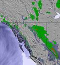 | 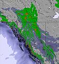 | 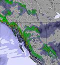 | 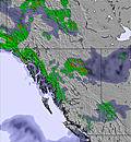 | 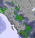 | 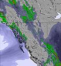 | ||||||||||
6 | 1 | 2 | 1 | — | 1 | 2 | — | — | — | — | — | — | — | — | — | |
— | — | — | — | — | — | — | — | 2 | 1 | 1 | 2 | 1 | 1 | — | 3 | |
max °C | -1 | -4 | -3 | -3 | -1 | 1 | -2 | 0 | 3 | 3 | 3 | 5 | 4 | 4 | 7 | 5 |
min °C | -5 | -4 | -3 | -6 | -3 | 1 | -3 | -2 | 2 | 0 | 1 | 5 | 1 | 2 | 6 | 2 |
-9 | -8 | -7 | -9 | -6 | 1 | -3 | -2 | 2 | -2 | 1 | 4 | -1 | 1 | 4 | -1 | |
91 | 82 | 89 | 80 | 72 | 61 | 89 | 82 | 64 | 68 | 73 | 61 | 70 | 76 | 57 | 74 | |
1750 | 1650 | 1800 | 1400 | 1700 | 2350 | 1850 | 1900 | 2450 | 2350 | 2350 | 2700 | 2600 | 2500 | 2850 | 2800 | |
— | 5:56 | — | — | 5:54 | — | — | 5:52 | — | — | 5:52 | — | — | 5:50 | — | — | |
— | — | — | 9:30 | — | — | 9:31 | — | — | 9:34 | — | — | 9:35 | — | — | 9:37 | |
Latest snow reports near CMH Bobbie-Burns:
| Top snow depth: | — |
|---|---|
| Bottom snow depth: | — |
| Fresh snowfall depth: | 1 cm |
| Last snowfall: | 13 May 2026 |
| Snow Alerts | Create Alert |
0.1 | Bluebird Powder days Fresh snow, mostly sunny, light wind. |
|---|---|
0.3 | Powder days Fresh snow, limited sun, any wind. |
0.2 | Bluebird days Average snow, mostly sunny, light wind. |
The above table gives the weather forecast for CMH Bobbie-Burns at the specific elevation of 2216 m. Our sophisticated weather models allow us to provide snow forecasts for the top, middle and bottom ski stations of CMH Bobbie-Burns. To access the weather forecasts for the other elevations, use the tab navigation above the table. For a wider view of the weather, check out the Weather Map of Canada.
Click here to read further information on freezing levels and how we forecast our temperatures.
Es ist bei weitem der schönste Heliskiurlaub den ich je gemacht habe. Einmalige Runs in abwechslungsreicher Landschaft. Aber entscheidend ist der wirklich exzellente Service. Anreise auf Minute genau, herzlicher Empfang , hervorragendes essen. Alle vom Service kennen deinen Namen. Die Krönung jedoch sind die Guides . Alle maximal skifahrerorientiert. Regeln sehr freundlich vorgetragen, keine Arroganz von oben herab, sondern Hilfsbereitschaft, locker, humorvoll und immer Kundenorientiert. Mit solchen netten Guides wird Heliskiing zum vollendeten Genuss. Meine große Anerkennung . Freundlicher Profipilot und gutes Sportequippment runden die überall vorhandene Proffessionalität ab.
Georg Oberrauch from Italy writes:
Es ist bei weitem der schönste Heliskiurlaub den ich je gemacht habe. Einmalige Runs in abwechslungsreicher Landschaft. Aber entscheidend ist der wirklich exzellente Service.
Anreise auf Minute genau, herzlicher Empfang , hervorragendes essen.
Alle vom Service kennen deinen Namen.
Die Krönung jedoch sind die Guides . Alle maximal skifahrerorientiert. Regeln sehr freundlich vorgetragen, keine Arroganz von oben herab, sondern Hilfsbereitschaft, locker, humorvoll und immer Kundenorientiert.
Mit solchen netten Guides wird Heliskiing zum vollendeten Genuss.
Meine große Anerkennung . Freundlicher Profipilot und gutes Sportequippment runden die überall vorhandene Proffessionalität ab.


 Nearest