

Global Weekly Snow Roundup #314
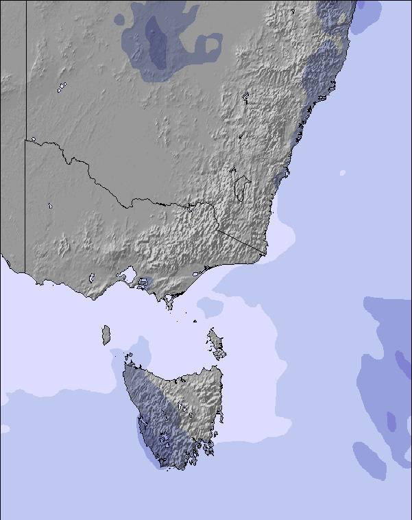
Weekly Global Snow News, updated 14 May 2026: Fresh snowfall in Argentina, Australia and Lesotho signals winter’s approach, while Japan maintains the world’s deepest snowpack.

Next 3 days weather summary:Light rain (total 5.0mm), mostly falling on Sun morning. Mild temperatures (max 8°C on Sat morning, min 3°C on Mon night). Winds decreasing (near gales from the NNW on Sat night, light winds from the NW by Sun night). | Days 4-6 weather summary:Some drizzle, heaviest during Tue night. Freeze-thaw conditions (max 7°C on Tue morning, min 0°C on Tue night). Winds increasing (calm on Tue afternoon, fresh winds from the SW by Thu afternoon). | |||||||||||||||||
Saturday 16 | Sunday 17 | Monday 18 | Tuesday 19 | Wednesday 20 | Thursday 21 | |||||||||||||
AM | PM | night | AM | PM | night | AM | PM | night | AM | PM | night | AM | PM | night | AM | PM | night | |
cloudy | some clouds | some clouds | light rain | light rain | cloudy | some clouds | rain shwrs | clear | some clouds | cloudy | rain shwrs | clear | clear | clear | clear | clear | clear | |
km/h | ||||||||||||||||||
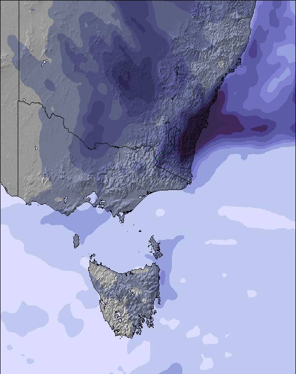
Snow map | 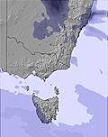 | 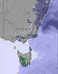 | 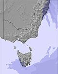 | 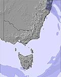 | 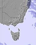 | 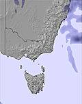 | ||||||||||||
— | — | — | — | — | — | — | — | — | — | — | — | — | — | — | — | — | — | |
— | — | — | 2 | 2 | — | — | 1 | — | — | — | 1 | — | — | — | — | — | — | |
max °C | 8 | 8 | 7 | 7 | 6 | 6 | 8 | 7 | 5 | 7 | 5 | 3 | 3 | 3 | 2 | 4 | 4 | 2 |
min °C | 8 | 7 | 6 | 7 | 6 | 5 | 7 | 5 | 3 | 6 | 4 | 0 | 3 | 1 | 1 | 4 | 3 | 2 |
3 | 2 | 0 | 2 | 3 | 4 | 5 | 1 | -3 | 3 | 2 | -6 | -2 | -4 | -4 | 0 | -3 | -4 | |
74 | 68 | 56 | 91 | 97 | 84 | 74 | 85 | 73 | 71 | 79 | 84 | 49 | 83 | 66 | 53 | 80 | 88 | |
2850 | 3000 | 2950 | 2700 | 2700 | 2600 | 2550 | 2550 | 2450 | 2350 | 2300 | 2150 | 2100 | 2600 | 3100 | 2750 | 2650 | 3150 | |
7:11 | — | — | 7:11 | — | — | 7:11 | — | — | 7:13 | — | — | 7:13 | — | — | 7:15 | — | — | |
— | 4:59 | — | — | 4:58 | — | — | 4:57 | — | — | 4:55 | — | — | 4:54 | — | — | 4:54 | — | |
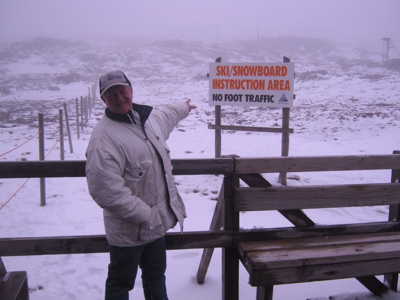
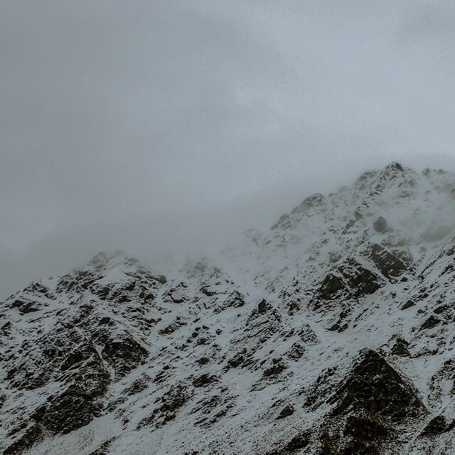
Latest snow reports near Ben Lomond:
| Top snow depth: | — |
|---|---|
| Bottom snow depth: | — |
| Fresh snowfall depth: | — |
| Last snowfall: | 6 May 2026 |
| Snow Alerts | Create Alert |
0.1 | Bluebird Powder days Fresh snow, mostly sunny, light wind. |
|---|---|
0.2 | Powder days Fresh snow, limited sun, any wind. |
0.3 | Bluebird days Average snow, mostly sunny, light wind. |
The above table gives the weather forecast for Ben Lomond at the specific elevation of 1448 m. Our sophisticated weather models allow us to provide snow forecasts for the top, middle and bottom ski stations of Ben Lomond. To access the weather forecasts for the other elevations, use the tab navigation above the table. For a wider view of the weather, check out the Weather Map of Australia.
Click here to read further information on freezing levels and how we forecast our temperatures.
Overall 2.9 Based on 10 votes and 3 reviews
Well if you want to get good at skiing or boarding Ben's the place to go!. You can hone your skills avoiding all the rocks that generally poke up out of the snow. You can also get very skilled at using the T bars, as the runs are so short you'll spend more time on the lift that on the runs.
Trev from Australia writes:
Well if you want to get good at skiing or boarding Ben's the place to go!. You can hone your skills avoiding all the rocks that generally poke up out of the snow. You can also get very skilled at using the T bars, as the runs are so short you'll spend more time on the lift that on the runs.


 Nearest