

Global Weekly Snow Roundup #314
Weekly Global Snow News, updated 14 May 2026: Fresh snowfall in Argentina, Australia and Lesotho signals winter’s approach, while Japan maintains the world’s deepest snowpack.

Next 3 days weather summary:A dusting of snow giving way to moderate rain (total 13.0mm) heaviest on Mon night. Freeze-thaw conditions (max 9°C on Mon afternoon, min -1°C on Sat night). Wind will be generally light. | Days 4-6 weather summary:Moderate rain (total 13.0mm), heaviest on Wed afternoon. Very mild (max 14°C on Thu afternoon, min 3°C on Tue morning). Wind will be generally light. | |||||||||||||||||
Saturday 16 | Sunday 17 | Monday 18 | Tuesday 19 | Wednesday 20 | Thursday 21 | |||||||||||||
AM | PM | night | AM | PM | night | AM | PM | night | AM | PM | night | AM | PM | night | AM | PM | night | |
light snow | light snow | snow shwrs | some clouds | rain shwrs | light rain | rain shwrs | risk thun- der | mod. rain | cloudy | light rain | cloudy | light rain | light rain | rain shwrs | rain shwrs | rain shwrs | rain shwrs | |
km/h | ||||||||||||||||||
Snow map |  |  |  |  |  |  | ||||||||||||
2 | — | — | — | — | — | — | — | — | — | — | — | — | — | — | — | — | — | |
— | — | — | — | 1 | 1 | 1 | 3 | 7 | — | 2 | — | 2 | 3 | 2 | 1 | 2 | 1 | |
max °C | 1 | 2 | 1 | 3 | 6 | 5 | 8 | 9 | 6 | 5 | 9 | 8 | 8 | 10 | 8 | 11 | 14 | 10 |
min °C | 0 | 1 | -1 | 1 | 5 | 3 | 5 | 9 | 3 | 3 | 8 | 5 | 6 | 10 | 6 | 7 | 14 | 7 |
-2 | -2 | -4 | 1 | 5 | 3 | 5 | 9 | 2 | 3 | 8 | 5 | 5 | 9 | 6 | 6 | 14 | 6 | |
96 | 88 | 95 | 80 | 74 | 87 | 68 | 74 | 99 | 81 | 64 | 90 | 80 | 77 | 90 | 66 | 50 | 90 | |
1650 | 1800 | 1400 | 2000 | 2300 | 2100 | 2450 | 2650 | 2150 | 2350 | 2600 | 2450 | 2650 | 2850 | 2700 | 2850 | 3100 | 3100 | |
5:31 | — | — | 5:30 | — | — | 5:28 | — | — | 5:26 | — | — | 5:26 | — | — | 5:24 | — | — | |
— | — | 8:37 | — | — | 8:37 | — | — | 8:38 | — | — | 8:39 | — | — | 8:40 | — | — | 8:43 | |
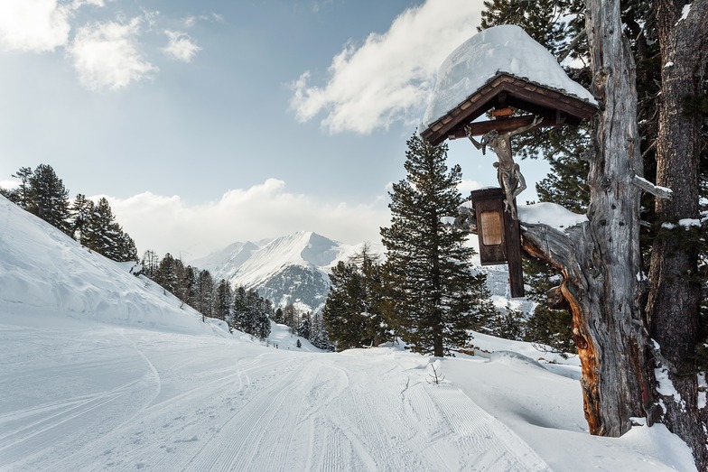
Latest snow reports near Bad Gastein:
| Top snow depth: | 0 cm |
|---|---|
| Bottom snow depth: | 0 cm |
| Fresh snowfall depth: | 27 cm |
| Last snowfall: | 15 May 2026 |
| Snow Alerts | Create Alert |
0.0 | Bluebird Powder days Fresh snow, mostly sunny, light wind. |
|---|---|
0.3 | Powder days Fresh snow, limited sun, any wind. |
0.0 | Bluebird days Average snow, mostly sunny, light wind. |
The above table gives the weather forecast for Bad Gastein at the specific elevation of 1543 m. Our sophisticated weather models allow us to provide snow forecasts for the top, middle and bottom ski stations of Bad Gastein. To access the weather forecasts for the other elevations, use the tab navigation above the table. For a wider view of the weather, check out the Weather Map of Austria.
Click here to read further information on freezing levels and how we forecast our temperatures.
Overall 3.8 Based on 23 votes and 9 reviews
Having paid E1250 for three weekly passes for Bad Gastein, it was only by accident we discovered that the Grauogel side lifts had permanently closed in 2025, taking out 7 ski runs. The only remaining lifts out of Bad Gastei are now a short two man chair (serving a short blue beginner slope) and a double double on the Stubnerkogel side. From the half-way point on the bubble there is only one way down via a narrow, glassy blue run with some challenging reverse-camber corners littered with petrified beginners and overun with oafish boy-racers. From about 14.30 onwards it is absolutely rammed and impossible to find a rhythm or a line. It is difficult and slow to access the Angertal side in poor conditions and only one lift back up. There is a single, brutalist-design restaurant at the foot of the B16 on the Bad Gastein side, and a scruffy cash-only bar by the ski school playing oompah music; no apres-ski scene on the slopes. Two decent alpine restaurant below the mid station, but once more you are then committed to the Only Way Down (B16), which even my daring daughter vetoed after doing it once and being taken out by an out-of-control beginner. I cannot recommend this resort for really any level of skier even in good conditions. Only two lifts, poorly designed, a single demanding blue that has to take everyone home in the afternoon.
Mike Katesmark from United Kingdom writes:
Having paid E1250 for three weekly passes for Bad Gastein, it was only by accident we discovered that the Grauogel side lifts had permanently closed in 2025, taking out 7 ski runs.
The only remaining lifts out of Bad Gastei are now a short two man chair (serving a short blue beginner slope) and a double double on the Stubnerkogel side.
From the half-way point on the bubble there is only one way down via a narrow, glassy blue run with some challenging reverse-camber corners littered with petrified beginners and overun with oafish boy-racers. From about 14.30 onwards it is absolutely rammed and impossible to find a rhythm or a line.
It is difficult and slow to access the Angertal side in poor conditions and only one lift back up. There is a single, brutalist-design restaurant at the foot of the B16 on the Bad Gastein side, and a scruffy cash-only bar by the ski school playing oompah music; no apres-ski scene on the slopes. Two decent alpine restaurant below the mid station, but once more you are then committed to the Only Way Down (B16), which even my daring daughter vetoed after doing it once and being taken out by an out-of-control beginner.
I cannot recommend this resort for really any level of skier even in good conditions. Only two lifts, poorly designed, a single demanding blue that has to take everyone home in the afternoon.


 Nearest