

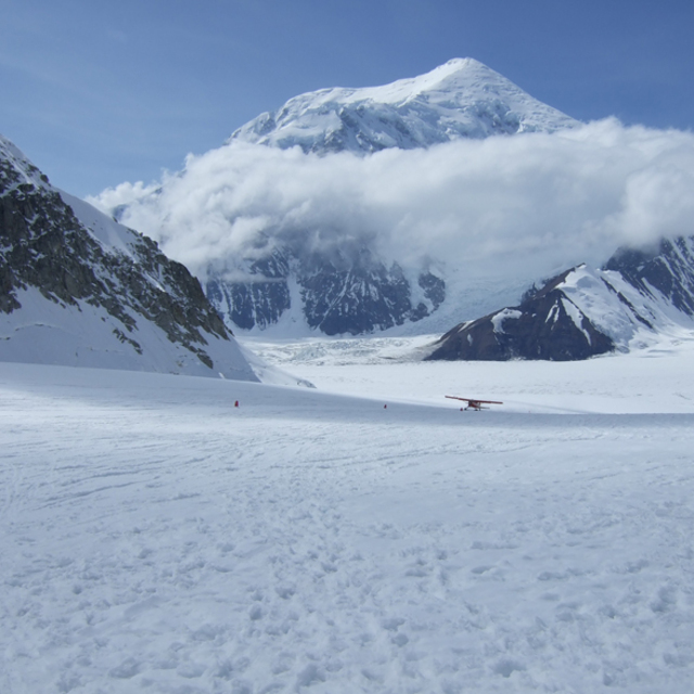
Global Weekly Snow Roundup #314
Weekly Global Snow News, updated 14 May 2026: Fresh snowfall in Argentina, Australia and Lesotho signals winter’s approach, while Japan maintains the world’s deepest snowpack.

Next 4 days weather summary:A heavy fall of snow, heaviest during Sun morning. Freeze-thaw conditions (max 1°C on Fri night, min -1°C on Fri night). Winds increasing (light winds from the ESE on Fri night, near gales from the ESE by Sun morning). | Days 5-7 weather summary:A heavy fall of snow, heaviest during Tue morning. Temperatures will be below freezing (max 0°C on Tue afternoon, min -2°C on Mon night). Wind will be generally light. | |||||||||||||||
Saturday 16 | Sunday 17 | Monday 18 | Tuesday 19 | Wednesday 20 | ||||||||||||
night | AM | PM | night | AM | PM | night | AM | PM | night | AM | PM | night | AM | PM | night | |
some clouds | light snow | light snow | mod. snow | heavy snow | mod. snow | light snow | light snow | light snow | light snow | light snow | light snow | light snow | light snow | light snow | light snow | |
km/h | ||||||||||||||||
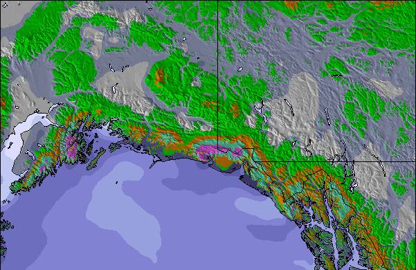
Snow map |  |  |  | 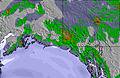 | 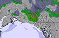 | 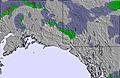 | ||||||||||
— | — | — | 10 | 18 | 8 | 1 | — | — | 2 | 4 | 4 | 5 | 2 | 1 | 1 | |
— | — | — | — | — | — | — | — | — | — | — | — | — | — | — | — | |
max °C | 1 | 0 | 0 | -1 | -1 | 0 | -1 | 0 | 0 | -1 | -1 | 0 | 0 | 0 | 0 | 0 |
min °C | -1 | 0 | 0 | -1 | -1 | -1 | -1 | -1 | 0 | -2 | -1 | 0 | 0 | 0 | 0 | -1 |
-5 | -4 | -6 | -8 | -10 | -7 | -5 | -5 | -4 | -8 | -8 | -6 | -5 | -3 | -2 | -4 | |
91 | 92 | 92 | 95 | 94 | 96 | 95 | 93 | 91 | 90 | 93 | 95 | 95 | 98 | 98 | 97 | |
900 | 750 | 850 | 700 | 650 | 750 | 750 | 700 | 850 | 550 | 700 | 750 | 750 | 850 | 850 | 700 | |
— | 5:07 | — | — | 5:05 | — | — | 5:03 | — | — | 5:01 | — | — | 4:58 | — | — | |
— | — | — | 10:37 | — | — | 10:40 | — | — | 10:43 | — | — | 10:45 | — | — | 10:47 | |
Latest snow reports near Alyeska Resort:
| Top snow depth: | — |
|---|---|
| Bottom snow depth: | — |
| Fresh snowfall depth: | — |
| Last snowfall: | 11 May 2026 |
| Snow Alerts | Create Alert |
0.1 | Bluebird Powder days Fresh snow, mostly sunny, light wind. |
|---|---|
1.0 | Powder days Fresh snow, limited sun, any wind. |
0.0 | Bluebird days Average snow, mostly sunny, light wind. |

The above table gives the weather forecast for Alyeska Resort at the specific elevation of 838 m. Our sophisticated weather models allow us to provide snow forecasts for the top, middle and bottom ski stations of Alyeska Resort. To access the weather forecasts for the other elevations, use the tab navigation above the table. For a wider view of the weather, check out the Weather Map of United States.
Click here to read further information on freezing levels and how we forecast our temperatures.
Overall 4.3 Based on 15 votes and 8 reviews
Yah, I wouldn't recommend it either. My youngest almost got eaten there! Kidding, but all around seem hungry + moving too fast to be up to any good.
John Brawn from United States writes:
Yah, I wouldn't recommend it either. My youngest almost got eaten there! Kidding, but all around seem hungry + moving too fast to be up to any good.

 Nearest