

Global Weekly Snow Roundup #314
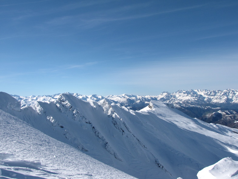
Weekly Global Snow News, updated 14 May 2026: Fresh snowfall in Argentina, Australia and Lesotho signals winter’s approach, while Japan maintains the world’s deepest snowpack.

Next 3 days weather summary:A dusting of snow on Sun afternoon. Freezing level rising with drizzle on Mon night. Freeze-thaw conditions (max 6°C on Mon afternoon, min -1°C on Sat morning). Wind will be generally light. | Days 4-6 weather summary:Light rain (total 3.0mm), mostly falling on Tue afternoon. Very mild (max 14°C on Thu afternoon, min 5°C on Tue morning). Wind will be generally light. | |||||||||||||||||
Saturday 16 | Sunday 17 | Monday 18 | Tuesday 19 | Wednesday 20 | Thursday 21 | |||||||||||||
AM | PM | night | AM | PM | night | AM | PM | night | AM | PM | night | AM | PM | night | AM | PM | night | |
clear | cloudy | cloudy | light snow | light snow | light snow | cloudy | cloudy | rain shwrs | some clouds | light rain | rain shwrs | clear | some clouds | clear | clear | clear | some clouds | |
km/h | ||||||||||||||||||
Snow map |  |  |  |  |  |  | ||||||||||||
— | — | — | — | 2 | — | — | — | — | — | — | — | — | — | — | — | — | — | |
— | — | — | — | — | — | — | — | 1 | — | 2 | 1 | — | — | — | — | — | — | |
max °C | 0 | 1 | 1 | 1 | 2 | 2 | 4 | 6 | 6 | 6 | 6 | 7 | 8 | 12 | 12 | 12 | 14 | 13 |
min °C | -1 | 1 | -1 | 0 | 2 | 1 | 3 | 6 | 5 | 5 | 6 | 6 | 8 | 11 | 12 | 12 | 13 | 13 |
-7 | -3 | -4 | -3 | 1 | -2 | -1 | 2 | 2 | 2 | 4 | 4 | 6 | 10 | 11 | 10 | 11 | 13 | |
72 | 77 | 98 | 85 | 91 | 85 | 54 | 71 | 83 | 74 | 84 | 63 | 55 | 43 | 33 | 54 | 54 | 54 | |
2150 | 2350 | 2100 | 2200 | 2450 | 2350 | 2850 | 2850 | 2950 | 3000 | 3100 | 3600 | 3850 | 4050 | 4100 | 3800 | 3750 | 3800 | |
6:52 | — | — | 6:52 | — | — | 6:50 | — | — | 6:50 | — | — | 6:50 | — | — | 6:48 | — | — | |
— | — | 9:34 | — | — | 9:35 | — | — | 9:36 | — | — | 9:37 | — | — | 9:37 | — | — | 9:38 | |
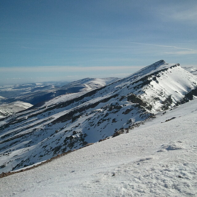
Latest snow reports near Alto Campoo:
| Top snow depth: | — |
|---|---|
| Bottom snow depth: | — |
| Fresh snowfall depth: | 17 cm |
| Last snowfall: | 15 May 2026 |
| Snow Alerts | Create Alert |
0.1 | Bluebird Powder days Fresh snow, mostly sunny, light wind. |
|---|---|
0.3 | Powder days Fresh snow, limited sun, any wind. |
0.1 | Bluebird days Average snow, mostly sunny, light wind. |
The above table gives the weather forecast for Alto Campoo at the specific elevation of 2124 m. Our sophisticated weather models allow us to provide snow forecasts for the top, middle and bottom ski stations of Alto Campoo. To access the weather forecasts for the other elevations, use the tab navigation above the table. For a wider view of the weather, check out the Weather Map of Spain.
Click here to read further information on freezing levels and how we forecast our temperatures.
Overall 3.2 Based on 115 votes and 81 reviews
Siempre poco aprovechada, pocos remontes y aún quitan mas, solo una silla sube a cota alta, parece que se piensa mas en el turismo que en el esquí, una pena por que el lugar tiene muchisimo potencial, mala gestión y más siendo del gobierno de Cantabria...
Manu from Spain writes:
Siempre poco aprovechada, pocos remontes y aún quitan mas, solo una silla sube a cota alta, parece que se piensa mas en el turismo que en el esquí, una pena por que el lugar tiene muchisimo potencial, mala gestión y más siendo del gobierno de Cantabria...


 Nearest