


View forecast
Altaussee at 1750 m altitude
Issued by Snow-Forecast.com at: 7 am (local time) / 09 May 2024
Now
Thursday 9 | Friday 10 | Saturday 11 | Sunday 12 | Monday 13 | Tuesday 14 | Wednesday 15 | |||||||||||||||
AM | PM | night | AM | PM | night | AM | PM | night | AM | PM | night | AM | PM | night | AM | PM | night | AM | PM | night | |
rain shwrs | rain shwrs | clear | clear | some clouds | rain shwrs | clear | some clouds | some clouds | some clouds | clear | rain shwrs | light rain | risk thun- der | rain shwrs | clear | risk thun- der | light rain | cloudy | risk thun- der | rain shwrs | |
km/h | |||||||||||||||||||||
Snow map | 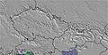 | 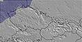 | 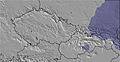 | 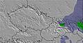 | 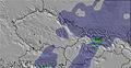 | 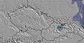 | 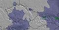 | ||||||||||||||
— | — | — | — | — | — | — | — | — | — | — | — | — | — | — | — | — | — | — | — | — | |
1.0 | 1.0 | — | — | — | 1.0 | — | — | — | — | — | 1.0 | 1.0 | 5 | 4 | — | 1.0 | 3 | — | 2.0 | 3 | |
max°C | 4 | 6 | 6 | 7 | 9 | 7 | 8 | 10 | 9 | 9 | 11 | 10 | 10 | 11 | 11 | 12 | 15 | 13 | 10 | 13 | 11 |
min°C | 3 | 6 | 5 | 5 | 8 | 5 | 5 | 10 | 7 | 7 | 11 | 8 | 8 | 11 | 9 | 9 | 14 | 6 | 7 | 11 | 7 |
1 | 5 | 5 | 5 | 7 | 5 | 5 | 10 | 7 | 7 | 10 | 7 | 8 | 11 | 9 | 8 | 14 | 4 | 6 | 10 | 6 | |
82 | 66 | 66 | 55 | 66 | 72 | 54 | 57 | 74 | 61 | 56 | 72 | 68 | 73 | 75 | 59 | 56 | 93 | 76 | 64 | 79 | |
2450 | 2650 | 2700 | 2750 | 2800 | 2650 | 2950 | 3050 | 2950 | 2950 | 3100 | 3050 | 3050 | 3200 | 3300 | 3450 | 3400 | 3300 | 3200 | 3400 | 3350 | |
5:35 | — | — | 5:33 | — | — | 5:31 | — | — | 5:30 | — | — | 5:28 | — | — | 5:28 | — | — | 5:26 | — | — | |
— | — | 8:28 | — | — | 8:29 | — | — | 8:30 | — | — | 8:31 | — | — | 8:32 | — | — | 8:35 | — | — | 8:36 | |
Next 0-3 days weather summary:
Light rain (total 3.0mm), mostly falling on Thu morning. Very mild (max 10°C on Sat afternoon, min 3°C on Thu morning). Wind will be generally light.
Next 4-6 days weather summary:
Moderate rain (total 15.0mm), heaviest on Mon afternoon. Very mild (max 15°C on Tue afternoon, min 6°C on Tue night). Wind will be generally light.
Popular Altaussee Pages
Snow Radar
Submit a reportLatest snow reports near Altaussee:
26 km away from Altaussee
7 hours ago
Light rain showers reported from Ramsau/Dachstein at 1210 metres elevation one km WNW of Dachstein Glacier but it is forecast cold enough for snow at higher elevations in the ski area from Dachstein Glacier
46 km away from Altaussee
7 hours agoRain reported from Obertauern (automatic) at 1742 metres elevation one km N of Obertauern but it is forecast cold enough for snow at higher elevations in the ski area from Obertauern
26 km away from Altaussee
9 hours agoRain reported from Ramsau/Dachstein at 1210 metres elevation one km WNW of Dachstein Glacier but it is forecast cold enough for snow at higher elevations in the ski area from Dachstein Glacier
Altaussee Snow Conditions
| Top snow depth: | 0 cm |
|---|---|
| Bottom snow depth: | 0 cm |
| Fresh snowfall depth: | — |
| Last snowfall: | 24 Apr 2024 |
| Snow Alerts | Create Alert |
Other resorts in Austria are reporting: powder (2) / good piste (2)
Snow-Forecast Partner Offers
Show your business here
Snow History
Week 2 of May has on average:
0.0 | Bluebird Powder days Fresh snow, mostly sunny, light wind. |
|---|---|
0.0 | Powder days Fresh snow, limited sun, any wind. |
0.0 | Bluebird days Average snow, mostly sunny, light wind. |
Altaussee Forecast Snowfall


Other resorts in Austria are reporting: powder (2) / good piste (2)
The above table gives the weather forecast for Altaussee at the specific elevation of 1750 m. Our sophisticated weather models allow us to provide snow forecasts for the top, middle and bottom ski stations of Altaussee. To access the weather forecasts for the other elevations, use the tab navigation above the table. For a wider view of the weather, check out the Weather Map of Austria.
Click here to read further information on freezing levels and how we forecast our temperatures.
Visitor Reviews of Altaussee
- Nick from United Kingdom writes:
Altausee is a quiet, but friendly resort - mainly local skiers. Queues are small but probably due to the lack of serious skiing to be had. A great place to visit if you are a beginner or have only skied blue runs. The view from the top of Loser is inspiring. The black run at the top is short but thrilling if you ski down without stopping.
Visitor Reviews of Altaussee
Nick from United Kingdom writes:
Altausee is a quiet, but friendly resort - mainly local skiers. Queues are small but probably due to the lack of serious skiing to be had. A great place to visit if you are a beginner or have only skied blue runs. The view from the top of Loser is inspiring. The black run at the top is short but thrilling if you ski down without stopping.
Free Snow-Forecast.com weather widget for your website
The Altaussee skiing weather widget is available to embed on external websites free of charge. It provides a daily summary of our Altaussee snow forecast and current weather conditions. Simply go to the feed configuration page and follow the 3 simple steps to grab the custom html code snippet and paste it into your own site. You can choose the snow forecast elevation (summit, mid-mountain or bottom lift) and metric/imperial units for the snow forecast feed to suit your own website…. Click here to get the code.
View detailed snow forecast for Altaussee at:
snow-forecast.com

 Nearest